 Accessibility tools
National Class 3 Drought Relief Dimension Exemption Operator’s Guide
National Class 3 Drought Relief Dimension Exemption Operator’s Guide
National
Heavy
Vehicle
Regulator
The National Class 3 Drought Assistance Dimension Exemption Notice 2025 (No.2) provides width, height and side projection dimension exemptions to heavy vehicles carrying specified baled and rolled commodities to drought affected areas.

| Specifications | |
|---|---|
| Gazette Notice: | C2025G00278 |
| Starts: | 9 June 2025 |
| Expires: | 19 September 2028 |
| Vehicle types: | Class 3, rigid vehicle, prime mover low loader, prime mover semitrailer, B-double, road train |
| Exemptions: |
Dimension requirements (width, height by load, side projection) |
| Law: | HVNL, MDL |
| *Coverage: | ACT, NSW, QLD, SA, TAS, VIC |
| To be carried: | No |
*Specific state conditions are explained below.
- Overview
- Definitions
- Eligible
Vehicles - Conditions
- Network and
Mapping - Related
Notices - Resources
- Changes and
Updates
Overview
The information in this Operator’s Guide is intended to do two things:
- Explain how the National Class 3 Drought Assistance Dimension Exemption Notice 2025 (No.2) (the Notice) operates, to assist in complying with it. It is important to remember this Operator’s Guide is instructional only and it is the Notice that provides the exemption or authorisation. If there is a difference or misunderstanding between the Operator’s Guide and the Notice, the Notice has priority and must be followed. The only exceptions are the requirements or conditions set out in the ‘Network and Mapping’ section explained below.
- Provide additional information referred to in the network requirements of the Notice. This includes links to network maps and other information such as vehicle, travel and road conditions. Networks and their conditions published in the ‘Network and Mapping’ section of this Operator’s Guide are not general advice and must be treated as conditions of the Notice.
Please read the Notice and this Operator's Guide together. To download or print this guide, use the print or PDF buttons on the top right of this page
About the Notice
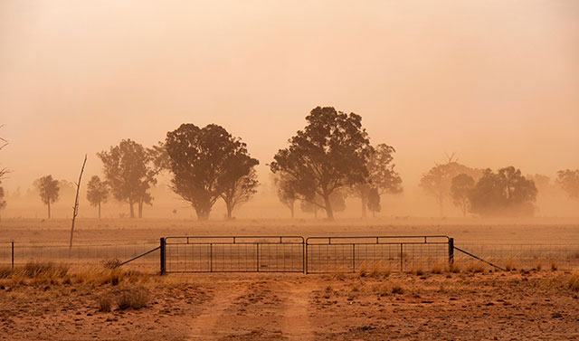
This Notice assists farmers with the transport of specified commodities to drought-affected areas.
This Notice primarily acts to allow vehicles that already have a level of access—be it general access or restricted access—to maintain that access if operating under this Notice, even when loaded to 2.83m wide or 4.6m high.
A heavy vehicle operating under this notice must also comply with the conditions from Schedule 8 of the Heavy Vehicle (Mass Dimension and Loading) National Regulation (MDL).
Eligible vehicles must comply with the conditions of the networks specified in the schedules of the Notice. These networks and their conditions can be found in the ‘Network and Mapping’ section of this Guide.
Exemptions
These exemptions only apply to the extent to which conditions are granted.
Dimension requirements
An eligible combination operating under this Notice is exempt from the following dimension requirements of Schedule 6 of the MDL:
- section 7 — Width; and
- section 8 — Height; and
- section 13 — Side projection.
Note: Other mass and dimension limits in the MDL apply.
Definitions
Unless otherwise stated, words and expressions used in this Operator’s Guide have the same meanings as those defined in the HVNL and the Notice.
|
Term |
Definition |
|---|---|
| ADR | Australian Design Rules. |
|
Class 3 heavy vehicle |
A heavy vehicle is a Class 3 heavy vehicle if— (a) it, together with its load, does not comply with a prescribed mass requirement or prescribed dimension requirement applying to it; and (b) it is not a class 1 heavy vehicle. |
|
Drought-affected area |
An area stated as drought-affected or similar under a law of the relevant participating jurisdiction. Check your state or territory government website for drought-affected areas. |
| Eligible vehicle |
The following vehicles are eligible to operate under the notice:
|
|
General access |
When a heavy vehicle complies with mass and dimension requirements and does not require a notice or permit to operate on the road network. These vehicles have general access to the road network subject to the operation of the Heavy Vehicle National Law and the road rules of the relevant participating jurisdiction. |
|
HVNL |
|
| MDL | Heavy Vehicle (Mass, Dimension and Loading) National Regulation. |
|
Restricted access |
When a heavy vehicle does not meet mass and dimension requirements and requires a notice or permit to access certain parts of the road network. |
|
Specified commodities |
Baled or rolled hay or straw. |
| The Notice | National Class 3 Drought Assistance Dimension Exemption Notice 2025 (No.2) |
| VS Regulation | Heavy Vehicle (Vehicle Standards) National Regulation. |
Eligible vehicles
To be eligible to operate under the Notice, eligible vehicles must comply with all the conditions of this Notice and the requirements of the MDL.
The Notice applies to the following vehicles when they are used to transport specified commodities for consumption by livestock in drought-affected areas:
- a heavy rigid vehicle up to 12.5m in length
- a prime mover and semi-trailer combination up to 19m in length
- a prime mover and low loader combination up to 19m in length
- a B-double
- a road train.
Under the Heavy Vehicle National Law (HVNL), heavy vehicles are normally limited to 2.5m in width and 4.3m in height. The MDL also requires that loads on a heavy vehicle must not project more than 150mm past the outermost part of either side of the vehicle. This Notice provides eligible vehicles with exemptions to these prescribed dimension requirements.
Under this Notice, an eligible vehicle that already has either general access, or restricted access under a Gazette notice, may operate up to 2.83m in width, 4.6m in height, and with a load that projects no more than 165mm past the outermost part of either side of the vehicle.
Note: The vehicle must already have access to be able to benefit from this Notice, and must comply with the conditions of that Notice. For example, a rigid vehicle up to 12.5m in length would have general access if its width and height are no more than 2.5m and 4.3m, respectively. The rigid vehicle carrying baled hay to a drought affected area under this notice would be able to load up to 2.83m in width and 4.6m in height and retain general access on participating road manager roads.
Conditions
Notices are subject to various conditions to ensure public safety, protect assets and prevent adverse impacts on the community, such as noise, emissions and traffic congestion. See the sections below for specific conditions related to this Notice.
Dimension conditions - Click to expand
General dimension conditions
All eligible vehicles operating under this Notice may operate up to 2.83m in width, 4.6m in height, and with a load that projects no more than 165mm past the outermost part of either side of the vehicle.
Stated areas and routes (General Access Vehicles) conditions
The following vehicles and combinations that comply with all condition of this Notice have general access under this Notice:
- heavy rigid vehicles up to 12.5m in length; and
- prime mover and semi-trailer combinations up to 19m in length; and
- prime mover and low loader combinations up to 19m in length.
Stated areas and routes (B-Doubles and Road Trains) conditions
A road train or a B-double that has access under a current notice may access the networks available under that notice.
As well as complying with the requirements of this Notice, an eligible vehicle must comply with all the conditions of the current Notice, except for:
- Height, width, side projection: Eligible vehicles may use the conditional height, width and side projection limits specified in section 12 of this Notice.
- Warning sign and flag conditions: Eligible vehicles must always comply with the requirements in section 15 of this Notice.
- Any special conditions set out in the schedule of a participating jurisdiction.
Schedule 8 conditions - Click to expand
Conditions from MDL Schedule 8
Eligible vehicles operating under this notice that are over 2.6m in width, must comply with the following requirements from Schedule 8 of the MDL.
Note: These conditions apply to the Class 3 vehicles operating under this Notice, despite the MDL otherwise, only applying them to Class 1 vehicles.
The applicable conditions from MDL Schedule 8 are:
- From Part 1:
Other conditions and additional information
Third party approvals
Gazette notices, permits and some jurisdictional laws may require third parties and other entities to provide permission for a vehicle to travel if it exceeds certain mass or dimension limits.
Operators must secure all approvals from third parties such as electricity/utility companies, rail authorities and other third parties as part of their heavy vehicle operations.
For more information, visit the Third party approvals page.
Loading requirements
To meet the loading requirements, the heavy vehicle must be loaded:
- in a way that load placement does not make the heavy vehicle unsafe or unstable
- in a way that the load is not likely to fall or be dislodged from the vehicle
- using an appropriate system to restrain the load.
Visit the NHVR loading page for more information on load requirements.
Complying with the HVNL
Unless otherwise exempted by the Notice or this Operator's Guide, operators must ensure their vehicle or combination complies with ADRs, HVNL, MDL and VS Regulation.
Using or permitting another person to use a defective heavy vehicle or a heavy vehicle with unapproved modifications on a road may be an offence.
Failure to comply may result in the driver and/or operator being liable for an offence. Penalties can include infringement notices or prosecution.
Chain of Responsibility (CoR)
Under the HVNL, every party in the Chain of Responsibility (CoR) has a positive duty to ensure the safety of their activities in relation to a heavy vehicle. This duty, known as the “primary duty”, applies to the scheduling, loading and consigning of a vehicle, as well as to its operation on a road.
Safety is broader than the safety of drivers and other road users. It also includes protection of road infrastructure, preventing damage to other vehicles or property, and minimising environmental harm. Substantial penalties may be imposed upon parties who breach this obligation and upon their executives.
For more information on your CoR obligations visit Chain of Responsibility on the NHVR website.
Our Regulatory Advice offers guidance, tips and tools for managing a range of heavy vehicle safety risks.
The requirement to carry documents
Drivers do not need to carry a copy of the Notice.
Network and mapping
For the purposes of s121 of the HVNL, an area or route specified in the 'Network & Mapping' section of this Operator's Guide is a stated area or route to which this Notice applies. In addition to complying with the conditions stated in this Operator's Guide, operators must ensure compliance with the specific road manager access requirements set out below or in network maps.
National Network Map
The Notice may refer to state or territory government websites for the publication of networks. Certain authorised heavy vehicle road network maps for the Australian Capital Territory, New South Wales, Queensland, South Australia, and Victoria are published by the National Heavy Vehicle Regulator, through the NHVR National Network Map. Additional information and guidance can be found on the National Network Map webpage.
Network mapping home pages for states
- New South Wales heavy vehicle networks
- Queensland Heavy vehicle route maps and restrictions
- South Australia heavy vehicle networks
- Tasmanian Heavy vehicle access maps
- Victorian heavy vehicle networks
Approved routes covered by the Notice
The following routes are approved for travel for vehicles eligible under this Notice.
An eligible vehicle is authorised to use the stated routes and areas in the Notice subject to any restrictions or conditions specified, if any, for each network set out in the specified road manager network requirements.
General access vehicles
The following vehicles and combinations that comply with all conditions of the Notice have general access:
- heavy rigid vehicles up to 12.5m in length; and
- prime mover and semitrailer combinations up to 19m in length; and
- prime mover and low loader combinations up to 19m in length.
B-doubles and road trains
An eligible road train or a B-double that is authorised by a current notice may use the networks specified in that notice. In addition to following the requirements outlined in this Notice, an eligible vehicle must comply with all conditions stated in the current notice, except for:
- height and width, as eligible vehicles may use the conditional height and width limits specified; and
- the applied conditions from Schedule 8 of the MDL, as eligible vehicles, must always comply with the requirements in section 15 of the Notice; and
- any special conditions set out in participating jurisdictions.
Approved routes covered by the Notice for New South Wales - Click to expand
New South Wales
Drought assistance access is also available in New South Wales under the New South Wales Class 3 Drought Assistance Dimension Exemption Notice 2023 (No.1).
For travel in New South Wales, vehicles operating at a height of between 4.3m and 4.6m under this notice must also operate on the NSW 4.6m high network. The 4.6m high vehicle routes can be viewed on the National Network Map.
Participating local government road managers
The following participating councils have no conditions of travel:
- Albury City Council
- Armidale Regional Council
- Ballina Shire Council
- Balranald Shire Council
- Bathurst City Council
- Bega Valley Council
- Bellingen Shire Council
- Berrigan Shire Council
- Blacktown City Council
- Bland Shire Council
- Blayney Shire Council
- Blue Mountains City Council
- Bogan Shire Council
- Bourke Shire Council
- Brewarrina Shire Council
- Broken Hill City Council
- Burwood Council
- Byron Shire Council
- Cabonne Council
- Camden Council
- Campbelltown City Council
- Central Darling Shire Council
- Cessnock City Council
- City of Parramatta Council
- Clarence Valley Council
- Cobar Shire Council
- Coffs Harbour City Council
- Coolamon Shire Council
- Cootamundra-Gundagai Regional Council
- Cumberland Council
- Dubbo Regional Council
- Dungog Shire Council
- Edward River Council
- Eurobodalla Shire Council
- Federation Council
- Forbes Shire Council
- Georges River Council
- Gilgandra Shire Council
- Glen Innes Severn Council
- Goulburn Mulwaree Council
- Greater Hume Shire Council
- Griffith City Council
- Gunnedah Shire Council
- Hilltops Council
- Hornsby Shire Council
- Hunter's Hill Council
- Inverell Shire Council
- Kempsey Shire Council
- Ku-Ring-Gai Council
- Kyogle Council
- Lachlan Shire Council
- Leeton Shire Council
- Lismore City Council
- Lithgow City Council
- Liverpool Plains Shire Council
- Lockhart Shire Council
- Maitland City Council
- Manly Council
- Mid-Coast Council
- Moree Plains Shire Council
- Murray River Council
- Murrumbidgee Council
- Muswellbrook Shire Council
- Nambucca Shire Council
- Narrabri Shire Council
- Narrandera Shire Council
- Narromine Shire Council
- Newcastle City Council
- New South Wales Ports
- Oberon Council
- Parkes Shire Council
- Pittwater Council
- Port Kembla
- Port Macquarie-Hastings Council
- Port Stephens Council
- Queanbeyan-Palerang Regional Council
- Richmond Valley Council
- Shellharbour City Council
- Shoalhaven City Council
- Singleton Council
- Snowy Valleys Council
- Strathfield Municipal Council
- Sydney Harbour Foreshore Authority
- Tamworth Regional Council
- Temora Shire Council
- The Hills Shire Council
- Tweed Shire Council
- Upper Hunter Shire Council
- Upper Lachlan Shire Council
- Uralla Shire Council
- Warren Shire Council
- Warringah Council
- Warrumbungle Shire Council
- Waverley Council
- Weddin Shire Council
- Wentworth Shire Council
- Wingecarribee Shire Council
- Wollondilly Shire Council
- Wollongong City Council
- Yass Valley Council
Carrathool Shire Council
Any Shire roads that are unsealed are Dry Weather Access Only and may not be accessed when wet.
No access is permitted through High Street, Hillston (the section of MR80S Kidman Way); the Hillston Heavy Vehicle Bypass must be used.
Hawkesbury City Council
Access to the following roads are refused due to height restrictions (4.4m) as set by Sydney Trains across the electrified railway level crossings:
- Bourke Street, Richmond (Windsor Street to March Street)
- Racecourse Road. Clarendon (approximately 140m South of Hawkesbury Valley Way)
- Fairey Road. Windsor / South Windsor (James Meehan Street to Argyle Street)
- Level Crossing Road. Vineyard (Railway Road South to Wallace Road)
- Bandon Road (Wallace Road to James Street) George Street. Windsor / South Windsor (Brabyn Street to Bell Street) Railway Overpass Bridge is restricted to 3.6m in height.
- For rural local roads, where line marking does not exist, these roads will generally be less than 6m wide; for safety reasons, these roads will require further consideration.
Orange City Council
Confirmation of access to these two bridges will need to be obtained from John Holland Rail:
- Peisley Street Rail Overpass between Tynan Street and Gardiner Road.
- Cecil Road Rail Bridge between Park Road and Alison Place.
Tenterfield Shire Council
Load limit to be applied (GVM tonnes) |
Road | Stream name | Length (m) | Width (m) | |
| No. | Name | ||||
|
10 |
MR 622 |
Mt Lindesay Road |
Boonoo Boonoo River |
39.8 |
5.9 |
|
Closed |
7358 |
Tooloom Road |
Beauty Creek |
31.1 |
5.26 |
|
Only for school buses |
5154 |
Beaury Creek Road |
Five Mile Creek |
15.9 |
5.6 |
|
10 |
5220 |
Black Swamp Road |
Cataract River |
32.65 |
3.5 |
|
9 |
6111 |
Hooten's Road |
Clarence River |
32 |
4.15 |
|
10 |
6720 |
Paddy's Flat Road (North) |
Kangaroo Creek |
19 |
4.2 |
|
Width restriction |
6720 |
Paddy's Flat Road (North) |
Unnamed Creek |
12 |
2.8 |
|
12 |
7390 |
Torrington Road |
Deepwater River |
18.9 |
4.88 |
|
9 |
7541 |
White Swamp Road |
Woodenbong Creek |
17.4 |
4.4 |
|
30 |
5154 |
Beaury Creek Road |
Beaury Creek |
12 |
5 |
|
11 |
5154 |
Beaury Creek Road |
Boundary Creek |
10 |
5.3 |
|
7 |
5187 |
Billirimba Road |
Hawkins Gully |
6.74 |
5.1 |
|
|
5187 |
Billirimba Road |
Swamp Oak Creek |
11.8 |
4.8 |
|
13 |
5451 |
Castlerag Road |
Deepwater River |
10.45 |
3.6 |
|
14 |
6716 |
Paddy's Flat Road |
Unnamed Creek |
10.1 |
6.23 |
|
8 |
7211 |
Sunnyside Loop Road |
Blacksmith's Creek |
11.2 |
6.4 |
|
12 |
7390 |
Torring Road |
Kangaroo Creek |
6.7 |
6.6 |
|
16 |
6243 |
Leeches Gully Road |
Washpool Creek |
8.36 |
6 |
Upper Lachlan Shire Council
The following roads are only approved:
- MR52S Gundaroo Road – from Shire Boundary (includes part of Hume Street and Yass Street Gunning), length of 13.21km.
- Gunning, Yass Street, MR52N Grabben Gullen Road to intersection with Cullerin Road (Old Hume Highway), length of 2km.
- Cullerin Road (old section of Hume Highway) – from intersection with MR52N Grabben Gullen Road to shire boundary length of 24km.
Wagga Wagga City Council
Travel is not permitted on urban roads in residential areas. These are roads that are subject to a speed limit of less than 70 km/h and that have residential development adjacent to the road, on one or both sides, at intervals of less than 100 metres.
The following exceptions are given to this rule:
|
Road |
From |
To |
|---|---|---|
|
Mill Street, North Wagga Wagga |
Oura Road |
Hampden Ave |
|
Hampden Avenue, North Wagga Wagga |
Full length |
|
|
Horseshoe Road, Cartwrights Hill |
Full Iength |
|
|
Travers Street, Wagga Wagga |
Full length |
|
|
Moorong St Service Road, Wagga Wagga |
Full length |
|
|
Kooringal Road, Wagga Wagga |
Full length |
|
|
Red Hill Road, Wagga Wagga |
Kooringal Road |
Glenfield Road |
|
Pearson Street, Wagga Wagga |
Full length |
|
|
Dobney Avenue, Wagga Wagga |
Full length |
|
|
Gregadoo Road, Lake Albert |
Full length |
|
|
Main Street, Lake Albert |
Full length |
|
|
Lake Albert Road, Wagga Wagga |
Full length |
|
|
Plumpton Road, Wagga Wagga |
Kooringal Road |
Southern end of road |
|
Elizabeth Avenue, Forest Hill |
Full length |
|
|
Tumbarumba Road |
Through Ladysmith |
|
|
Tywong Street, Ladysmith |
Tumbarumba Road |
Western end |
|
Old Narrandera Road, Currawarna |
Through Currawarna |
|
|
Oura Road, Oura |
Through Oura |
|
|
Barney Street, Oura |
Full length |
|
|
Ryan Street, Uranquinty |
Full length |
|
|
Key Street, Uranquinty |
Full length |
|
|
Yarragundry Street, Uranquinty |
Full length |
|
|
Cox Street, Mangoplah |
Full length |
|
|
Kyeamba Street, Mangoplah |
Full length |
|
|
Mangoplah- The Rock Road, Mangoplah |
Holbrook Road |
Through Mangoplah |
|
Downside Village Road, Downside |
Full length |
|
|
Downside Road, Downside |
Coolamon Road |
Through Downside |
|
Centenary Avenue, Tarcutta |
Full length |
|
|
Humula Road, Humula |
Full length |
|
|
Mate Street, Humula |
Full length |
|
|
Walker Street, Humula |
Full length |
Walcha Council
Operators on council roads should investigate the route prior to proceeding to ensure that their load will not contact powerlines or overhanging tree limbs.
Approved routes covered by the Notice for Queensland - Click to expand
Queensland
In addition to the eligible vehicles stated in this Notice, truck and dog combinations operating in Queensland may have access under this notice.
Truck and dog combinations up to 19m in length have general access.
Truck and dog combinations longer than 19m in length that have access under a current notice may access the networks available under that notice.
As well as complying with the requirements of this Notice, a truck and dog combination longer than 19m in length must comply with all the conditions of the current Notice, except for:
- Height, width, side projection: Eligible vehicles may use the conditional height, width and side projection limits specified in section 12 of this Notice; and
- Applied conditions from schedule 8 of the MDL: Eligible vehicles must always comply with the requirements in section 15 of this Notice; and
- Any special conditions set out in the schedule of a participating jurisdiction.
Participating local government road managers
The following participating councils have no conditions of travel:
- Balonne Shire Council
- Banana Shire Council
- Barcaldine Regional Council
- Barcoo Shire Council
- Bulloo Shire Council
- Bundaberg Regional Council
- Burdekin Shire Council
- Cairns Airport
- Cairns Works Cairns Fleet Cairns Water
- Cairns Civic Theatre Ticket Link
- Cassowary Coast Regional Council
- Charters Towers Regional Council
- Cook Shire Executive
- Croydon Shire Council
- Diamantina Shire Council
- HQ plantations
- Etheridge Shire Council
- Flinders Shire Council
- Fraser Coast Regional Council
- Gladstone Airport
- Gladstone Ports Corporation
- Goondiwindi Regional Council
- Gympie Regional Council
- Hinchinbrook Shire Council
- Ipswich City Council
- Livingstone Shire Council
- Lockhart River Aboriginal Council
- Lockyer Valley Regional Council
- Logan City Council
- Mackay Airport
- Mackay Regional Council
- Maranoa Regional Council
- Mareeba Shire Council
- Mckinlay Shire Council
- Moreton Bay Regional Council
- Mornington Aboriginal Shire Council
- Mount Isa City Council
- Murweh Shire Council
- North Burnett Regional Council
- Pormpuraaw Aboriginal Shire Council
- Port Douglas Shire Council
- Port Of Brisbane
- Port of Cairns
- Port of Townsville
- Quilpie Shire Council
- Redland City Council
- Richmond Shire Council
- Rockhampton Regional Council
- Somerset Regional Council
- South Burnett Regional Council
- Southern Downs Regional Council
- Sunshine Coast Regional Council
- Tablelands Regional Council
- Toowoomba Regional Council
- Townsville Airport
- Townsville City Council
- Weipa Town Council
- Western Downs Regional Council
- Whitsunday Regional Council
- Winton Shire Council
- Woorabinda Aboriginal Council
- Wujal Wujal Aboriginal Shire Council & Wujal Wujal Community Centre & Wujal Wujal Service Station
Brisbane Airport Corporation
- No access to the Domestic and International Precinct will be allowed.
- No access to the Skygate Precinct will be allowed
- The consignor is responsible for providing a schedule of operation to be forwarded to: Adam Hazell, Landside Transport Operations Manager - Commercial Projects and Operations Brisbane Airport Corporation Pty Ltd adam.hazell@bne.com.au.
Brisbane City Council
- Vehicles must travel outside peak hours of 7am to 9am and 4pm to 6pm during weekdays in Brisbane.
- Vehicles must not travel through school zones during hours of reduced speed operation (that is, 7am to 9am and 2pm to 4pm on school days).
Carpentaria Shire Council
All damage must be reported to Carpentaria Shire Council immediately.
Gladstone Regional Council
Vehicle is to keep left when approaching crests and corners with poor visibility and reduce speed to a maximum of 40km/hr.
Isaac Regional Council
Information on Isaac Regional Council local road closures and current road works affecting all road users is available on the Isaac Regional Council website (www.isaac.qld.gov.au).
Low railway power lines at Railway Level Crossing on Peak Downs Mine Rd - 4.5m height clearance. Low underpass on Peak Downs Mine Rd - 4.8m height clearance, 3m width clearance (BMA Peak Downs overpass). Contact Peak Downs Mine ROM Control on (07) 4968 8277 or UHF30 or OCE (07) 4968 8239 to organise alternate route through Peak Downs Mine via Possum Flat Gate if required.
Isaac Regional Council does not accept responsibility for the privately owned section of Goonyella Road and/or Red Hill Road.
For travel on unsealed roads, maximum speed of 80km/h not to be exceeded.
Travel during daylight hours only. Damage to infrastructure or property must be reported by contacting IRC on 1300 472 227. During movement of the excess mass/dimension load, you must obey any direction or instruction given by an Officer of Isaac Regional Council.
Longreach Regional Council
- Travel is permitted on Longreach Regional Council rural roads during dry conditions.
- Travel is not permitted after rainfall events.
- Longreach Regional Council shall be contacted in the event of recent rainfall events. Please call 07 4658 4111 for road conditions prior to travel.
Noosa Shire Council
The following bridges are load-limited or have restrictions:
|
Road Name |
Structure Name |
Structure type |
Suburb (Location) |
Restriction |
|---|---|---|---|---|
|
Cooroy |
Cooroy |
Timber Bridge |
Cooroy |
20t limit ** |
|
David Low |
Orealla Crescent |
Concrete Bridge |
Sunrise Beach |
30t limit |
|
Eenie Creek Road |
Koala Footbridge |
Timber Footbridge (pedestrian) |
Sunshine Beach |
5.4m clearance under the bridge |
|
Eenie Creek Road |
Noosa Springs Overpass Bridge |
Concrete Bridge (road overpass) |
Noosa Heads |
5.4m clearance under the bridge |
|
Frying Pan |
Frying Pan Track |
Timber Bridge |
Noosa North Shore |
5t limit |
|
Frying Pan |
Frying Pan Track |
Timber Bridge |
Noosa North Shore |
5t limit |
|
James Street |
Railway Bridge (overpass) |
Railway Bridge (overpass) |
Cooran |
2.9m Clearance under the bridge |
|
King Street |
Railway |
Railway overhead |
Cooran |
5.2m clearance |
|
Lake Weyba Road |
Monks Bridge |
Concrete Bridge (road overpass) |
Noosaville |
5.0m Clearance under the bridge |
|
Mary River |
Mary River |
Timber Bridge |
Cooroy |
Closed * |
|
Memorial |
Doonella Lake |
Concrete Bridge |
Tewantin |
33t limit |
|
Noosa |
Sheraton Bridge |
Concrete Bridge |
Noosa heads |
33t limit |
|
Old Noosa |
Old Noosa |
Timber Bridge |
Cooran |
Closed * |
|
Orealla |
Orealla Crescent |
Concrete Bridge |
Sunrise Beach |
4.4m clearance |
|
Park Court |
|
Road drainage structures |
Noosaville |
9t limit on entire roadway |
|
Park Road |
|
Road subject to land slip |
Sunshine Beach |
9t limit on entire roadway |
|
Park Road |
|
Road subject to land slip |
Noosa Heads |
9t limit on entire roadway |
|
Skyring |
Skyring Creek |
Timber Bridge |
Federal |
16t limit |
|
Reserve |
Railway |
Railway overhead |
Pomona |
5.2m clearance |
|
Subway Avenue |
Railway Bridge (overpass) |
Railway Bridge (overpass) |
Pomona |
2.8m clearance under the bridge |
|
Tablelands |
Tablelands |
Timber Bridge |
Federal |
16t limit |
|
Wahpunga |
Wahpunga Lane |
Timber Bridge |
Kin Kin |
16t limit |
|
Witta Circle |
Witta Bridge |
Concrete Bridge |
Noosa heads |
33t limit |
|
Woodland Drive |
Murdering Creek Bridge |
Timber Bridge (road) |
Peregian Beach |
5t limit |
|
Special notes: * Bridges under construction. Closed until December 2018, Weather permitting |
||||
Banyule City Council
- To the satisfaction of Council, the contractor shall be responsible for the reinstatement, repairs or replacement of any Council infrastructure that may be damaged, removed or modified during the course of the trip;
- Ensure all vehicle movements can be safely accommodated before the trip commences. Please note there may be some narrow points and low-lying power lines and trees along these roads;
- Banyule City Council does not accept any responsibility for accidents, damage or injury to property, participants or third parties.
Colac Otway Shire
Some roads are subject to regular cattle crossings. The applicant is to identify the location of these and the normal crossing times and exercise appropriate caution.
Glen Eira City Council
The applicant is to undertake a local route assessment that it is safe for the intended vehicle to travel on the nominated council roads. The applicant is to be responsible for any damages or cleaning that may be required to the road assets as a result of the proposed operations.
Loddon Shire Council
Approval is granted subject to the following load limits:
|
Bridge ID |
Bridge overall width (m) |
No. of Span |
Total bridge length (m) |
Gross Vehicle Mass (tonne) |
Road name |
|---|---|---|---|---|---|
|
ST008345 |
8.6 |
2 |
18 |
44 |
24 Mile - Wychitella Bus Route Road |
|
ST023455 |
6.6 |
3 |
22.5 |
32.7 |
Aitken's Road |
|
ST029693 |
6.6 |
2 |
21 |
44 |
Aitkens Road |
|
ST008359 |
5.75 |
1 |
7.5 |
32.7 |
Andrews Road |
|
ST009440 |
6.35 |
1 |
5.95 |
24.5 |
Bears Three Chain Road |
|
ST023309 |
5.75 |
2 |
12 |
24.5 |
Bennetts Road No. 2 |
|
ST008394 |
6.6 |
2 |
15 |
33 |
Billings Road |
|
ST009704 |
3.9 |
1 |
7.5 |
32.7 |
Broad's Lane |
|
ST023319 |
5.75 |
1 |
9 |
24.5 |
Caldwells Rd |
|
ST008912 |
9.3 |
1 |
10.5 |
44 |
Calivil Mail Road |
|
ST008284 |
5.75 |
1 |
9 |
24.5 |
Challis Road |
|
ST029673 |
6.6 |
2 |
18 |
33 |
Dalrymples |
|
ST008600 |
6.65 |
3 |
27 |
32.7 |
Diss's Rd |
|
ST073679 |
7.2 |
1 |
9 |
33 |
Glenloth Road |
|
ST010069 |
5.7 |
1 |
6 |
24.5 |
Grieves Road |
|
ST029578 |
6.6 |
1 |
6 |
32.7 |
Hands Road |
|
ST023605 |
7.3 |
2 |
21 |
44 |
Hercus Road |
|
ST048250 |
7.3 |
2 |
18 |
33 |
Hockings Road |
|
ST009760 |
3.25 |
1 |
6 |
10 |
Hopefield Road |
|
ST008733 |
7.85 |
2 |
12 |
32.7 |
Jarklin - Yarrawalla Road |
|
ST023531 |
7.9 |
2 |
18 |
33 |
Jarklin-Yarrawalla Road |
|
ST023612 |
6.65 |
2 |
21 |
44 |
Laird's Road |
|
ST008338 |
6.6 |
2 |
15 |
33 |
Leech Road |
|
ST064020 |
6.6 |
3 |
21 |
32.7 |
Linton's Road |
|
ST025157 |
5.7 |
1 |
5.9 |
24.5 |
Maynards Road |
|
ST010002 |
6.6 |
1 |
9 |
33 |
McDougalls Road |
|
ST023458 |
6.6 |
3 |
22.5 |
32.7 |
McElwains Road |
|
ST008730 |
7.25 |
2 |
18 |
32.7 |
Miles Road |
|
ST048943 |
6.6 |
1 |
10.5 |
44 |
Miles Road |
|
ST008732 |
7.1 |
2 |
15 |
32.7 |
Miles's Road |
|
ST054615 |
5.6 |
1 |
5.95 |
10 |
Mincha North Road |
|
ST015319 |
7.2 |
1 |
9 |
32.7 |
Mincha West Road |
|
ST008872 |
5.85 |
1 |
6 |
24.5 |
Mologa - Durham Ox Road |
|
ST009025 |
6.55 |
1 |
6 |
32.7 |
Mologa North School Road |
|
ST029772 |
6.6 |
2 |
18 |
33 |
Mossops Road. |
|
ST008334 |
8.6 |
2 |
18 |
44 |
Mysia West Road |
|
ST008874 |
5.85 |
1 |
6 |
24.5 |
North Boundary Road |
|
ST029720 |
6.6 |
2 |
18 |
44 |
Paxfords Road |
|
ST008378 |
7.4 |
2 |
15 |
33 |
Peter McGraths Road |
|
ST029761 |
6.6 |
2 |
18 |
33 |
Pompapiel Mail Road |
|
ST008375 |
7.9 |
2 |
18 |
33 |
Quambatook-Whychitella Road |
|
ST009629 |
7.3 |
2 |
15 |
33 |
Raywood - Durham Ox Road |
|
ST023539 |
6.65 |
2 |
21 |
44 |
Raywood - Durham Ox Road |
|
ST023541 |
6.65 |
2 |
21 |
44 |
Raywood - Durham Ox Road |
|
ST029757 |
7.2 |
3 |
22.5 |
33 |
Raywood - Durham Ox Road |
|
ST023621 |
6.6 |
2 |
21 |
44 |
Richards Road |
|
ST008876 |
7.9 |
2 |
12 |
32.7 |
Richard's Road |
|
ST009091 |
6.35 |
1 |
6 |
24.5 |
Shays Road |
|
ST009435 |
6.35 |
1 |
6 |
24.5 |
Slys Road |
|
ST029684 |
6.6 |
2 |
21 |
44 |
Steads Road |
|
ST023462 |
6.6 |
3 |
22.5 |
32.7 |
Storey's Road |
|
ST029670 |
6.75 |
3 |
22.5 |
33 |
Thompson Roas |
|
ST029700 |
6.65 |
2 |
21 |
44 |
Tripletts Road |
|
ST008329 |
6.6 |
2 |
18 |
44 |
Verleys Road |
|
ST029765 |
6.55 |
2 |
18 |
32.7 |
Whites Pit Road |
|
ST048521 |
7.7 |
1 |
6 |
24.5 |
Whytes Lane |
|
ST008340 |
6.6 |
1 |
10.5 |
44 |
Wychitella Bus Route Road |
|
ST008342 |
6.25 |
2 |
15 |
33 |
Wychitella Bus Route Road |
|
ST008362 |
6 |
1 |
9 |
44 |
Wychitella Bus Route Road |
|
ST045722 |
6.6 |
1 |
9 |
32.7 |
Yarrawalla East Road |
Maroondah City Council
- Any vehicle and load combination exceeding 42 tonnes MUST NOT travel over the Eastfield Road bridge over Tarralla Creek, between Bayswater Road and Yvonne Avenue, Croydon.
- Any vehicle and load combination exceeding 3.4m in height MUST NOT travel under the railway bridge over Warrandyte Road, between Maroondah Highway and Bedford Road, Ringwood.
- Any vehicle and load combination exceeding 3.5m in height MUST NOT travel under the railway bridge over New Street, between Maroondah Highway and Molan Street, Ringwood.
- Any vehicle and load combination exceeding 3.6m in height MUST NOT travel under the railway bridge over Wantirna Road, between Maroondah Highway and Station Street, Ringwood.
Moorabool Shire Council
For gravel roads: Maximum vehicle speed of 60km/hr to be maintained at all times.
This consent does not guarantee that any given road is accessible to the permit holder at any time (use when road works may occur).
Any damages caused to kerb, road pavement, footpath, landscaped areas, drainage or other Council infrastructure during the proposed travel operation the applicant will be held liable and must reinstatement works as it was before with a 12 month maintenance warranty period.
Nillumbik Shire Council
Bridge load limits apply to the following bridge assets:
- Gipson Street Bridge, Gipson Street, Diamond Creek - 3 tonne load limit.
- Laidleys Bridge, Chapel Lane, Nutfield - 30 tonne load limit.
West Wimmera Shire Council
Approval is for pickup and delivery access to the local road only. Vehicles must travel state or federal controlled roads other than for pick up or delivery from the local road being accessed.
Approved routes covered by the Notice for South Australia - Click to expand
South Australia
For travel in South Australia, operators and drivers of eligible vehicles must assess the suitability of a road prior to operating on that road. Operators and drivers should consult the South Australian Height Clearance map and Limited Access Locations in SA Information Bulletin for restrictions applied on state roads. Noting further restrictions may be applied by other participating road managers.
Participating local government road managers
The following participating councils have no conditions of travel:
- Alexandrina Council
- Campbelltown City Council
- City of Holdfast Bay
- City Of Marion
- City Of Mount Gambier
- City of Playford
- City Of Port Lincoln
- City of Prospect
- City Of Tea Tree Gully
- City of Victor Harbour
- City of West Torrens
- Clare and Gilbert Valleys Council
- District Council of Barunga West
- District Council of Ceduna
- District Council of Cleve
- District Council of Elliston
- District Council of Franklin Harbour
- District Council of Grant
- District Council of Lower Eyre Peninsula
- District Council of Mount Remarkable
- District Council of Peterborough
- District Council of Renmark Paringa
- District Council of Robe
- District Council of Streaky Bay
- District Council of The Copper Coast
- District Council of Tumby Bay
- District Council of Yankalilla
- District Council of Yorke Peninsula
- Flinders Port
- Light Regional Council
- Mallala District Council
- Mid Murray Council
- Mount Barker District Council
- Northern Areas Council
- Port Augusta City Council
- Port Pirie Regional Council
- Regional Council Of Goyder
- Renewal SA
- Southern Mallee District Council
- The Barossa Council
- The Berri Barmera Council
- The City of Whyalla
- The Flinders Ranges Council
- Wakefield Regional Council
- Wattle Range Council
- Wudinna District Council
Approved routes covered by the Notice for Tasmania - Click to expand
Tasmania
An eligible vehicle must not travel on –
- The Tasman Bridge on Tasman Highway if the vehicle is higher than 4.3m;
- Any road where there is insufficient height clearance for the vehicle to pass without striking or damaging any road infrastructure.
The driver of an eligible vehicle that is higher than 4.3m must assess the suitability of a road prior to operating the vehicle on that road. One source of information which may be used is the Height Clearance Under Overhead Structures Map which is maintained by the Tasmanian Department of State Growth (DSG) on its website.
Participating local government road managers
The following participating councils have no conditions of travel:
- Bell Bay Port
- Break O’day Council
- Brighton Council
- Central Coast Council
- Central Highland Council
- Circular Head Council
- City Of Burnie
- Clarence City Council
- Department of Primary Industries Parks
- Water and Environment
- Derwent Valley Council
- Devonport Airport
- Devonport City Council
- Dorset Council
- Flinders Council
- Flingers Island Ports
- George Town Council
- Glamorgan Spring Bay Council
- Glenorchy City Council
- Hobart Airport
- Hobart City Council
- Huon Valley Council
- Hydro Tasmania
- Kentish Council
- King Island Council
- King Island Port
- Kingborough Council
- Latrobe Council
- Launceston Airport
- Launceston City Council
- Meander Valley Council
- Northern Midlands Council
- Port of Burnie
- Port of Devonport
- Port of Hobart
- Port of Smithton
- Port of Stanley
- Port of Strahan
- Sorell Council
- Southern Midlands Council
- Tasman Council
- Tasmania Parks and Wildlife Service
- Waratah-Wynyard Council
- West Coast Council
- West Tamar Council
Approved routes covered by the Notice for Victoria - Click to expand
Victoria
No additional eligible vehicles or conditions other than in the Notice.
Related notices
In this tab, you will find a list of national, state and territory notices related to the National Class 3 Drought Assistance Dimension Exemption Notice 2025 (No.2).
A related notice may be comparable with this Notice or provide alternatives for operators to find the appropriate notice under which to operate.
Related state and territory notices
| Jurisdiction | Notice |
|---|---|
| New South Wales |
New South Wales Class 3 Drought Assistance Dimension Exemption Notice 2023 (No.1) Exempts eligible vehicles from complying with certain dimension requirements when transporting baled or rolled hay to be used as fodder for consumption by livestock in drought-affected areas in New South Wales. Please note the following supporting document for this Notice |
Resources
There are no additional resources for this notice. However, operators are reminded of ongoing maintenance and other road infrastructure works across South Australia and are advised to refer to the South Australia Government’s Addinsight app and the Traffic SA - Department for Infrastructure and Transport to ensure their route is not impacted by works.
Operators in Tasmania can refer to the Tasmanian Government’s Roadworks status page to confirm if their route is impacted by roadworks.
In New South Wales, a drought-affected area means a zone identified as Drought Affected, Drought and Intense Drought on the Combined Drought Indicator Map published by the NSW Department of Primary Industries.
Note: If you have any feedback on the information provided please contact us at info@nhvr.gov.au
Changes and updates
| Date | Summary | Links to resources and communications |
|---|---|---|
| 9 June 2025 |
National Class 3 Drought Assistance Dimension Exemption Notice 2025 (No.2) commenced. Amendments include the removal of longstanding structural constraints associated with the old Bridgewater Bridge, Tasmania, relating to height (4.6m) and width (2.5m) which have historically limited heavy vehicle access under several notices following the 2 June 2025 opening of the new Bridgewater Bridge. |
|
| 15 January 2025 | National Class 3 Drought Assistance Dimension Exemption Notice 2025 (No.1) commenced. The Notice no longer requires a declaration to be made under a law of a relevant jurisdiction that an area is drought-affected area or similar to operate. This publication revokes and replaces the National Class 3 Drought Assistance Dimension Exemption Notice 2023 (No.1). | C2024G00766 |
| 22 November 2024 | Additional wording added to the 'Network and mapping' tab to clarify approved routes. | |
| 20 September 2023 | National Class 3 Drought Assistance Dimension Exemption Notice 2023 (No.1) commenced. | C2023G01093 |
www.nhvr.gov.au
E info@nhvr.gov.au
P 13 NHVR (136 487)
PO Box 492, Fortitude Valley QLD 4006