National Class 1 Agricultural Vehicle and Combination Mass and Dimension Exemption Notice Operator's Guide
National Class 1 Agricultural Vehicle and Combination Mass and Dimension Exemption Notice Operator's Guide
National
Heavy
Vehicle
Regulator
The National Class 1 Agricultural Vehicle and Combination Mass and Dimension Exemption Notice 2024 (No.1) provides an eligible vehicle or combination access to agricultural Zones. These Zones have different dimensions, mass and conditions of access for the eligible vehicle or combination (unless conditioned otherwise by a specific road manager).
This Notice applies to heavy agricultural vehicles and agricultural combinations operating in the Australian Capital Territory, New South Wales, Queensland, South Australia, Tasmania, and Victoria.
The Agricultural Heavy Vehicle Zone Map shows the legally approved network for this Notice.
In addition to the information in the Operator's Guide below, the National Class 1 Agricultural Notice - Quick Reference Guide (PDF, 278KB) helps operators understand the general conditions and requirements of this Notice.
| Specifications | |
|---|---|
| Gazette Notice: | C2024G00247 |
| Starts: | 1 May 2024 |
| Expires: | 30 April 2029 |
| Vehicle types: | Class 1, agricultural vehicle, agricultural combination |
| Exemptions: |
Mass requirements (axle mass limits, axle spacing mass limits, general combination mass, single vehicle mass) Dimension requirements (general length, trailer length, trailer drawbar length, width, height by load, rear overhang, ground clearance) |
| Law: | HVNL, MDL, VS |
| Coverage:* | ACT, NSW, QLD, SA, TAS, VIC |
| To be carried: | No |
*Specific state conditions are explained below.
- Overview
- Definitions
- Eligible
Vehicles - Conditions
- Network and
Mapping - Related
Notices - Resources
- Changes and
Updates
Overview
The information in this Operator’s Guide is intended to do two things:
- Explain how the National Class 1 Agricultural Vehicle and Combination Mass and Dimension Exemption Notice 2024 (No.1) (the Notice) operates, to assist in complying with it. It is important to remember this Operator’s Guide is instructional only and it is the Notice that provides the exemption or authorisation. If there is a difference or misunderstanding between the Operator’s Guide and the Notice, the Notice has priority and must be followed. The only exceptions are the requirements or conditions set out in the ‘Network and Mapping’ section explained below.
- Provide additional information referred to in the network requirements of the Notice. This includes links to network maps and other information such as vehicle, travel and road conditions. Networks and their conditions published in the ‘Network and Mapping’ section of this Operator’s Guide are not general advice and must be treated as conditions of the Notice.
Please read the Notice, this Operator's Guide and the Agricultural Heavy Vehicle Zone Map together. To download or print this guide, use the print or PDF buttons on the top right of this page.
About the Notice
This Notice provides an exemption for eligible agricultural vehicles and combinations from certain mass, dimension and vehicle standards in designated Agricultural Heavy Vehicle Zones (Zones). Use this operating guide to check the rules and requirements of this Notice.
The Notice was developed in partnership with industry and participating road managers to provide better road access to agricultural vehicles. The Notice was based on research conducted by Austroads and the Department of Transport and Planning, respectively.
Exemptions
These exemptions only apply to the extent to which conditions are granted.
Dimension requirements
Vehicles operating under the Notice are exempt from the following dimension requirements in Schedule 6 of the Heavy Vehicle (Mass, Dimension and Loading) National Regulation (MDL):
- section 3 – Length;
- section 4 – Length (trailers);
- section 5 – Rear overhang;
- section 6 – Drawbar length;
- section 7 – Width;
- section 8 – Height;
- section 9 – Ground clearance.
Mass requirements
Vehicles operating under the Notice are exempt from the following mass requirements in Schedule 1 of the MDL:
- section 2(1)(b) – Mass limits for a single vehicle or combination;
- section 4 – and Table 1 - Axle mass limits table; and
- section 5(1) – and Table 2 - Axle spacing mass limits general table.
The exemption for section 5 – and Table 2 - Axle spacing mass limits general table, only applies to an agricultural combination that meets conditions relating to tow mass ratio in section 17 of the Notice.
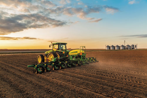
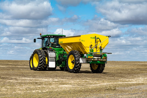
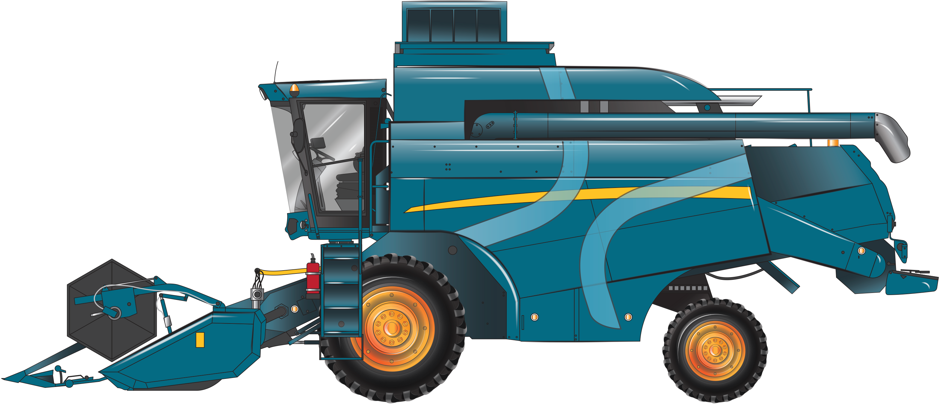
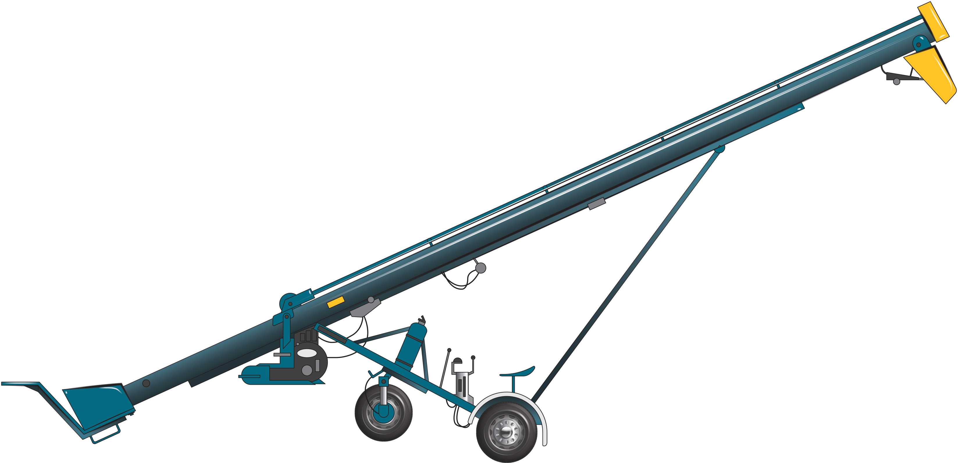
Examples of agricultural vehicles, implements and trailers - Click to expand.
Comb implement
A comb implement is considered an agricultural implement. The comb implement is a harvester head (otherwise known as a comb) being towed (i.e. under wheels attached to the harvester head).
To be eligible to operate under the Notice, the frame attached to the harvester head must be:
- designed and built for the dedicated purpose to carrying the harvester head; and
- be used to transport the harvester header to its agricultural task.

Definitions
Unless otherwise stated, words and expressions used in this Operator’s Guide have the same meanings as those defined in the HVNL and the Notice.
| Term | Definition |
|---|---|
| ATM | Aggregate Trailer Mass (ATM) is the maximum loaded mass of a trailer allowed under the HVNL. |
| Agricultural combinations | A combination where at least one unit is an agricultural machine, agricultural implement or agricultural trailer. |
| Agricultural combination mass | The mass of an agricultural combination, including the vehicle, implements, trailers, and any load being carried. |
| Agricultural Heavy Vehicle Restricted Road | A road for which Zone 1 dimension provisions apply regardless of the Zone the road passes through. Note: Agricultural heavy vehicle-restricted roads are specified on the Map. |
| Agricultural implement | A vehicle without its own automotive power, built to perform agricultural tasks, and includes an agricultural trailer. Examples include: Auger, conveyor, field bin, harvester front, irrigating equipment or machinery. |
| Agricultural machine | A vehicle with its own automotive power, built to perform agricultural tasks. Examples include: Harvester, tractor. |
| Agricultural task | A task carried out in agriculture. Examples include: Cultivating land, growing and harvesting crops, rearing livestock. |
| Agricultural trailer | A trailer that is designed to carry a load and used exclusively to perform agricultural tasks, but does not include a semitrailer. Examples include: Field bin, silage trailer. |
| Agricultural vehicle | An agricultural implement or agricultural machine. |
| Agricultural Vehicle Route Assessment | A route assessment completed in the prescribed form as for travel in New South Wales, subject to s22 of this Notice and the Guide |
| Approved Cotton Harvester Road | A road approved as an approved Cotton Harvester Road on the Map. |
| Approved Sugarcane Harvester Road | A road approved as an approved Sugar Harvester Road on the Map. |
| ATM | Aggregate Trailer Mass (ATM) is the maximum loaded mass of a heavy trailer as stated by the manufacturer. ATM is measured by weighing both the mass on the towing vehicle and the mass on the loaded trailer on a horizontal surface allowed under the HVNL. |
|
Built-up area |
An area in which there are buildings on land next to the road or there is street lighting at intervals not over 100m for a distance of at least 500m or, if the road is shorter than 500m, for the whole road. |
| Comb implement | A harvester head being towed (i.e. under wheels attached to the harvester head) is considered an agricultural implement. |
| Eligible cotton harvester |
A cotton harvester that has two axles and meets the following requirements:
The following cotton harvesters are the only approved cotton harvesters in New South Wales and Queensland. In all other states, the cotton harvester must comply with the applicable Zone conditions.
|
| Freeway | Has the same meaning as the road rules for the relevant jurisdiction |
| GVM | Gross Vehicle Mass is the maximum loaded mass of a motor vehicle allowed under the HVNL. |
| Low-beam | In relation to a headlight or front fog light fitted to a heavy vehicle, means the light is built or adjusted so that, when the vehicle is standing on level ground, the top of the main beam of light projected is:
|
| Major Road | A state-controlled road. |
| Map |
Agricultural Heavy Vehicle Zone Map, as published by the NHVR that displays:
|
| Night | The period between sunset on a day and sunrise on the next day. |
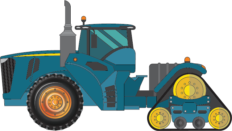
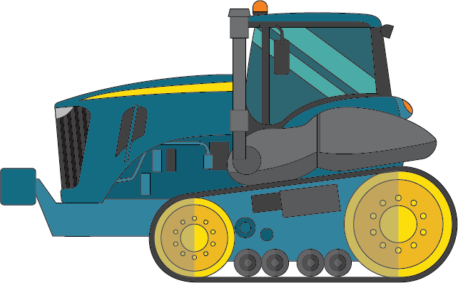
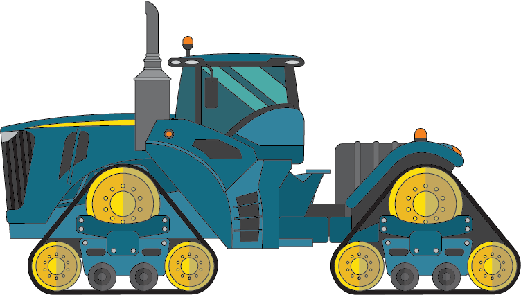
| Pair of tracks | A set of connected tracks on a rubber tracked tractor with one track on each side of the vehicle. |
| Participating jurisdiction | A participating jurisdiction of a Notice. For the purposes of the Notice, this includes the Australian Capital Territory, New South Wales, Queensland, South Australia, Tasmania and Victoria. |
| Rear marker | Red lights are also known as rear markers. |
| Rubber tracked tractor |
An agricultural machine designed to tow and provide power for agricultural implements, which has at least one pair of rubber tracks instead of conventional wheeled axles in one of the following configurations:
   |
| Side markers | Lights showing yellow to the front and red to the rear and known as ‘side markers’. |
| Silage | A green fodder stored for the purpose of fermentation and intended for the feeding of livestock. |
| Silage trailer | An agricultural trailer which is an agricultural implement used exclusively for the transport of:
|
| Sugarcane harvester | A harvester used to harvest sugar cane. |
| Tow Mass Ratio |
The ratio of the mass of the towing vehicle to the combined mass of the towed implements and/or trailers when all vehicles are connected as part of an agricultural combination. |
| Urban area | Has the same meaning as “built-up area”, meaning an area in which there are buildings on land next to the road, or there is street lighting at intervals not over 100m for a distance of at least 500m or, if the road is shorter than 500m, for the whole road. |
| Zone |
Agricultural Heavy Vehicle Zone. An area designated as such on the Map. Note: Zones are areas where specific mass and dimension limits and other conditions apply as specified in this Notice. Zones are numbered 1 to 5. |
Jurisdictional-specific definitions
Australia Capital Territory
| Term | Definition |
|---|---|
| Belconnen Area |
Means the area bounded by (and including) streets or other features as follows:
|
| Civic Area |
Means the area bounded by (and including) street or features as follows:
|
| Tuggeranong Area |
Means the area bounded by (and including) streets or other features as follows:
|
| Woden Area |
Means the area bounded by (and including) streets or other features as follows:
|
Queensland
| Term | Definition |
|---|---|
|
Christmas and New Year’s - If no pilot or escort is required or if no more than one pilot or escort is required. |
*24 December to 2 January of the following year (inclusive). |
|
Christmas and New Year’s - If more than one pilot or escort is required. |
*19 December to 2 January of the following year (inclusive). |
| Critical road or major road | As indicated on the Map. |
| Easter | Thursday before Easter to the Tuesday after Easter (inclusive). |
| *When Christmas day falls on a Sunday or a Monday, the Christmas and New Year’s holiday period will commence earlier from 12:00pm on Friday before Christmas day. When 1 January falls on a Friday, the Christmas and New Year’s holiday period will finish later and is extended to 11:59pm on 3 January of that year. | |
Eligible vehicles
The eligibility of a vehicle to operate under the Notice is based on the conditions of an approved Zone. These Zones determine the general dimensions and mass limits unless specific jurisdictional conditions state otherwise.
To be eligible to operate under this Notice, the vehicle combination must:
- be a heavy agricultural vehicle or agricultural combination; and
- comply with the conditions of the Notice.
For more information on what is not eligible, refer to the below expander - When travel is NOT allowed under this Notice.
| Term |
Example of term |
|---|---|
|
Agricultural vehicle |
An agricultural machine or implement. |
|
Agricultural machine |
Harvester, tractor, cotton harvester. |
|
Agricultural implement |
Auger, conveyor, field bin, harvester front, irrigating equipment, comb implement or machinery. |
|
Agricultural trailer |
Field bin, silage trailer. |
Note: Full definitions are located under the definitions tab
What is a heavy agricultural vehicle or combination
A vehicle is a heavy vehicle if it has a GVM or ATM of more than 4.5 tonnes.
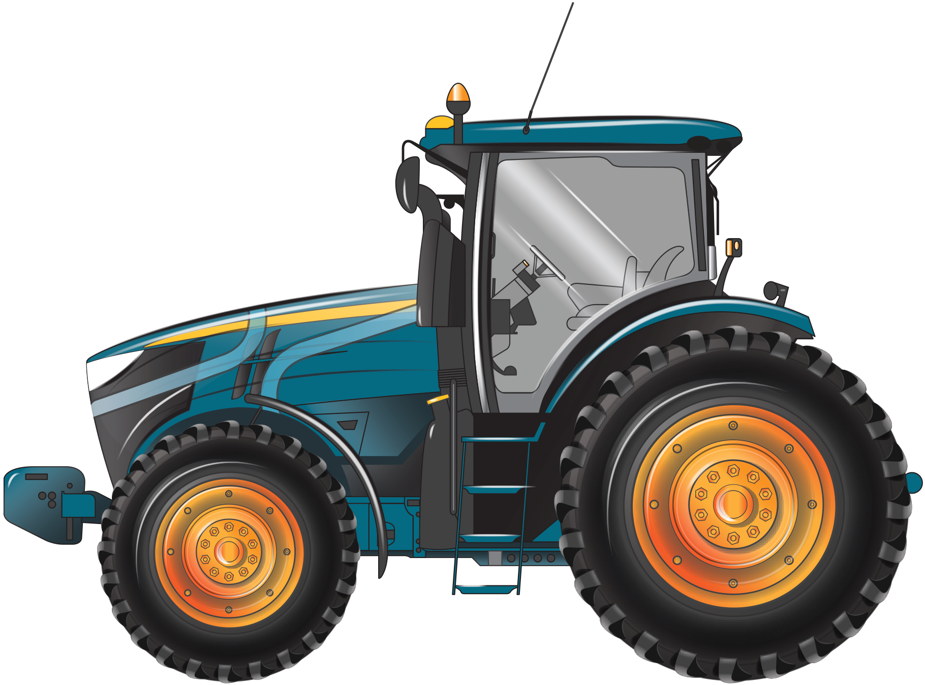
A heavy agricultural combination is a combination where at least one unit is an agricultural machine, agricultural implement or agricultural trailer with a GVM or ATM above 4.5 tonnes, even if the others are light vehicles.
Note: If a light agricultural vehicle is part of a heavy agricultural combination, the combination must comply with the notice and other HVNL provisions.
| Vehicle | Trailer | Combination | Light or heavy? |
|---|---|---|---|
 GVM = 2.0 tonnes (light) |
 ATM = 2.0 tonnes (light) |
 Light combination (light) |
This combination is not eligible under the Notice as this is a light combination consisting of a light machine and a light implement. All units are below 4.5 tonnes. |
 GVM = 4.0 tonnes (light) |
 ATM = 4.0 tonnes (light) |
 Light combination (light) |
This combination is not eligible under the Notice as this is a light combination consisting of a light machine and a light implement. Although the total mass is over 4.5 tonnes all units are below 4.5t. |
 GVM = 5.0 tonnes (heavy) |
 ATM = 2.0 tonnes (light) |
 Heavy combination (heavy) |
This combination is an eligible heavy combination consisting of a heavy machine towing a light implement. At least one unit is over 4.5 tonnes. |
 GVM = 4.0 tonnes (light) |
 ATM = 5.0 tonnes (heavy) |
 Heavy combination (heavy) |
This combination is an eligible heavy combination consisting of a light machine and a heavy implement. At least one unit is over 4.5 tonnes. |
 GVM = Over 4.5 tonnes (heavy) |
 ATM = Over 4.5 tonnes (heavy) |
 Heavy combination (heavy) |
This combination is an eligible heavy combination consisting of a heavy machine and a heavy implement. All units in the combination are over 4.5 tonnes. |
Eligible combinations consisting of non-agricultural components
A combination consisting of non-agricultural components is eligible to operate under the Notice if:
- at least one unit in the combination is an agricultural vehicle, agricultural machine, agricultural implement or agricultural trailer, and
- the combination will be completing or travelling to or from an agricultural task.
- being transported for the purpose associated with the intended agricultural task, for example, transported to mechanical services business (service or repair).
Examples of eligible combinations that include non-agricultural components, able to operate under the Notice:
- a prime mover or rigid truck towing an auger,
- a prime mover or rigid truck towing a comb implement.
A combination is considered a non-agricultural vehicle or combination if they are unable to comply with the conditions of the Notice, even if they are transporting equipment or goods used in agricultural activities.
For more information, refer to the When travel is NOT allowed under this Notice (non-agricultural combination).
Maximum number of towed implements or trailers in a combination
| Jurisdiction | Maximum number of towed implements or trailers |
|---|---|
| Australian Capital Territory, New South Wales, Queensland, Tasmania and Victoria | 2 |
| South Australia | No limit, the combination must not exceed the Zone dimension limits |
Transport of a harvester head
The frame used to transport the harvester header is eligible to travel (without the harvester head loaded on the frame) to:
- Pick up and drop off the harvester head.
- Transport the frame for a purpose associated with its intended purpose - e.g. towed to a mechanical service business (repair or service).
Eligible cotton harvesters in Queensland
In Queensland, eligible cotton harvesters are limited to the make and models in Table 4.
In all other states, a cotton harvester is eligible if it complies with the applicable Zone and Notice conditions.
| Cotton harvester |
|---|
| John Deere 7760 |
| John Deere CP690 |
| John Deere CS690, with or without the header being towed in the configuration |
When travel is NOT allowed under this Notice - Click to expand
When is travel NOT allowed under this Notice?
An agricultural vehicle is not considered eligible if it does not comply with any conditions of the Notice, the Guide or the Map, including:
- exceeding:
- a mass limit or a condition relating to mass; or
- a dimension limit for the Zone or condition,
- when not performing an agricultural task;
- If the vehicle or combination is a light agricultural vehicle or combination;
- when carrying a load not related to the agricultural task.
Non-agricultural vehicles and combinations
Non-agricultural vehicles or combinations cannot operate under the Notice, even if they are transporting equipment or goods used in agricultural activities.
Examples of a non-agricultural combination not eligible to operate under the Notice:
- a prime mover and non-agricultural trailer combination; or
- a rigid truck; or
- rigid and non-agricultural trailer combination.
This includes when transporting equipment or goods used in agricultural activities. These combinations are considered load-carrying vehicles.
Depending on the vehicle or combination, access may be considered for non-agricultural vehicles or combinations under another notice or via a mass and/or dimension permit subject to a granting of consent by the relevant road manager/s.
For more information, please contact the NHVR by email at info@nhvr.gov.au or by phone on 13 NHVR (13 64 87).
Light agricultural vehicles and implements
This Notice only relates to heavy agricultural vehicles or heavy agricultural combinations; refer to Table 2 for light agricultural vehicles operating as single vehicles, and light agricultural combinations that are not covered by this Notice.
Light agricultural vehicles, including agricultural trailers and implements, have a GVM or ATM not exceeding 4.5 tonnes.
Note: There may be state- or territory-specific legislation relating to the movement of light vehicles and light combinations that are over dimension. These are not administered by the NHVR.
For further information, please contact the relevant state or territory transport department.
Carrying a load not related to the agricultural task?
If the load on an agricultural implement or trailer is not relevant to the agricultural task, the agricultural vehicle or combination is not covered by the Notice.
For example, bagged fertiliser being carried on a silage trailer, which causes the combination to exceed regulation mass limits, is not covered by the Notice, as the load is not relevant to the agricultural task the trailer performs.
In these cases, access may be granted under another notice, or under a Class 1 or Class 3 mass and/or dimension permit, subject to consent by the relevant road manager/s. For more information, please contact the NHVR by email at info@nhvr.gov.au or by phone 13 NHVR (13 64 87).
Conditions
Notices are subject to various conditions to ensure public safety, protect assets and prevent adverse impacts on the community, such as noise, emissions and traffic congestion. See the sections below for specific conditions related to this Notice.
Note: Review the national dimension and mass requirements sections first then all other national conditions (including national pilot and escort conditions). Then consider the specific state, territory and council conditions related to this Notice.
National dimension conditions - Click to expand.
Unless a specific state condition is more restrictive, the following dimension limits apply nationally to eligible vehicles and combinations.
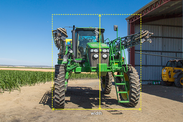
| Height (metres) | Zone 1 | Zone 2 | Zone 3 | Zone 4 | Zone 5 |
|---|---|---|---|---|---|
| All states | 5.0m | ||||
| Cotton Harvesters | 5.3m | ||||
| Width (metres) | Zone 1 | Zone 2 | Zone 3 | Zone 4 | Zone 5 |
|---|---|---|---|---|---|
| Victoria | 2.5m | 3.7m* | 5.0m* | 6.5m* | N/A |
| All other states and territories | 3.0m | 3.7m | 5.0m | 6.5m | 7.5m |
| *except for agricultural implements operating as an agricultural trailer, which are subject to a maximum width of 3.0m. | |||||
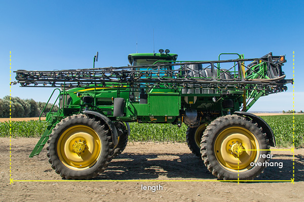
| Length (metres) | Zone 1 | Zone 2 | Zone 3 | Zone 4 | Zone 5 |
|---|---|---|---|---|---|
| Victoria and South Australia | 15.0m | ||||
| All other states and territories | 12.5m | 15.0m | |||
| Length (metres) | Zone 1 | Zone2 | Zone 3 | Zone 4 | Zone 5 |
|---|---|---|---|---|---|
| All states and territories | 19.0m | ||||
| Length (metres) | Zone 1 | Zone 2 | Zone 3 | Zone 4 | Zone 5 |
|---|---|---|---|---|---|
| South Australia | 19.0m | 25.0m | 35.0m | ||
| All other states and territories | 25.0m | 35.0m | |||
| Rear overhang (metres) | Zone 1 | Zone 2 | Zone 3 | Zone 4 | Zone 5 |
|---|---|---|---|---|---|
| Single vehicle | 5.5m | ||||
| Harvester rear overhang | 5.5m | 6.5m | |||
|
In Queensland, the rear overhang of a sugarcane harvester may be up to 7.8m during the daytime and night, subject to compliance with a pilot vehicle. Refer to Queensland – Pilot vehicle requirements for sugarcane harvesters with rear overhang up to 7.8m. |
|||||
| Rear overhang (metres) | Zone 1 | Zone 2 | Zone 3 | Zone 4 | Zone 5 |
|---|---|---|---|---|---|
| Victoria | 8.0m | 8.0m | 9.0m | 10.0m | 10.0m |
| All jurisdictions | 5.5m | ||||
| In NSW, an auger or conveyor rear overhang in Zone 1 may be up to 7.0m if the agricultural combination has a pilot vehicle positioned at the rear. | |||||
| Rear overhang (metres) | Zone 1 | Zone 2 | Zone 3 | Zone 4 | Zone 5 |
|---|---|---|---|---|---|
| All jurisdictions | 5.5m | 6.5m | |||
Smallest practicable size
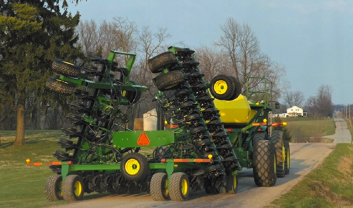
The driver of an agricultural vehicle or combination must ensure that it is kept to its smallest practicable dimensions during travel on public roads.
This is done by ensuring any mechanisms and/or booms are folded or retracted before travel. For example, transport mode is enabled on an air drill seeder during travel on a public road as illustrated in Figure 6, or raising implements designed to lower into the soil for seeding or tilling.
While travelling in their smallest practicable size, the agricultural vehicle/combination must still comply with the Notice's dimension limits and any other dimension-related conditions that apply.
National mass conditions - Click to expand
Unless a specific state condition is more restrictive, the following mass conditions apply nationally to an eligible vehicle or combination.
The mass of an agricultural vehicle or combination operating under the Notice must not exceed:
- 45.0 tonnes; or
- the mass of a single axle or axle group (Table 13); or
- the mass limit specific to rubber-tracked tractors (Table 15 and Table 32 in Queensland)
Agricultural vehicles and combinations are limited to a mass that is the lesser of:
- the mass limits specified or conditioned in the Notice;
- the mass determined by the tow mass ratios in the Notice; and
- any manufacturer's ratings.
Axle mass limits
Table 13 describes the maximum axle mass limits under the Notice.
| Number and width of tyres on an axle | Maximum axle mass limit (tonnes) | Maximum axle group mass limit (tonnes) |
|---|---|---|
| Axle fitted with 2 tyres and a tyre width less than 16 inches (406mm) | 10.0t | 20.0t on a tandem axle group 27.0t on a tri-axle group |
| Axle fitted with 2 tyres and a tyre width at least 16 inches (406mm) | 12.0t | 24.0t on a tandem axle group |
| Axle fitted with 4 tyres and a ground contact width less than 2.51m | 9.0t | N/A |
| Axle fitted with 4 tyres and a ground contact width at least 2.51m but not more than 3.5m | 10.5t | N/A |
| Axle fitted with 4 tyres and a ground contact width of more than 3.5m | 12.0t | N/A |
Restricted structures mass limits
An agricultural vehicle or combination must not be used on a structure with a signed load limit if the mass of the vehicle or combination exceeds the mass indicated on the signed load limit.
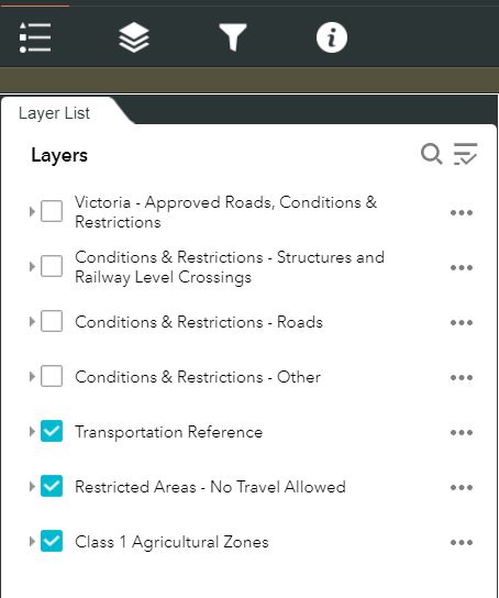
The Map or the Guide may identify restricted structures that must not be crossed or are subject to restricted access.
Check the Map and select the layer required.
Restricted structures without a signed mass limit
An agricultural vehicle or combination must not travel over a restricted structure with no signed mass limit if it has a mass greater than any one of the following mass limits:
| Axle or combination configuration | Mass limit (tonnes) |
|---|---|
| An axle fitted with 2 tyres | 6.0t |
| An axle fitted with 4 tyres | 10.0t |
| The total mass of the agricultural vehicle or combination | 42.5t |
| A tandem axle group* | 16.5t |
| A tri-axle group* | 20.0t |
| *Apply in Queensland only | |
Rubber tracked tractor requirements for travel in all states and territories other than Queensland
| Dual-tracked | Quad-tracked | Half-tracked | |
|---|---|---|---|
| Total mass | 24.0t | ||
| Tracked axle mass limits | N/A | ||
| Wheel axle mass limit | N/A | Refer to the axle mass limits table above | |
| Refer to Table 32 for special conditions for mass limits in Queensland. | |||
Cotton harvester mass limits
An eligible cotton harvester is a cotton harvester that has two axles that meet the following requirements:
| Axle location of the mass limit | Mass limits (tonnes) |
|---|---|
| Front axle | 18.0t |
| Rear axle | 13.0t |
National braking and tow mass ratio - Click to expand
Tow mass ratio restrictions for agricultural combinations
What is tow mass ratio?
Tow mass ratio means the ratio of the mass of the towing vehicle (agricultural machine or complying motor vehicle) to the combined mass of the towed implements and trailers, when all vehicles are connected as part of a combination.
Determining Tow Mass Ratio
When calculating the tow mass ratio, operators should weigh units of the combination when coupled. The mass of individual units may change when coupled to another vehicle, as mass can distribute across towed units in the combination.
Towing and towed vehicle masses include any load being carried by the vehicles.
Confirm your tow mass ratio with the Tow Mass Ratio Calculator (XLSX, 17KB)
Brakes
Agricultural machines and motor vehicles that provide the driving power in an agricultural combination must be fitted with brakes.
Trailers and implements towed in an agricultural combination are not required to be fitted with brakes; however, to promote acceptable braking performance, agricultural combinations are subject to:
- tow mass ratio requirements; or
- braking performance testing as detailed in National roller brake testing procedure (PDF, 728KB)
You must take extra care when towing, particularly if the towed trailer or vehicle is not fitted with brakes. The extra mass behind the towing vehicle may be less stable, have slower acceleration, and take longer to stop.
Complying braking system
For agricultural combinations where all towed implements and/or trailers comply with Australian Design Rule 38/00 – Trailer Brake Systems, the towed vehicles may have a combined total mass up to 3 times the mass of the towing vehicle. For example, for an agricultural combination where all units have complying brakes, if a tractor has a GVM of 10 tonnes, it may tow trailers with a combined GVM of up to 30 tonnes (i.e. a tow mass ratio of 1:3).
Non-complying braking system
If an agricultural combination includes at least one implement or trailer that is not compliant with Australian Design Rule 38/00 – Trailer Brake Systems, the combination must travel at a maximum speed of 25km/h in any zone and the towed mass ratio of the combination may be greater than 1.2 and up to 1.5 times more than the mass of the towing vehicle (that is 1:1.2 up to 1:1.5).
Braking performance test
If an operator cannot determine the mass of the vehicles to calculate the tow mass ratio, then a simple braking test can be performed.
The braking performance test is a procedure that may provide a means of complying with vehicle standards braking requirements upon successful completion and meeting the pass criteria.
Note that this braking performance test is optional, and you may choose to instead operate under the prescriptive requirements, which is explained in this Guide on:
- maximum operating speeds for agricultural combinations; and
- braking and Tow Mass Ratio requirements.
Important information
The braking performance test does not authorise a combination to exceed any mass limit of the Notice or a road manager condition relating to mass.
Basic brake test procedure
The following section outlines methods and requirements to measure stopping distance when applying brakes on your vehicle or combination.
Note:
- Information in this section is sourced from the National Heavy Vehicle Inspection Manual and the Heavy Vehicle (Vehicle Standards) National Regulation.
- Failure to undertake the braking performance test properly may result in a breach of the Chain of Responsibility (CoR) under the HVNL.
- The Braking Performance Test Form is not required to be submitted for approval by the NHVR or a road manager. However, it must be able to be presented upon request by an authorised officer.
The Braking Performance Test Form (DOCX, 132KB) must be completed by the driver or operator of an agricultural combination. This form is the approved template for recording the results of a braking performance test. All sections of the form must be completed.
- Operators must be satisfied that their vehicle passes the braking performance test and sign the declaration at the end of the form.
- The driver must keep a completed copy of the signed Braking Performance Test Form in the driving compartment of the combination when travelling.
- Each unit in the combination cannot be loaded to masses greater than when it passed the braking performance test.
- The braking performance test does not authorise any manufacturer’s ratings to be exceeded.
- The braking performance test does not authorise combinations to exceed sign posted speed limits.
Test track requirements
The test must be conducted on a dry, smooth, level road surface (i.e. flat) and free from loose material.
Ensure that you take adequate safety precautions considering the environment and any other factors that may pose a safety risk.
Please allow enough distance for your vehicle to accelerate up to test speed and stop safely.
Equipment requirements
- Minimum 4 markers (e.g. cone, box etc.) to set up on the test track approximately 10m apart.
- The first pair of markers is to indicate to the driver when to apply brakes.
- You may use a person to signal the driver when to apply brakes.
- The second pair of markers is to assist in measuring stopping distance.
- Additional pairs of markers are recommended for higher test speeds (10m spacing).
- Markers must be set up on both sides of the combination as per Step 4 (Table 17), to assist in measuring braking on a straight path. The distance from the combination to where the markers must be set up depends on the combination's width.
- Tape measure (recommended 10m or longer) or another measuring device to measure stopping distance and straight path.
Braking performance test instructions
| Step | Method |
|---|---|
| 1 |
Drive the vehicle to a nominal speed (common operating speed). If the vehicle has a manual transmission, once at the testing speed, put the transmission into neutral, automatic transmission vehicles may remain in gear. |
| 2 |
With hands-on the steering wheel, bring the vehicle to a halt as rapidly as possible. This is to be done safely with one sustained and smooth application of the service brakes. Examples of service brakes include hydrostatic brakes or a foot pedal. |
| 3 |
Measure stopping distance. The stopping distance is to be measured from the front of the combination to the first marker or where it is evident on the ground where brakes were first applied. 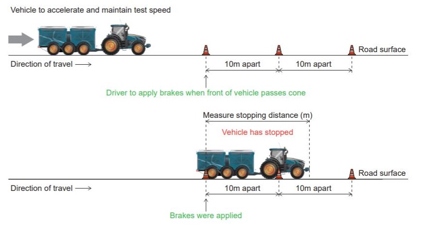 Successful result: Refer to Maximum stopping distance at various operating speeds to pass the braking performance test Table 18. |
| 4 |
Measuring straight path. The straight path to be measured based on the placement of the markers on the right and left sides of the combination. The distance that each pair of markers must be placed is provided below:
The markers must be set up so that they are in a straight line to each other (e.g. the markers form a parallel line on either side of the combination for the length of the test track) 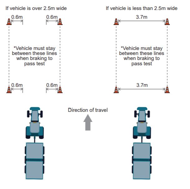 Note: This is an adaptation of section 87(1)(d) of the Heavy Vehicle (Vehicle Standards) National Regulation Successful result: After brakes have been applied, at no point in time did the unit in the combination move outside of the markers. |
| 5 | Record results. Refer to the mandatory Braking Performance Test Form (DOCX, 132KB) |
| 6 |
Repeat test and record results another two times. You must pass three attempts of the test. Note: Adjusting loading, operating speed and braking system performance may result in better performance. |
| 7 | Sign the declaration on the Braking Performance Test Form (DOCX, 132KB) |
| Operating speed (km/h) | Maximum stopping distance (m) | Operating speed (km/h) | Maximum stopping distance (m) | Operating speed (km/h) | Maximum stopping distance (m) |
|---|---|---|---|---|---|
| <10 | 1.3 | 24 | 7.9 | 38 | 19.9 |
| 11 | 1.6 | 25 | 8.6 | 39 | 20.9 |
| 12 | 1.9 | 26 | 9.3 | 40 | 22.0 |
| 13 | 2.3 | 27 | 10.0 | 41 | 23.1 |
| 14 | 2.7 | 28 | 10.8 | 42 | 24.3 |
| 15 | 3.1 | 29 | 11.5 | 43 | 25.4 |
| 16 | 3.5 | 30 | 12.4 | 44 | 26.6 |
| 17 | 3.9 | 31 | 13.2 | 45 | 27.9 |
| 18 | 4.4 | 32 | 14.1 | 46 | 29.1 |
| 19 | 4.9 | 33 | 15.0 | 47 | 30.4 |
| 20 | 5.5 | 34 | 15.9 | 48 | 31.7 |
| 21 | 6.0 | 35 | 16.8 | 49 | 33.0 |
| 22 | 6.6 | 26 | 17.8 | 50 | 34.4 |
| 23 | 7.2 | 37 | 18.8 | -- | -- |
Explanatory statement:
- Pass result: You may operate the combination, at the masses the test was performed, up to a speed of 40km/h, if you did the test at 40km/h and stopped within a maximum distance of 22m.
- Fail result: If you exceed the maximum stopping distance for the operating speed, your combination does not pass the braking performance test
National daytime conditions and holiday restrictions - Click to expand
Unless a specific state condition is more restrictive, operators must also adhere to the following daytime conditions listed below.
| Jurisdiction | Vehicle or Zone conditioned | Conditions of access | ||
|---|---|---|---|---|
| Australian Capital Territory |
Any agricultural vehicle and combination:
|
Travel i not permitted on the following locations or day at the time specified: | ||
| Location or day | Time | |||
| On weekdays or public holidays between | 7:00am and 9:00am; or 4:00pm and 6:30pm |
|||
| In Civic, Belconnen, Woden and Tuggeranong between | 8:00am and 9:00am; or 4:30pm and 5:30pm |
|||
| On the Tuggeranong Parkway | 8:00am and 9:00am; or 4:30pm and 5:30pm on weekdays |
|||
| On Saturdays | sunrise and 1.00pm | |||
| On Sundays | 10.00am and sunset | |||
| New South Wales | Any agricultural vehicle or combination operating under the Notice is travelling in Zone 1:
|
Travel is not permitted on the following roads on the day and time specified: | ||
| Road | Day | Time | ||
| Clearways or transit lanes when signed restrictions apply | Monday to Friday | 6:00am and 10:00am, or 3:00pm and 7:00pm |
||
| Any state road | Monday to Friday | 6:00am and 9:00am, or 4:00pm and 6:00pm |
||
| Any road | Sunday | 8:30am and 11:59pm | ||
| Cotton harvester or combination including a cotton harvester |
Travel is not permitted on school days
|
|||
| Queensland |
Any agricultural vehicle and combination Note: dimension limits apply 3.048m wide and 19m long. |
Travel is limited to the following locations at the approved operating times: | ||
| Location | Approved operating times | |||
| Gillies Highway (Gordonvale – Atherton Road) | 6:00pm and 7:00am; or 9:00am and 4:00pm |
|||
| Mossman – Mt Molloy Road (Rex Highway) | 6:00pm to 7:00am; or 9:00am to 4:00pm |
|||
| Kuranda Range (Kennedy Highway: Cairns – Mareeba) | 6:00pm to 7:00am; or 9:00am to 4:00pm. |
|||
|
Any agricultural vehicle and combination Note: dimension limits apply 3.3m wide to the extreme tyre edge. |
No access is permitted on the following bridges unless the load can be elevated at least 1.0m to clear the guard rails at the approaches: | |||
| Rifle Creek Bridge | Peninsula Developmental Road (Mt Molloy - Laura) | |||
| McLeod River Bridge | Peninsula Developmental Road (Mt Molloy - Laura) | |||
| Any agricultural vehicle and combination | No access is permitted at the following locations during the time of year: | |||
| Locations | Time of year | |||
| Cooktown Developmental Road North of Lakeland Downs | During the annual ‘wet’ season (January to June) | |||
| The Peninsula Developmental Road North of Laura | ||||
|
South East Corner |
||||
| No access is permitted on roads bounded by the area of Coolangatta in the South, Gympie in the North, and Toowoomba and Warwick in the West on the following day and time specified: | ||||
| Day | Hours | |||
| Saturdays and Sundays | 7:00am to sunset | |||
| A public holiday that is only one day in length | ||||
| Midday, the day before a state-wide long weekend | 7:00am to sunset on each day of the long weekend (long weekend is when a weekend joins a public holiday).
|
|||
|
The restrictions on public holidays do not include the Easter and Christmas holiday periods. Please refer to Queensland special conditions for Holiday Restrictions during the Easter and Christmas periods in Queensland. |
||||
| Major city and central business district (CBD) | ||||
| No access is permitted in Brisbane, the Gold Coast City or a CBD of any other city on the day and time specified: | ||||
| Day | Hours | |||
| Business days | 7.00am and 9.00am; and 4.00pm and 6.00pm |
|||
|
Major City and Central business district restriction doesn't apply to the following vehicle or combinations operating on the nominated Queensland network: |
||||
| Vehicle dimensions | Nominated Queensland network | |||
|
25m/26m B-double Networks | |||
|
Type 1 and Type 2 road train networks | |||
Holiday restrictions
| Jurisdiction | Vehicle | Public Holiday | Restriction or condition |
|---|---|---|---|
| Australian Capital Territory | Any agricultural vehicle and combination
|
|
No travel is permitted on weekends along Monaro Highway, Federal Highway, Sutton Road and Majura Road during the official snow season. |
| New South Wales | Any agricultural vehicle or combination operating under the Notice is travelling in Zone 1:
|
State-wide public holiday | No travel is permitted on any State road from 08:30am on the first day of the public holiday to 11:59pm on the final day of the public holiday period. |
Any agricultural vehicle or combination operating under the Notice is travelling in Zone 3 and Zone 5:
|
State-wide public holiday |
May only operate during a public holiday period if they are accompanied by (at a minimum) a pilot vehicle, unless travelling a distance of up to 500m between paddocks adjoining public roads. |
|
| Queensland |
Any agricultural vehicle and combination (Eligible cotton harvesters are exempt from the travel restrictions over the Easter period in Queensland, subject to the conditions contained within this Notice) |
Easter, Christmas and New Year’s holiday periods |
No travel is permitted in the following areas: A “Critical Area” is identified on the Map. Any place that is a built-up area within the town/city limits of Atherton, Ayr, Barcaldine, Biloela, Blackwater, Bowen, Brisbane, Bundaberg, Cairns, Caboolture, Charleville, Charters Towers, Cloncurry, Dalby, Emerald, Gladstone, Gold Coast, Goondiwindi, Gordonvale, Gympie, Ingham, Innisfail, Ipswich, Kingaroy, Logan City, Longreach, Mackay, Mareeba, Maryborough, Mount Isa, Port Douglas, Proserpine, Sarina, Sunshine Coast, Townsville, Rockhampton, Roma, Toowoomba, Warwick. |
|
No travel is permitted on the following roads: A “Critical Road” or “Major Road” is identified on the Map. Flinders Highway (Townsville – Cloncurry) 14 A, 14B, 14C, 14D, 14E Barkly Highway (Mt Isa – Northern Territory border) 15B, 15C Landsborough Highway (Morven – Cloncurry) 13A, 13B, 13C, 13D, 13E, 13F, 13G, 13H Capricorn Highway (Jericho-Barcaldine) 16D Carnarvon Development Road (Roma – Rolleston) 96A, 96B Carnarvon Highway (Surat – Roma) 24C Surat Development Road (Surat – Tara) 86A Moonie Highway (St George – Moonie) 35A. |
|||
| During the Easter, Christmas and New Year’s holiday periods, agricultural vehicles or combinations must be accompanied by at least one pilot vehicle extra to the requirements that would have normally applied. |
National night conditions - Click to expand.
When night travel is allowed
An agricultural vehicle or combination can travel at night, subject to compliance with the following width and length limits and accompanying pilot vehicle requirements (if applicable).
| Area | Width limit (metres) | Length limit (metres) | Pilot requirements |
|---|---|---|---|
| Zones 1–5 (all jurisdictions other than South Australia) | 2.5m | 25.0m | Nil |
| Agricultural Heavy Vehicle Restricted Road |
New South Wales approved night travel conditions
| Zone | Width limit (metres) | Length limit (metres) | Pilot requirements |
|---|---|---|---|
| NSW - Zone 3 | 3.5m | 25.0m | 2 pilots |
| NSW - Zone 5 | 3.5m | 25.0m | 2 pilots |
Queensland approved night travel conditions
| Zone | Width limit (metres) | Length limit (metres) | Pilot requirements |
|---|---|---|---|
| Queensland - Zones 3 and 4 (excluding Queensland 'Critical Roads') | 3.5m | 25.0m | 2 pilots |
Queensland sugarcane harvester night travel conditions
| Location of travel | Dimension | Distance (metres) | Pilot condition |
|---|---|---|---|
| To any road other than a road in an excluded area, listed in this Guide | Rear overhang | Up to 7.8m | One pilot vehicle (positioned at the rear) |
South Australia approved night travel conditions
An agricultural vehicle or combination can travel at night in South Australia, subject to compliance with:
- South Australian standard night travel conditions (Table 25);
- South Australian special night travel conditions (Table 26);
- South Australia non-participating night travel road managers (Table 27).
| Area | Width limit (metres) | Length limit (metres) | Pilot requirements |
|---|---|---|---|
| South Australia - Zone 2 | 3.7m | 19.0m | 2 Pilots (one at the front and one at the rear) |
| South Australia - Zone 5 | 4.0m | 25.0m | 1 pilot (at rear unless conditioned otherwise) |
| Council area | Conditions or restrictions |
|---|---|
|
Adelaide Plains Council |
2 pilot vehicles (one at the front and one at the rear) in the council area. Rubber tracked tractor: No night travel is permitted for rubber tracked vehicles. |
|
District Council of Cleve District Council of Franklin Harbour Kangaroo Island Council |
2 pilot vehicles (one at the front and one at the rear) in these council areas. |
| Clare and Gilbert Valleys Council | Rubber tracked vehicles:
|
| District Council of Elliston | Rubber tracked vehicles:
|
|
District Council of Barunga West District Council of Ceduna Wudinna District |
Operator to notify the council if the infrastructure is damaged. |
| City of Onkaparinga |
Restricted night travel area: No night travel in the following 'Restricted Agricultural Vehicle' area within the City of Onkaparinga refer to the 'Network and mapping' tab. |
|
District Council of Kimba Yorke Peninsula Council |
Rubber tracked vehicles: No travel is permitted unless the tractor is travelling to the location where it is being repaired or serviced. |
|
District Council of Yankalilla District Council of Robe Mount Barker District Council Tatiara District Council The Rural City of Murray Bridge The Berri Barmera Council The Corporations of the City of Whyalla The District Council of Mount Remarkable |
Rubber tracked tractor: No night travel is permitted for rubber tracked vehicles. |
South Australian - Non-participating night travel road managers
Non-participating road managers have not provided night travel to local roads within the council boundary.
| Zone | Road manager list |
|---|---|
| Zone 1 |
|
| Zone 2 |
|
| Zone 5 |
|
Tasmania approved night travel conditions
| Zone | Width limit (metres) | Length limit (metres) | Pilot requirements |
|---|---|---|---|
| Tasmania – Zone 3 | 2.5m – 3.1m | 25.0m | Nil |
| 3.5m | 22.0m | 1 pilot |
Victoria approved night travel conditions
| Zone | Width limit (metres) | Length limit (metres) | Pilot requirements |
|---|---|---|---|
| Victoria – Zones 2 and 3 (excluding harvesters) | 3.1m | 25.0m | 1 pilot |
| Victoria – Zones 2 and 3 (harvesters) | 3.5m | 25.0m | 1 pilot |
| Victoria – Zone 4 (excluding harvesters) | 3.1m | 25.0m | Nil |
| Victoria – Zone 4 (harvesters) | 4.0m | 25.0m | Nil |
When night travel is not allowed
If an agricultural vehicle or combination exceeds the width or length limit or does not have the required pilots (if applicable), as outlined in the jurisdiction night travel restrictions table, then access is not allowed at night under the Notice.
If travel at night is not allowed under the Notice, access may be possible at night under a Class 1 mass and/or dimension permit for the agricultural vehicle or combination, subject to a granting of consent by the relevant road manager/s. Refer to applying for a permit under the 'Network and mapping' tab.
| Jurisdiction | Location | Vehicle or combination restricted |
|---|---|---|
| Australian Capital Territory | All roads | Any agricultural vehicle and combination:
|
| Queensland | 'Critical Roads' | Any agricultural vehicle and combination that exceed 2.5m in width. |
|
Sugarcane harvesters with a rear overhang exceeding 6.5m. | |
| South Australia | Zone 1, and non-participating night travel road managers: | Any agricultural vehicle or combination. |
| Greater than 3.05 metres in width and/or 23 metres long must not travel on: | Horrocks Pass Road between Stirling North and Wilmington; | |
| Bridge over the River Murray on Old Princes Highway (Bridge Street) at Murray Bridge; | ||
| Paringa Bridge, Sturt Highway, Paringa. | ||
| Any tractor or combination must not travel: | Germein Gorge Road between Murray Town and Augusta Highway near Port Germein. | |
| Greater than 2.5m in width: | Must not travel on the Hindmarsh Island Bridge without Police closing the bridge to traffic. | |
| Greater than 4.0m in width must not travel on the following bridges without Police closing the bridge to other traffic: | Port Augusta Rail Bridge approximately 2.5km southeast of Joy Baluch Am Bridge, Port Augusta; | |
| Swanport Bridge, Murray Bridge; | ||
| Berri Bridge, Berri; | ||
| Blanchetown Bridge, Blanchetown; | ||
| Kingston Bridge, Kingston on Murray. | ||
| Greater than 4.8m in height must not travel on: | Murray Bridge over Long Flat Road on the flood plain at Murray Bridge; | |
| Bridge over the River Murray on Old Princes Highway (Bridge Street) at Murray Bridge; | ||
| Arches over the Barossa Valley Way (Main Street) at Tanunda. |
National travel conditions - Click to expand
No travelling if low visibility
The driver of an agricultural vehicle or combination must not travel on a public road if:
- visibility is less than 250m in the daytime; or
- the headlights of a vehicle approaching within 250m could not be seen at night.
If visibility is reduced to a distance less than described above, the driver must leave the road at the nearest safe parking area and wait there until visibility improves before recommencing travel.
Minimum following distance
On a public road, the driver of an agricultural vehicle or combination must drive at least 200m behind another oversize vehicle travelling in front of it, except when driving on a multi-lane road, in a built-up area or while overtaking.
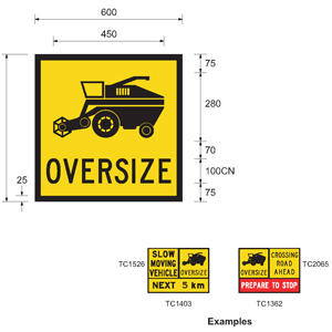
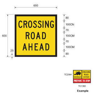
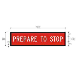
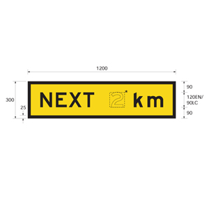
An oversize vehicle must comply with the warning sign requirements in Table 48 (warning signs tab below).
Allowing other vehicles to overtake
On a public road, the agricultural vehicle or combination driver must, at regular intervals, when reasonably practical and safe and in line with the road rules, move off the road to allow other vehicles to overtake it, unless there is a separate lane for overtaking vehicles.
The driver should assess a route for its capacity to allow for overtaking when conducting the pre-assessment of the route before travel.
Headlight operation during the day
An agricultural vehicle or combination fitted with headlights must operate with its headlights on and in the low beam position during the daytime when travelling on a public road.
This also applies to non-agricultural vehicles providing the drive power in an agricultural combination.
Can an eligible agricultural vehicle or combination carry a load
Agricultural implements and trailers used in agricultural combinations may carry a load if:
- all loads are properly restrained; and
- all loads are transported for the purpose of the agricultural task performed by the implement or machine; and
- the combination complies with the conditions of the Notice.
Examples are field bins, silage trailers, fertiliser spreaders and seeders, as long as the load they carry is relevant to the agricultural task being performed by the agricultural implement or trailer.
Schedule 8 of the MDL Regulations
Unless otherwise stated, eligible agricultural vehicles and combinations must comply with Schedule 8 of the MDL Regulation (conditions of mass or dimension exemptions applying to Class 1 heavy vehicles). In particular:
New South Wales special conditions - Click to expand
Rail level crossings
If crossing a rail level crossing in New South Wales, an agricultural vehicle or combination must contact and obtain the consent of a Rail Infrastructure Manager if:
- width is greater than 6.0m; or
- length is longer than 25.0m; or
- height is greater 4.6 metres.
Rail level crossings in New South Wales are indicated on the Map.
Requirements for cotton harvesters while being walked
The travel extension on the header of an eligible cotton harvester must be removed when the vehicle is being walked
New South Wales Agricultural Vehicle Route Assessment
The operator or driver of an agricultural vehicle or combination exceeding 6.5 metres in width that is operating in New South Wales in Zone 5 must complete a New South Wales Agricultural Vehicle Route Assessment (DOCX, 135KB).
A copy of the completed 'Agricultural Vehicle Route Assessment' must be carried in the driving compartment of the vehicle and produced upon request from an authorised officer or representative of the road authority, road manager or the NHVR.
The 'Agricultural Vehicle Route Assessment is not required to be submitted for approval.'
Queensland Special Conditions - Click to expand
Width restrictions on certain roads in Queensland
The maximum width of an agricultural vehicle or combination operating under the Notice is restricted on Critical Areas, Critical Roads and Major Roads in Queensland. These areas and roads are indicated on the Map and apply only to Queensland. These restrictions do not apply if crossing a road with a clear view of approaching traffic of at least 500m in both directions.
| Zone | Locations/roads (as identified on the Map or the Guide 'Network and mapping' tab) | Maximum width (unless otherwise conditioned) |
|---|---|---|
| Zone 4 | 'Critical Areas' and 'Critical Roads' |
5.0m This restriction does not apply to a cotton harvester up to 5.55m if travelling in accordance with the Queensland Police escort and level 2 escort vehicle requirements in Table 41. |
| Zone 3 Coastal Area | 'Major Roads' | 5.0m unless conditions in the dimension limits on certain 'TMR identified Major roads in the Zone 3 Coastal Area' |
| Dimension limits on certain roads ‘TMR Identified Major Roads in the Zone 3 Coastal Area’ | 4.0m and in accordance with Zone conditions of travel and pilot requirements. | |
| 'Critical Areas' and 'Critical Roads' | 4.0m and in accordance with the conditions of travel in the Zone 3 Coastal Zone | |
| Zone 3 | 'Critical Areas', 'Critical Roads' and 'Major Roads' | 3.5m and in accordance with the conditions of travel specified within the list. |
| Dimension limits on certain roads ‘TMR Critical Roads in the Gold Coast City Council Area' | 3.5m and in accordance with Zone conditions of travel and pilot requirements. |
Conditions of travel on a 'Critical Road' in Zone 3 Coastal Area
Agricultural vehicles and combinations with a width greater than 3.5m that are travelling in Coastal Zone 3 on 'Critical Roads' must travel in accordance with the requirements in Table 39: Pilot requirements for certain identified roads in Queensland.
Special conditions for sugarcane harvesters in Queensland
The following exemption applies only during daylight in Queensland.
A sugarcane harvester with a rear overhang up to 7.8m is allowed to travel on any road in Queensland, without being accompanied by a pilot vehicle, except for in the following three situations:
- No travel is allowed on a road in the sugarcane harvester excluded areas.
- Travel in a 'Critical Area' or on a 'Critical Road' is allowed only if accompanied by one pilot vehicle, positioned at the rear.
- Travel on a 'Major Road' is allowed only if accompanied by one pilot vehicle, positioned at the rear.
Note: If a rear pilot vehicle is already required due to another condition (e.g. due to the width being over 4.5m), then an additional rear pilot is not required.
Despite the above requirements, if a road is listed as an 'Approved Sugarcane Harvester Road', no pilot is required for travel during daylight hours.
Sugarcane harvesters with rear overhang up to 7.8m
In Queensland, the rear overhang of a sugarcane harvester may be up to 7.8m during the daytime and night, subject to compliance with:
- any pilot vehicle conditions that may exist (refer to the pilot vehicle requirements under the 'National pilot and escort conditions' expander);
- sugarcane harvester excluded areas (refer to the 'Network and mapping' tab).
At all times, the elevator of the sugarcane harvester must be moved in the same direction as the vehicle is turning to minimise the distance the overhang projects into the adjacent lane. The elevator should not project out beyond the side of the vehicle in an unsafe manner while performing this procedure.
Mass limits for cane bins and rubber tracked tractors in Queensland
Cane bin tri-axle mass limit
Agricultural machine and cane bin combinations with tri-axle groups may operate with a tri-axle group mass of up to 28.0 tonnes in Queensland only.
Rubber tracked tractor requirements for travel in Queensland
For travel in Queensland, rubber tracked tractors must meet the following requirements.
| Dual-tracked | Quad-tracked | Half-tracked | |
|---|---|---|---|
| Total mass | 24.0t | 28.0t | 24.0t |
| Track axle mass limits | Maximum mass of 12.0t per track | A mass not exceeding 7.0t per track, or 14 tonnes per pair of tracks | A mass not exceeding 7.0t per track, or 14 tonnes per pair of tracks |
| Wheeled axle mass limit | N/A | N/A | Refer to Axle Mass limits table |
| Track width | At least 16 inches (406mm) | At least 16 inches (406mm) | At least 16 inches (406mm) |
| Track length | Length must enable the tractor to comply with the Gross Mass Limit Formula (3L + 12.5) for travel over bridges in Queensland. |
|
|
Travelling over bridges in Queensland
This condition applies to all travel in Queensland, regardless of the Zone of travel.
The driver of an agricultural vehicle or combination must not drive over a bridge in Queensland if the total mass of the vehicle exceeds the Gross Mass Limit Formula, as follows: Mass in tonnes = (3 x L) + 12.5 where: ‘L’ is the distance in metres between the centre lines of the extreme axles of any axle group
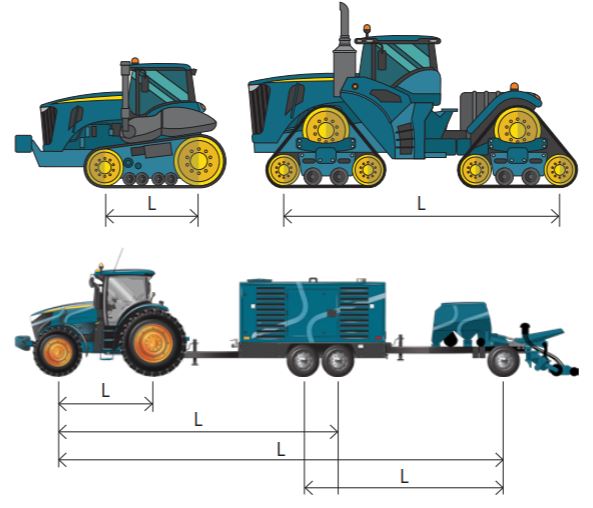
South Australian special conditions - Click to expand
River Murray Ferries
In South Australia, some agricultural vehicles and combinations may travel on ferries. However, some ferries are unable to accommodate larger agricultural vehicles and combinations.
If planning to travel on a ferry, you must:
- Contact the ferry operator before arriving at the ferry.
- Obtain the approval of the ferry operator before commencing your journey.
- Comply with all reasonable directions of a ferry operator, including providing details of the vehicle and load.
- Provide the ferry operator with dimensions of the vehicle/combination, or a weigh note or advise of the weight per axle in the combination.
Note: The ferry operator has the right to refuse access onto the ferry if insufficient details of the combination are provided.
Dimensional conditions apply to the River Murray Ferries.
| Width | Height | Length |
|---|---|---|
| 2.5m | 4.3m | 19.0m |
Ferry location can be located on the South Australian Government website - Ferry locations and operational status.
Victorian special conditions - Click to expand
Rubber tracked tractor requirements for travel in Victoria
For travel in Victoria, rubber tracked tractors must comply with the following conditions:
- travel at a maximum speed of 30 km/h; and
- where practicable, avoid turning movements on road surfaces, particularly sealed pavements, to minimise road damage.
Rail level crossings and tramway crossings
If crossing a rail level or tramway crossing in Victoria, an agricultural vehicle or combination must not exceed any of the following maximum dimension limits:
| Dimension | Maximum dimension (tram) | Maximum dimension (rail) |
|---|---|---|
| Width | 3.0m | 5.0m |
| Length | 26.0m | 26.0m |
| Height | 4.3m | 4.9m for railway crossing (may not apply in regional areas) |
| Level crossings in Victoria are indicated on the Map. | ||
What to do if a dimension limit is exceeded when travelling on rail level crossings and tramway crossings
If a dimension exceeds any of the above limits, you require a third-party approval.
For more information on how to get the relevant third-party approvals, visit the Victoria’s Department of Transport and Planning (DTP) website.
National pilot and escort conditions - Click to expand
Pilot vehicle requirements
A pilot vehicle must have at least 4 wheels and a GVM of:
- no more than 4.5t; or
- if the pilot vehicle is the rear pilot vehicle of 2 pilot vehicles that are required to accompany a Class 1 heavy vehicle—no more than 6.5t.
A pilot vehicle must have a warning sign attached to its roof.
A pilot vehicle must only have a warning light attached:
- above or below the warning sign; or
- at each side of the warning sign.
The low-beam headlights on a pilot vehicle or escort vehicle must be switched on when it is accompanying a Class 1 heavy vehicle during the daytime.
Where a pilot vehicle must be driven
The following pilot vehicle positions apply, unless stated otherwise. If one pilot, the pilot vehicle must travel:
- behind the heavy vehicle if they are on a divided road; or
- in front of the heavy vehicle if they are on a road that is not divided.
If two pilot vehicles, one pilot vehicle must travel in front of the heavy vehicle and the other behind it. A pilot vehicle must travel far enough away to give adequate warning to other road users of the presence of the oversize agricultural vehicle or combination, taking into account traffic speed, weather, visibility and other driving conditions.
General pilot requirements
General pilot conditions apply unless more restrictive requirement applies. Refer to state requirements.
| Pilot condition | Width greater than 3.7m | Width greater than 4.5m |
|---|---|---|
|
Pilot requirements related to the width. |
Nil, pilot requirements as conditioned below. |
One pilot vehicle. |
|
One pilot vehicle. |
Two pilot vehicles. |
|
A trip is less than 500m on a public road. |
No pilot is required unless otherwise required by another condition. |
|
|
Crossing a road with a clear view* of approaching traffic of at least 500m in both directions. |
No pilot is required unless otherwise required by another condition |
|
|
Crossing a road when clear view* of approaching traffic is:
|
One pilot is required while crossing the road. The pilot must be positioned on the side with the least vision when crossing the road. |
|
|
Crossing a road when a clear view* of approaching traffic is in both directions is less than 500m but longer than 100m. |
Two pilots are required while crossing the road. A pilot vehicle must be positioned on each side when crossing the road. |
|
|
Crossing a road when a clear view* of approaching traffic is less than 100m in any direction. |
The road is not to be crossed. An alternate location with the required clear vision distances of approaching traffic must be used. |
|
|
*Clear view means the view of the driver of the agricultural vehicle or combination. |
||
Pilot requirements for travel in an 80km/h or higher speed zone
This condition manages safety aspects of speed differences between the agricultural combination and other traffic using a high-speed road.
| When a pilot is required | Pilot requirement and location |
|---|---|
| The combined total mass of the towed vehicle(s) is greater than 1.2 times the mass of the towing vehicle, and travel is in an 80km/h or higher speed zone |
One pilot vehicle(positioned at the rear)* |
|
*The rear pilot applies regardless of distance travelled, and is in addition to a condition requiring a pilot vehicle to be positioned at the front. Note: If a rear pilot vehicle is already required due to another condition (e.g. due to the width being over 4.5m), an additional rear pilot is not required. A pilot vehicle is not required if crossing a road with a clear view of approaching traffic of at least 500m in both directions. |
|
Pilot requirements if the rear overhang greater than 6.5m
The following conditions manage safety aspects of tail swing and interaction of the combination with other traffic, particularly when turning (e.g. at intersections or when entering and exiting a property).
| When a pilot is required | Pilot requirement and location | |
|---|---|---|
|
An agricultural vehicle or combination with a rear overhang greater than 6.5m. |
One pilot vehicle (positioned at the rear). The rear pilot applies regardless of distance travelled, and in addition to a condition requiring a pilot vehicle to be positioned at the front. |
|
|
Sugarcane harvesters with a rear overhang of up to 7.8m that are travelling in Queensland. |
Excluded area. |
No travel approved. |
|
Critical area or critical road. |
One pilot (positioned at the rear). |
|
|
Major road. |
||
|
Approved sugarcane harvest road. |
Nil pilots during day travel. One pilot (positioned at the rear) during night travel. |
|
|
Note: If a rear pilot vehicle is already required due to another condition (e.g. due to the width being over 4.5m), an additional rear pilot is not required. A pilot vehicle is not required if crossing a road with a clear view of approaching traffic of at least 500m in both directions. Despite the above exemptions from pilot vehicle requirements for rear overhang up to 7.8m, sugarcane harvesters must still travel following any other dimension and pilot conditions that may apply for travel during daytime or night (e.g. due to vehicle width). |
||
Escort vehicles
An escort vehicle must have:
- at least 4 wheels; and
- a GVM of 4.5t or less; and
- 1 or 2 warning lights on its roof.
A police vehicle or transport enforcement vehicle, the warning light may flash any colour (section 79 of Schedule 2 of the Heavy Vehicle (Vehicle Standards) National Regulation).
This section does not apply to an escort vehicle that is a motorcycle driven by a police officer in the course of the officer’s duty.
New South Wales special escort conditions
New South Wales – Augers and conveyors in Zone 1
The following condition applies to agricultural combinations towing augers or conveyors, regardless of the distance travelled in Zone 1 in New South Wales.
| Zone | When a pilot is required | Pilot requirement |
|---|---|---|
|
NSW - Zone 1 |
With a rear overhang that exceeds 5.5m but is not more than 7.0m |
One pilot vehicle (positioned at the rear) |
|
Note: A pilot vehicle is not required if crossing a road with a clear view of approaching traffic of at least 500m in both directions. |
||
New South Wales escort vehicle requirement
The operator or driver of an agricultural vehicle or combination exceeding 6.5m in width that is operating in Zone 5 in New South Wales must contact NSW Police prior to travel, to organise any additional pilot vehicles or escort services that may be required.
A minimum of five working days is required for police notification letters and/or the organisation of police resources.
For further information, contact the NSW Police Traffic and Highway Patrol Command office on (02) 8882 1436 or at trafficosom@police.nsw.gov.au
For information on pilot and escort accreditation, see the NHVR publication Pilots and escort training and recognition.
Queensland special Pilot and Escort conditions
Level 1 pilots in the Coastal Zone area
In Queensland, certain roads have been granted access under the Notice that would have otherwise been granted access only by permit. To manage the risks associated with the movement of oversize agricultural combinations on these roads, level 1 pilots are required as an alternative option instead of using portable roadside warning signs for travel in the Coastal Zone area. Information on level 1 pilots in Queensland is available on the TMR website under pilot and escort vehicle driver.
Special pilot requirement for Queensland Zone 3 Coastal
When travelling in Queensland, the following pilot vehicle arrangements instead of the general pilot requirements:
| Zone | Location/roads | Dimension | Pilot requirements |
|---|---|---|---|
| Zone 3 Coastal Area | 'Critical Road' (unless conditioned otherwise) | Vehicle or combinations with a width greater than 3.5m |
A minimum buffer zone of 0.5m from the centre line at all times (unless turning across a roadway). Must be accompanied by one pilot and one level 1 pilot:
or Must be accompanied by one pilot vehicle, and portable roadside warning signs must be placed:
|
| 'Critical Roads' in the Gold Coast City Council Area | Agricultural vehicles and combinations less than 3.5m wide | As per the general pilot requirements table and night travel conditions | |
| 'Major roads' identified in the dimension limits on certain roads in Queensland Zone 3 Coastal Area | Vehicles and combinations up to 3.5m wide | As per the general pilot requirements table | |
| Vehicles and combinations greater than 3.5m up to 4.0m wide |
Must be accompanied by two pilot vehicles; or Must be accompanied by one pilot vehicle and portable roadside warning signs placed:
|
||
|
Local government roads (within the Gold Coast City Council limits) |
Agricultural vehicles and combinations with a width greater than 3.5m |
Must be accompanied by two pilot vehicles; or Must be accompanied by one pilot vehicle, and portable roadside warning signs must be placed:
|
Queensland – Additional pilot vehicle requirement
Pilot vehicle requirements for travel in Queensland regardless of the distance travelled.
| When a pilot is required | Pilot requirement |
|---|---|
| A length greater than 25.0m and up to 30.0m and travelling in any QLD Zone | At least one pilot vehicle 1 |
|
1 This does not apply if already accompanied by a pilot vehicle due to another requirement Note: A pilot vehicle is not required if crossing a road with a clear view of approaching traffic of at least 500m in both directions. |
|
Pilot vehicle requirements in Queensland during holiday periods
During the Easter, Christmas and New Year’s holiday periods, agricultural vehicles or combinations must be accompanied by at least one pilot vehicle extra to the requirements that would have normally applied.
Queensland Level 2 escort vehicle requirements
In Queensland, certain roads have been granted access under the Notice that would have otherwise been granted access only by permit.
To manage the risks associated with the movement of oversize agricultural combinations on these roads, level 2 escort vehicles are required as per Table 39. These requirements apply, despite the distance travelled.
Pilot vehicles and level 2 escort vehicles are not required if crossing a road with a clear view of approaching traffic of at least 500m in both directions.
Information on level 2 escort vehicles in Queensland is available on the TMR website.
An operator of an agricultural vehicle or combination operating under the Notice must not operate on any part of the following roads/ bridges without contact being made with the Department of Transport and Main Roads service to ascertain any escort requirements that may apply:
- the Old Marlborough Sarina Road on the Sarina Range (Sarina Police)
- the Peak Downs Highway on the Eton Range (Mackay Superintendent of Traffic)
- the Burdekin River Bridge (Home Hill Police)
- the Kuranda Range (Kennedy Highway: Cairns – Mareeba)(Cairns Police).
Queensland Police escort vehicle requirements
The operator or driver of an agricultural vehicle or combination requiring a Queensland Police Escort must give Queensland Police reasonable Notice when requesting it from them. The Queensland Police Heavy Vehicle Road Operations Program Office can be contacted on 1300 077 020 or at www.police.qld.gov.au/units/police-wide-load-escorts.
| Dimensions | Road | Escort requirement |
|---|---|---|
| Width greater than 5.0m up to 5.55m for eligible cotton harvesters | Warrego Highway (between Henningsen Road Oakey and Dalby) | One Queensland Police escort that is positioned:
Two level 2 escort vehicles that are positioned:
|
| Width greater than 5.0m up to 5.55m for eligible cotton harvesters | Approved Major Roads for eligible cotton harvesters in Zone 4 - Major Roads are identified on the Map | Two level 2 escort vehicles that are positioned:
|
| Width greater than 5.0m | Warrego Highway (between Mitchell and Charleville) | Three level 2 escort vehicles that are positioned:
|
| Burke Development Road (between Dimbulah and Chillagoe) | ||
| Kennedy Highway (between Mt Garnett and intersection of Tumoulin Rd) | ||
| Tumoulin Road (between Ravenshoe and Evelyn) | ||
| Width greater than 5.0m, up to 5.5m (excluding cotton harvesters) | Major Roads in Zone 4 Major Roads are identified on the Map | Three level 2 escort vehicles that are positioned:
|
| Width greater than 5.5m up to 6.5m | Major Roads in Zone 4 Major Roads are identified on the Map |
One Queensland Police escort that is positioned:
Two level 2 escort vehicles that are positioned:
|
| Combination length greater than 30m and up to 35m | Any road |
If the combination already requires two pilot vehicles due to its width, the pilot ahead of the combination is to be substituted with a level 2 escort vehicle. This level 2 escort vehicle is required to direct traffic as necessary, due to potentially significant swept path. |
Special pilot requirements in South Australia
Pilot vehicle requirements for travel in Zone 2 and Zone 5
When travelling in South Australia, the following pilot vehicle arrangements instead of the general pilot requirements:
| When a pilot is required | Pilot requirement and location | |
|---|---|---|
| Zone location and dimensions |
Zone 2 Width greater than 3.0m |
Zone 5 Width greater than 3.7m but not more than 6.0m |
| If a clear view of approaching traffic is less than 500m ahead. | One pilot vehicle required (positioned at the front) | |
| If a clear view of approaching traffic is less than 500m behind. | One pilot vehicle required (positioned at the rear) | |
| If a clear view of approaching traffic is less than 500m both ahead and behind approaching travel is reduced to less than 500m. | Two pilots vehicles are required (positioned at front and rear) | |
| A pilot vehicle is not required if crossing a road with a clear view of approaching traffic of at least 500m in both directions | ||
| Zone | When a pilot is required | Pilot requirements and location |
|---|---|---|
| Zone 5 | Width greater than 6.0m but not more than 7.5m | Two pilot vehicles are required (one positioned at the front and one positioned at the rear). |
| Note: A pilot vehicle is not required if crossing a road with a clear view of approaching traffic of at least 500m in both directions. | ||
Police requirements for certain bridges in South Australia
Agricultural vehicles and combinations must not travel over the bridges listed below without police closing the bridge to traffic if they exceed the following dimensions:
| Bridge name and location | Police escort required if exceeding the following width |
|---|---|
| Hindmarsh Island Bridge, Hindmarsh Island | 3.5m |
| Port Augusta Rail Bridge approximately 2.5km southeast of Joy Am Bridge, Port Augusta | 4.0m |
| Swanport Bridge, South Eastern Freeway | |
| Murray Bridge, South Eastern Freeway | |
| Blanchetown Bridge, Sturt Highway, Blanchetown | |
| Berri Bridge, Bookpurnong Road, Berri | |
| Kingston Bridge, Sturt Highway, Kingston on Murray |
Restriction on what a pilot or escort vehicle may carry
A pilot vehicle or escort vehicle must not tow a trailer or carry goods, but it may carry equipment or substances for use in connection with the Class 1 heavy vehicle it is accompanying or for restraining a load on that heavy vehicle.
Special pilot requirements in Tasmania
Pilot vehicle requirements related to the width
When travelling in Tasmania, the following pilot vehicle arrangements instead of the general pilot requirements.
| When a pilot is required | Width greater than 3.5m | Width greater than 4.5m |
|---|---|---|
| Pilot required due to width | One pilot | Two pilots |
Special pilot requirements in Victoria
Victoria – Additional pilot vehicle requirements
When travelling in Victoria, the following pilot requirements apply when exceeding 25.0m in length or 5.0m in width.
| Pilot condition | Pilot requirement and location |
|---|---|
| A length greater than 25.0m | Two pilots vehicles (one positioned at the front and one positioned at the rear)* |
| A width greater than 5.0m | Two pilots vehicles (one positioned at the front and one positioned at the rear)* |
|
*Where a pilot is already required in a position due to another condition, an additional pilot is not required in that same position. Note: A pilot vehicle is not required if the trip is less than 500m on a public road; or crossing a road with a clear view of approaching traffic of at least 500m in both directions. |
|
Warning lights, flags and signs - Click to expand
Warning lights
An agricultural vehicle or combination operating under the Notice must have an active warning light attached as per the requirements in Table 47.
| Dimension | Time | Road |
|---|---|---|
|
Width is wider than 3.0m |
Day |
Any road |
|
Width is wider than 2.5m, or length is longer than 22m |
Any time |
'Major Road' |
|
Width is wider than 2.5m, or length is longer than 22m |
Night |
Any road |
A warning light attached to an agricultural vehicle or combination, when switched on, must:
- emit a yellow coloured light of rotating and flashing effect
- flash between 120 and 200 times a minute
- have a power of at least: 25W if LED technology is used, or
- 55W if another technology is used; and
- not be a strobe light.
A warning light attached to an agricultural vehicle must be:
- clearly visible at a distance of 500m in all directions, or
- supplemented by one or more additional warning lights, so that the light emanating from at least one of them is clearly visible at a distance of 500m in any direction.
However, for a pilot vehicle travelling in front of a Class 1 heavy vehicle, a filter may be placed behind the warning light attached to the pilot vehicle to reduce the intensity of the light directed to the driver of the heavy vehicle.
The switch for a warning light must be within easy reach of the driver in the normal driving position in the vehicle.
A warning light must only be switched on when the heavy vehicle is travelling or is stationary in a position that is likely to cause danger to other road users.
Warning lights must be designed and fitted in accordance with Schedule 8 Part 3 Division 1 of the MDL.
Warning flags and signs
An agricultural vehicle or combination operating under the Notice must be fitted with warning signs (Figure 9) and flags as outlined in Table 48.
Note: the most restrictive requirement applies, where more than one of the following conditions applies to the agricultural vehicle or combination.
| Dimension | Attachment location | |
|---|---|---|
| Warning flag | Warning sign | |
| Longer than 22m | N/A | Rear |
|
Longer than 25m |
Front and rear | |
|
Wider than 2.5m* *Tractors with a constructed width exceeding 2.5m are exempt from requiring warning flags or signs. |
Front and rear | |
|
Agricultural implement being towed by a tractor* *This warning device requirement applies, regardless of the dimension. |
N/A | Rear |
| During the day crossing a road, or travelling along a grass reservation beside a road. | N/A | N/A |
Warning flag requirements
A warning flag must:
- be 450mm long and 450mm wide;
- be bright coloured red, red and yellow, or yellow; and
- be mounted on each side of the rear of an agricultural vehicle or combination (if required).
Warning light and side and rear marker requirements for night travel
If travelling at night:
- side markers must be displayed: not more than 2m apart along the total length of each side of the vehicle and any load projecting from the front or rear of the vehicle; and
- at each corner of any load projecting from the front or rear of the vehicle; and
- two rear markers must be fitted to the rear of any load projecting from the rear of the vehicle within 400mm of each side of the load and at least 1m, but not more than 2.1m, above the ground; and
- a warning light must be attached to the vehicle if it, together with any load, is wider than 2.5m or longer than 22m.
Light and reflector requirements for night travel
Agricultural vehicles and combinations operating at night must comply with Part 6 of the VS Regulation, concerning lights and reflectors.
Warning sign requirements
The warning sign on an agricultural vehicle must be at least 1,200mm long and at least 450mm high. The length of the sign may be split in two parts, in which case the combined length of its parts must be at least 1,200mm.
A warning sign on the agricultural vehicle must:
- have a face showing the word OVERSIZE, in black capital letters and in typeface Series C(N) complying with AS 1744 Forms of Letters and Numerals for Road Signs. Note: AS 1744 Forms of Letters and Numerals for Road Signs may be purchased from Standards Australia; and
- have letters at least 200mm high and at least 125mm from the top and bottom of the warning sign.
If the length of the warning sign is spilt into two parts:
- the word OVER must be on the left part and the word SIZE on the right part;
- there must be no border between the two parts; and
- both parts must be mounted at the same height.
A warning sign on an agricultural vehicle must be fitted horizontally. The lower edge of the warning sign must be:
- above the bottom bumper bar; or
- if there is no bumper bar, at least 500mm above ground level.
The face of a warning sign on a Class 1 agricultural vehicle must have:
- a yellow surface complying with Class 1 or 2 of AS 1906 ‘Retro-reflective Materials and Devices for Road Traffic Control Purposes’;
- a black border that is at least 20mm wide and, unless the sign is made with a box edge, the outermost edge of which is at least 10mm in from the edge of the sign; and
- its manufacturer’s name or trademark, and the brand and class of material as used for the warning sign’s surface, permanently marked in letters at least 3mm but no more than 10mm high on any visible part of the sign.
A warning sign on an agricultural vehicle must be made of stiff, flat, weatherproof material, for example:
- zincalume that is at least 0.8mm thick
- aluminium that is at least 1.6mm thick.
However, it may be made of flexible, weatherproof material if the sign is:
- held taught
- clearly visible
- unlikely to become dislocated or rolled up, or otherwise difficult to be read by other road users.
Warning signs must be designed and fitted in accordance with Schedule 8 Part 3 Division 2 of the MDL.
Warning patterns
A warning pattern (Figure 10) must be displayed at the sides of the rear of any auger, conveyor or the reaping implement of a combine harvester.
A warning pattern must:
- cover an area of at least 0.16m2; and
- consist of diagonal stripes at least 150mm wide that are alternately coloured red and white or black and white.
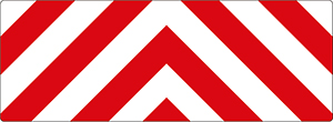

Headlights
The agricultural vehicle or combination must have its low-beam headlights on while it is being used in the daytime.
Requirements for tractors
Any part of an axle extending more than 150mm from the outside wall of a tractor’s tyre must be painted fluorescent yellow, or have yellow fluorescent or other high-visibility material wrapped around it.
Warning lights and delineators if a load projects from a vehicle
As per Section 3 of Schedule 8 of the MDL Regulation, an agricultural vehicle or combination requires warning lights and delineators if:
- a load projects more than 150mm beyond the side of the vehicle or combination; and
- the projection is less than 500mm thick from top to bottom.
Warning lights must be designed and fitted in accordance with Schedule 8 Part 3 Division 1 of the MDL Regulation.
Delineators must be designed and fitted in accordance with section 3 of Schedule 8 of the MDL Regulation.
Portable road side warning sign designs for Queensland
Registration and licensing - Click to expand
Registration
An eligible vehicle must have registration or conditional registration before operating on the road network.
Conditional registration is registration for non-standard vehicles that do not comply with the standard registration regulations and have a genuine need for limited access to the road network.
As agricultural machines have their own automotive power, they generally need to be registered. Some agricultural implements and trailers may not require registration.
The NHVR is not responsible for registration or conditional registration. State and territory governments administer the registration aspect of transport law.
Registration requirements are dependent on the state or territory. For further information, please use the links below or contact the relevant state or territory transport department:
| Jurisdiction | Website |
|---|---|
| Australian Capital Territory | Access Canberra |
| New South Wales | Transport for NSW (TfNSW) |
| Queensland | Department of Transport and Main Roads (TMR) |
| South Australia | Department for Infrastructure and Transport (DIT) |
| Tasmania | Department of State Growth (DSG) |
| Victoria | Department of Transport and Planning (DTP) |
Licensing
In order to drive a heavy agricultural vehicle or agricultural combination on public roads, operators require a licence of the appropriate class.
The NHVR is not responsible for licence requirements. State and territory governments administer the licensing aspect of transport law.
Licensing requirements are dependent on the state or territory. For further information, please use the links below or contact the relevant state or territory transport department:
| Jurisdiction | Website |
|---|---|
| Australian Capital Territory | Access Canberra |
| New South Wales | Transport for NSW (TfNSW) |
| Queensland | Department of Transport and Main Roads (TMR) |
| South Australia | Department for Infrastructure and Transport (DIT) |
| Tasmania | Department of State Growth (DSG) |
| Victoria | Department of Transport and Planning (DTP) |
Complying with licensing conditions
Travel on public roads must be conducted in accordance with any licensing conditions that may apply.
Other conditions and additional information
Assessing routes before travel
Before driving on a public road, the driver or operator of an oversize or overmass agricultural vehicle or combination must be satisfied that the route has been assessed and that the vehicle can be driven without:
- disrupting telecommunication, electricity, rail, gas, water or sewage services; and
- damaging roads, structures, rail crossings or trees.
Part of this process is assessing the Map and reading this Guide before travel to identify any restrictions or conditions that may affect travel. In some cases, approval is required from third parties or entities when a vehicle exceeds certain mass or dimension limits.
Third party approvals
Gazette notices, permits and some jurisdictional laws may require third parties and other entities to provide permission for a vehicle to travel if it exceeds certain mass or dimension limits.
Operators must secure all approvals from third parties such as electricity/utility companies, rail authorities and other third parties as part of their heavy vehicle operations.
Third-party providers may need to:
- be notified of the movement.
- assess the proposed route, assessing for suitability of the movement.
- provide approval, which may impose conditions, for the movement to occur either over or under assets they own (in most cases, there is a legislated requirement for operators to seek this approval).
For more information, visit the Third party approvals page.
Complying with the HVNL
Unless otherwise exempted by the Notice or this Operator's Guide, operators must ensure their vehicle or combination complies with the:
- Australian Design Rules (ADRs); and,
- Heavy Vehicle National Law (HVNL); and,
- Heavy Vehicle (Mass, Dimension and Loading) National Regulation (MDL); and,
- Heavy Vehicle (Vehicle Standards) National Regulation (VS Regulation).
Using or permitting another person to use a defective heavy vehicle or a heavy vehicle with unapproved modifications on a road may be an offence.
Failure to comply may result in the driver and/or operator being liable for an offence. Penalties can include infringement notices or prosecution.
Loading requirements
To meet the loading requirements, the heavy vehicle must be loaded:
- in a way that load placement does not make the heavy vehicle unsafe or unstable
- in a way that the load is not likely to fall or be dislodged from the vehicle
- using an appropriate system to restrain the load.
Visit the NHVR loading page for more information on load requirements.
Chain of Responsibility (CoR)
Under the HVNL, every party in the Chain of Responsibility (CoR) has a positive duty to ensure the safety of their activities in relation to a heavy vehicle. This duty, known as the “primary duty”, applies to the scheduling, loading and consigning of a vehicle, as well as to its operation on a road.
Safety is broader than the safety of drivers and other road users. It also includes protection of road infrastructure, preventing damage to other vehicles or property, and minimising environmental harm. Substantial penalties may be imposed upon parties who breach this obligation and upon their executives.
For more information on your CoR obligations visit Chain of Responsibility on the NHVR website.
Our Regulatory Advice offers guidance, tips and tools for managing a range of heavy vehicle safety risks.
The requirement to carry the Notice
Drivers do not need to carry a copy of the Notice.
Network and mapping
For the purposes of s121 of the HVNL, an area or route specified in the 'Network and Mapping' section of this Operator's Guide is a stated area or route to which this Notice applies. In addition to complying with the conditions stated in this Operator's Guide, operators must ensure compliance with the specific road manager access requirements set out below or in network maps.
National networks - Roads covered by this Notice
The Agricultural Heavy Vehicle Zone Map displays the Agricultural Heavy Vehicle Zones as areas of operation.
Agricultural vehicles and combinations are provided access to all public roads in the approved Zone of the Map unless conditioned by a specific road manager or structural conditions.
The Map is published and maintained by the NHVR.
Specified road manager network requirements
The following section outlines specific road manager network requirements under the Notice, including route conditions, restrictions, and non-participating road managers.
Road manager network requirements in this section may change from time to time and should be reviewed regularly to ensure compliance.
For further information on how to comply with a requirement, please contact the relevant road manager.
Road managers may publish specific route conditions and restrictions on the approved network map. These conditions and restrictions must be complied with in addition to any route requirements outlined in the Notice or within this Operator's Guide. If a condition listed in any section of this Operator's Guide conflicts with a route condition or restriction published on an approved network map, the more restrictive requirement applies.
National speed conditions - Click to expand
Important: You must take extra care when towing a trailer or another vehicle, particularly if the towed vehicle is not fitted with brakes. This is because, with the extra mass behind the towing vehicle, your combination vehicle may be less stable, have slower acceleration, and may take longer to stop.
Maximum operating speed for agricultural combinations
The Notice states speed limits for certain agricultural combinations. The speed limits are based on the tow mass ratio between the hauling unit and the trailer.
An agricultural combination must be operated at a speed that is the lesser of:
- A speed condition described in Table 51 and Table 52.
- For operation under any of the conditions described in Table 51 - the applicable speed conditions in Table 51.
- For all other agricultural vehicles and combinations - the applicable speed condition in Table 52.
- A posted speed limit.
- Any applicable vehicle manufacturer's speed limit.
| Combination type | State | Maximum speed | Speed condition |
|---|---|---|---|
| Rubber tracked tractors | Victoria only |
The lesser of:
|
|
| Eligible cotton harvesters or combinations including a cotton harvester | New South Wales and Queensland only | 10km/h | Applies only when travelling over structures (bridges), travel over structures must also be on the centre carriageway. |
| A motor vehicle (other than an agricultural machine) towing a laden or unladen comb implement | Queensland only | 80km/h |
Applies when:
Does not apply when:
|

| Brake test | Trailer brakes | Tow mass ratio limit | The speed limit is lesser of | |
|---|---|---|---|---|
|
Conducted - and meets the requirements of the alternate method - brake performance test |
Any |
No more than the operating mass and tow mass ratio used in the braking performance test |
The posted speed limit on a section of road |
No more than the speed used in the braking performance test |
|
Not Conducted - no braking performance test conducted |
At least one trailer brake is not compliant with ADR38/00 |
No greater than 1:1.2 |
50km/h |
|
|
Greater than 1:1.2 but less than 1:1.5 |
25km/h |
|||
|
Greater than 1:1.5 |
Operation prohibited under this Notice |
|||
|
Equipped with brakes compliant with ADR38/00 |
No greater than 1:3 |
50km/h |
||
The following Table 53 provides a list of road managers where the Queensland 80km/h speed condition doesn't apply. These road managers have not provided consent to allow the increased speed limit.
| Local council area |
|---|
|
New South Wales network conditions - Click to expand
Transport for New South Wales (TfNSW state roads)
Cotton harvesters
Cotton harvesters and combinations including cotton Harvesters are limited to 100km per trip.
Eligible cotton harvesters must comply with the mass limits of the Notice and may only travel on approved Cotton Harvester Roads, as identified on the Map.
Eligible cotton harvesters must not:
- cross a timber bridge; or
- cross a cotton harvester 'Do Not Cross Structure', as identified on the Map.
Travel is only permitted over other structures (e.g. bridges) if travelling down the centre of the carriageway at a speed not exceeding 10km/h.
Travel conditions on certain roads
Agricultural vehicles and combinations may travel on the restricted highways in Table 54, only in accordance with any conditions that apply.
| Road name | From | To | Conditions |
|---|---|---|---|
| Barton Highway | Yass River | ACT Border | An agricultural vehicle or combination exceeding 2.5 metres wide or 22 metres long is not permitted to travel after 8:30am on Sundays and state-wide public holidays. |
| Bruxner Highway | Sneaths Road, Wollongbar | Three Chain Road, South Lismore | An agricultural vehicle or combination exceeding 3.2 metres wide is not permitted to travel from Monday to Saturday from 7:30am to 9:30am and from Monday to Friday from 3:00pm to 6:00pm (except on state-wide public holidays). |
| Cobb Highway | Shaw Street, Moama | Sturt Street, Echuca |
An agricultural vehicle or combination exceeding 2.5 metres wide is not permitted to travel from Monday to Friday from 7:30am to 9:30am and from 12 noon to 1:00pm and from 3:00pm to 6:00pm. Travel is also not permitted on Saturday and Sunday from 7:30am to 9:00am and from 12 noon to 1:00pm. |
| Golden Highway | Zone 5 boundary | Mitchell Highway, Dubbo | An agricultural vehicle or combination exceeding 6.5 metres wide is not permitted to travel more than 15 kilometres per trip on the Golden Highway. |
| Great Western Highway | Nepean River, Emu Plains | Queens Road, Katoomba |
An agricultural vehicle or combination wider than 2.5 metres is not permitted to travel from Monday to Friday between 6:00am and 9:00am and between 4:00pm and 7:00pm (except on state-wide public holidays). An agricultural vehicle exceeding 2.5 metres wide or 22 metres long is not permitted to travel after 8:30am on Sundays and state-wide public holidays. |
| Kings Highway | Nerriga Road, Braidwood | Princes Highway, Batemans Bay | An agricultural vehicle or combination exceeding 2.5 metres wide or 22 metres long is not permitted to travel between sunrise and sunset on weekends from the first day of November to the last day of February (inclusive). |
| Mitchell Highway | Zone 5 boundary | South Australia border | An agricultural vehicle or combination exceeding 6.5 metres wide is not permitted to travel more than 15 kilometres per trip on the Mitchell Highway. |
| New England Highway | Denton Park Road, Rutherford | Liverpool Street, Scone | An agricultural vehicle or combination wider than 2.5 metres is not permitted to travel from Monday to Friday from 4:30am to 9:30am and from 2:30pm to 7:30pm. |
| New England Highway | Magpie Street, Singleton Heights | Weakleys Drive, Beresfield | An agricultural vehicle or combination exceeding 2.5 metres wide is not permitted to travel from Monday to Friday from 7:30am to 9:30am and from Monday to Friday from 3:00pm to 6:00pm (except on state-wide public holidays). |
| Newell Highway | Queensland Border |
Victorian Border | An agricultural vehicle or combination exceeding 6.5 metres wide is not permitted to travel more than 15 kilometres per trip on the Newell Highway. |
| Olympic Highway | Coolamon Road, Wagga Wagga | Dunns Road, Kapooka | An agricultural vehicle or combination exceeding 4.6 metres wide is not permitted to travel from 7:30am to 9:30am and from 3:30pm to 6:00pm (except on state-wide public holidays). |
| Oxley Highway | Zone 5 boundary | Mitchell Highway, Nevertire | An agricultural vehicle or combination exceeding 6.5 metres wide is not permitted to travel more than 15 kilometres per trip on the Oxley Highway. |
| Pacific Highway | Ferry Street, Nambucca | Wallace Street, Nambucca | An agricultural vehicle or combination exceeding 2.5 metres wide or 22 metres long is not permitted to travel from Monday to Saturday from 7:30am to 9:30am and from Monday to Friday from 3:00pm to 6:00pm (except on state-wide public holidays). |
| Pacific Highway | Stadium Drive, Coffs Harbour | West Korora Road, Coffs Harbour | An agricultural vehicle or combination exceeding 2.5 metres wide or 22 metres long is not permitted to travel from Monday to Saturday from 7:30am to 9:30am and from Monday to Friday from 3:00pm to 6:00pm (except on state-wide public holidays). |
| Princes Highway | Cobargo Bermagui Road, Cobargo | Old Highway, Narooma | An agricultural vehicle or combination exceeding 2.5 metres wide or 22 metres long is not permitted to travel after 8:00am on Saturdays, Sundays and state-wide public holidays. |
| Princes Highway | Illaroo, Bomaderry | Bridge Road, Nowra | An agricultural vehicle or combination exceeding 2.5 metres wide or 22 metres long is not permitted to travel from Monday to Saturday from 8:00am to 10:00am and from Monday to Friday from 3:00pm to 6:00pm (except on state-wide public holidays). This condition applies to Southbound travel only. |
| Princes Highway | Imlay Street, Eden | Victorian border | An agricultural vehicle or combination exceeding 2.5 metres wide or 22 metres long is not permitted to travel after 8:00am on Saturdays, Sundays and state-wide public holidays. |
| Princes Highway | Rose Valley Road, Gerringong | Woodhill Mountain Road intersection, Berry | An agricultural vehicle or combination exceeding 2.5 metres wide or 22 metres long is not permitted to travel after 8:00am on Saturdays, Sundays and state-wide public holidays. |
| Snowy Mountains Highway | Gocup Road Tumut | Kosciuszko Highway, Cooma | An agricultural vehicle or combination exceeding 2.5 metres wide or 22 metres long is not permitted to travel between sunrise and sunset on weekends during the official snow season from the Queen’s Birthday weekend in June to the Labour Day weekend in October (inclusive). |
| Sturt Highway | River Drive, Mildura | Hugh King Drive, Mildura | An agricultural vehicle or combination exceeding 3.5 metres wide is not permitted to travel from Monday to Saturday from 8:00am to 10:00am and from Monday to Friday from 3:00pm to 6:00pm (except on state-wide public holidays). |
| Sturt Highway | Smith Street, Forest Hill | Olympic Highway, Moorong | An agricultural vehicle or combination exceeding 4.6 metres wide is not permitted to travel from Monday to Friday from 7:00 am to 9:30 am and from 3:30pm to 6:00pm (except on state-wide public holidays). |
| Summerland Way | Clarence Street, Grafton | Through street, Grafton | An agricultural vehicle or combination exceeding 2.5 metres wide or 22 metres long is not permitted to travel from Monday to Saturday from 7:30am to 9:30am and from Monday to Friday from 3:00pm to 6:00pm (except on state-wide public holidays). |
Prohibited bridges in New South Wales
Agricultural vehicles and combinations are not allowed to travel under the Notice on the prohibited bridges listed in Table 55.
| Bridge number and name | Description | Bridge number and name | Description | Bridge number and name | Description |
|---|---|---|---|---|---|
| BN226 Sydney Harbour Bridge | Over Sydney Harbour on MR632. | BN29 Tom Ugly’s Bridge | Northbound bridge on Princes Highway (HW1) across Georges River at Sylvania. | BN172 Suspension Bridge | Over waterway on Strathallen Avenue (MR599) at Northbridge. |
| BN333 Victoria Bridge | Over Nepean River on Great Western Highway (HW5) at Penrith. |
BN415 Windsor Bridge | Over Hawkesbury River on Bridge Street (MR182) Windsor. | BN98 Bentley’s Bridge | Park Creek (Channel), Rushcutters Bay (Urban) |
| BN143 | Bridge on Sir Bertram Stevens Drive, over Flat Rock Creek No. 2, Royal National Park | BN291 | Northbound bridge on Hume Highway over Prospect Creek, at Lansdowne | BN292 | Southbound bridge on Hume Highway over Prospect Creek, at Lansdowne |
| BN341 Peats Ferry Bridge | Over Hawkesbury River on Pacific Highway, Peats Ferry | BN360 Lennox bridge | Church Street, over Parramatta River at Parramatta | BN388 | Bridge on Showground Road, over Cattai Creek, at Castle Hill |
| BN592 Gasworks Bridge | On Macarthur Street, over Parramatta River, at Parramatta | BN1461 Gostwyck Bridge | Over Paterson River, Dungog Road near Martins Creek | BN1472 Coorei Bridge | Over Williams River, Stroud Hill Road Dungog |
| BN2082 Barrington Bridge | Over Barrington River, Thunderbolts Way Barrington | BN1535 Vacy Bridge | Over Paterson River, Tocal Road Vacy | BN1481 Morpeth Bridge | Over Hunter River, Phoenix Park Road Morpeth |
| BN1780 Luskintyre Bridge | Over Hunter River, Luskintyre Road Luskintyre | BN1683 Dunmore Bridge | Over Paterson River, Paterson Road Woodville | BN1784 Glennies Creek Bridge | Over Glennies Creek, Middle Falbrook Road Middle Falbrook |
| BN1557 Kayuga Bridge | Over Hunter River, Kayuga Road Muswellbrook | BN1527 Beckers Bridge | Over Webbers Creek, Gresford Road Glendon Brook | BN1737 Bulga Bridge | Over Wollombi Brook, Putty Road Bulga |
| BN1661 Elderslie Bridge | Over Hunter River, Elderslie Road Elderslie. | BN2266 Tabulam Bridge | Over Clarence River, Bruxner Highway Tabulam | BN2462 Glebe Bridge | Over Richmond River, Dawson Street Coraki |
| BN2531 | Bridge over Sportsmans Creek, Bridge Street Lawrence | BN2537 McFarlane Bridge | Over Clarence River, Lawrence Road Maclean. | BN2680 Briner Bridge | Over Upper Coldstream River, East of Ulmarra. |
| BN2676 Bawdens Bridge | Over Orara River, Old Glen Innes Road Chambigne | BN2581 Korns Bridge | Over Rous River, Numinbah Road Crystal Creek | BN2594 Colemans Bridge | Over Leycester Creek, Union Street Lismore |
| BN2681 | Bridge over Orara River, Sherwood Creek Road Glenreagh | BN3140 Fladbury Bridge | Over Severn River, Emmaville Road Glen Innes | BN1015 Abercrombie Bridge | Over Abercrombie River (67km North of Crookwell) |
| BN1185 Wallaby Rocks Bridge | Over Turon River, Hill End Road West of Sofala | BN6396 James Park Bridge | Over Crookwell River, Binda Road Northwest of Crookwell | BN6675 Lansdowne Bridge | Over Mulwaree Ponds, Bungonia Road Goulburn. |
| BN6237 New Buildings Bridge | Over Towamba River, New Buildings Road New Buildings | BN6129 Crankies Plain Bridge | Over Coolumbooka River, Cathcart Road Bombala | BN875 Hampden Bridge | Over Kangaroo River, Moss Vale – Nowra Road, Kangaroo Valley |
| BN6168 | Bridge over Wallaga Lake, Bermagui – Tathra Road Wallaga Lake | BN6506 Charleyong Bridge | Over Mongarlowe River, Nerriga Road Charleyong | BN5575 Bethanga Bridge | Over Murray River, Riverina Highway at Hume Weir |
| BN5947 Towong Bridge | Over Murray River, Towong Road at Towong. | BN5945 Indi Bridge | Over Murray River, Indi Road at Indi | BN5944 Goldsworthy Bridge | Over Murray River, Indi Road at Biggara |
| BN6633 Wee Jasper Bridge | Over Goodradigbee River, Tumut – Yass Road Wee Jasper | BN6637 Prince Alfred Bridge | Over Murrumbidgee River, Middleton Drive Gundagai | BN713 | Bridge over Shoalhaven River, Southbound at Nowra |
| BN935 | Bridge over Tongarra Creek at Shellharbour | BN3318 Barmah Bridge | Over the Murray River, near Barmah (VIC) | BN5950 Batemans Bay Bridge | Over Clyde River at Batemans Bay |
| BN5974 | Bridge over Corunna Lake, Corunna | BN1832 Dennis Bridge | Over Hastings River (39.83km South of Kempsey) | BN2948 Bingara Bridge | Over Halls Creek, Fossickers Way North Bingara |
| BN2949 Bingara Bridge | Over Gwydir River, Fossickers Way North Bingara | BN3655 Namoi River Bridge | Over Namoi River, Fossickers Way Manilla | BN3137 Bengalla Bridge | Over Dumaresq River, near Queensland border Yetman |
| BN3763 Bundarra Bridge | Over Gwydir River, Thunderbolts Way Bundarra | BN4050 Cohens Bridge | Over Namoi River, Kelvin Road Gunnedah | BN4100 Lignum Bridge | Over Lignum Creek, Mid Western Highway East of Marsden – use sidetrack |
| BN4285 Iron Bridge | Over Lachlan River, Cowra Road Forbes | BN4659 Paytens Bridge | Over Lachlan River, at Colletts Crossing | BN1304 Beryl Bridge | Over Wialdra Creek, Spring Ridge Road Northwest of Gulgong |
| BN4469 Holman Bridge | Over Lachlan River, at Gooloogong on Grenfell – Canowindra Road | BN4645 Rawsonville Bridge | Over Macquarie River, North Minore Road Minore | BN4658 Waroo Bridge | Over Lachlan River, Hodges Road West of Warroo |
| BN4660 Scabbing Flat Bridge | Over Macquarie River, Ponto Road Geurie. | BN3970 Iron Bridge | Over Namoi River, Boggabri to Manilla Road North of Boggabri. | BN5149 Abbotsford Bridge | Over Murray River, Silver City Highway at Curlwaa |
| BN3244 Tooleybuc Bridge | Over Murray River, Kyalite Road at Tooleybuc | BN3377 Nyah Bridge | Over Murray River, Nyah Road at Nyah | BN3375 Gonn Crossing | Over Murray River, Murrabit Road at Gonn Crossing |
| BN3215 Swan Hill Bridge | Over Murray River, McCallum Street at Swan Hill | BN3256 Koondrook Bridge | Over Murray River, Thule Street at Barham. | BN3184 Echuca Bridge | Over Murray River, Cobb Highway Echuca – Moama |
| BN5819 Mulwala Bridge | Over Murray River, Yarrawonga Road at Mulwala | BN3220 Jacksons Bridge | Over Lachlan River, Mossgiel Road Hillston | BN3315 Coonamit Bridge | Over Wakool River, Moulamein Road, Swan Hill |
| BN3248 Carrathool Bridge | Over Murrumbidgee River, South of Carrathool | BN3235 Gee Gee Approach Bridge | Over Wakool River North, Swan Hill – Barham Road Wetuppa | BN3237 Gee Gee Bridge | Over Wakool River North, Swan Hill – Barham Road Wetuppa |
Prohibited roads in New South Wales
Agricultural vehicles and combinations are not allowed to travel under the Notice on the prohibited roads listed in Table 56.
| Road name | From | To | Road name | From | To | Road name | From | To |
|---|---|---|---|---|---|---|---|---|
| Sydney CBD Zone | Sydney CBD Zone | Sydney CBD Zone | Barrenjoey Road | Avalon Parade, Bigola Beach | Neptune Road, Bigola Beach | Berowra Waters Road | Pacific Highway, Berowra | Berowra Waters Ferry |
| Boundary Street | South Dowling Street, Darlinghurst | Nield Avenue, Darlinghurst | Bradfield Highway | Southern Toll Plaza, Sydney | Lavendar Street, North Sydney | Bridge Street | George Street, Windsor | Freemans Reach Road, Windsor |
| Bulli Pass (HW1) | Mount Ousley Road, Bulli Tops | Lawrence Hargrave Drive, Thirroul | Cahill Expressway | Southern Toll Plaza, Sydney | Eastern Distributor, Sydney | Concord Road | Llewellyn Street, Rhodes | The Loop Road, Meadowbank |
| Cross City Tunnel | McLachlan Avenue, Rushcutters Bay | Harbour Street, Darling Harbour | Eastern Distributor | Sydney Harbour Tunnel, Sydney | Baker Street, Kensington | Frederick Street | Heighway Avenue, Ashfield | Elizabeth Street, Ashfield |
| Galston Road | Mountview Pde, Hornsby Heights | Calderwood Road, Glaston | George Booth Drive (MR527) | M1 Motorway, Seahampton | 1km North West of Mount Sugarloaf Road | Great Western Highway | Bruce Neale Drive, Penrith | Stanton Place, Emu Plains |
| Heathcote Road | New Illawarra Road, Lucas Heights | Princes Highway, Heathcote | Henry Parry Drive Gosford (MR673) | York Street, Gosford | Etna Street, Gosford | Johnston Street | The Crescent, Annandale | Bayview Crescent, Annandale |
| King Street | Sydney Park Road, St Peters | Carillon Avenue, Newtown | Lady Wakehurst Drive, Sir Bertram Stevens Drive, Audley Road and Farnell Avenue (MR393) | Princes Highway, Loftus | Bald Hill Lookout, Stanwell Park | Lane Cove Tunnel | Pacific Highway, Chatwood | Lane Cove River, Lane Cove North |
| Lawrence Hargrave Drive (MR185) | Princes Highway, Thirroul | Princes Highway, South of Helensburgh | M2 Motorway | Lane Cove Road, Macquarie Road | Beecroft Road, Epping | M5 East Motorway | King Georges Road, Beverly Hills | General Holmes Drive Mascot |
| Macarthur Street | George Street, Parramatta | New Zealand Street, Parramatta | Macquarie Street | Brabyn Street, Windsor | Argyle Street, Windsor | McCarrs Creek Road | Monavale Road, Terry Hills | Church Point Ferry Wharf |
| McKell Avenue (MR393) | Princes Highway, Waterfall | Sir Bertram Stevens Drive, Waterfall | NorthConnex M1 | Pacific Motorway Wahroonga | M2 Motorway West Pennant Hills | Old Pacific Highway | Hawkesbury River | M1 Pacific Motorway Overpass, Kariong |
| Parramatta CBD | Parramatta CBD | Parramatta CBD | Princes Highway (HW1) | Belgrave Esplanade, Sylvania | Tom Ugly’s Point, Blakehurst | Raw Square | Albert Road, Strathfield | Leicester Avenue, Strathfield |
| Seven Ways Rockdale (MR169) | Princes Highway, Rockdale |
Watkin Street, Rockdale | Strathallen Avenue | Cliff Road, Northbridge | The Boulevarde, Northbridge | Sydney Harbour Tunnel | Warringah Freeway, North Sydney | Cahill Expressway, Sydney |
| Wilton Road | Douglas Park Road, Wilton | Cataract Dam Road, Appin | Wisemans Ferry Road | Berecry Road, Mangrove Mountain | Hawkesbury River, Wisemans Ferry | Wollongong CBD | Wollongong CBD | Wollongong CBD |
| Wollongong Road | Allen Street, Arncliffe | Wollongong Road, Arncliffe | Woy Woy Bay Road (RR7751) | Central Coast Highway, Kariong | Rawson Road, Woy Woy | -- | -- | -- |
Dimension limits on certain roads
The maximum dimensions allowed to travel under the Notice are limited on certain roads in New South Wales, as shown
in Table 57. Agricultural vehicles and combinations must only travel on these roads following the conditions of access that
may apply.
| Road | From | To | Width limit (m) | Height limit (m) | Length limit (m) | Conditions |
|---|---|---|---|---|---|---|
| Araluen Road | Seymour Stree at Majors Creek | Wamban Road at Moruya | 2.5 | N/A | 19.0 | If your vehicle or combination exceeds a dimension limit, you must obtain a Class 1 permit before commencing your journey. No through travel permitted. |
| Armidale Road | South Street, Nymbodia | Tyringham Road, Tyringham | 2.5 | N/A | 19.0 | If your vehicle or combination exceeds the dimension limit you must obtain a Class 1 permit before you commence your journey. |
| Bells Line of Road | Hermitage Road at Kurrajong Hills | Darling Causeway at Bell | 2.9 | N/A | 19.0 | If your vehicle or combination exceeds a dimension limit you must obtain a Class 1 permit before you commence your journey. |
| Bruxner Highway | Long Gully Road, Drake | Bellevue Road, Tenterfield | 2.5 | N/A | 25.0 | If your vehicle or combination exceeds a dimension limit you must obtain a Class 1 permit before you commence your journey. Conditions of travel include:
|
| Bruxner Highway | Tabulam Road, Tabulam | Clarence River Road, Tabulam | 3.5 | N/A | 25.0 | If your vehicle or combination exceeds a dimension limit you must obtain a Class 1 permit before you commence your journey. Overmass travel is not permitted. |
| Coramba Road (RR120) | Vine Street, Dorrigo | Orara Way, Coramba | 2.5 | N/A | 19.0 | If your vehicle or combination exceeds a dimension limit you must obtain a Class 1 permit before you commence your journey |
| Crookwell to Trunkey Creek (Binda Road MR54) | Peelwood Road, Tuena | Caves Road, Abercrombie Caves | 2.5 | N/A | 19.0 | If your vehicle or combination exceeds a dimension limit you must obtain a Class 1 permit before you commence your journey. |
| Darling Causeway | Bells Line of Road, Bell | Great Western Highway, Mount Victoria | 2.9 | N/A | 19.0 | If your vehicle or combination exceeds a dimension limit you must obtain a Class 1 permit before you commence your journey./td> |
| Gocup Road | Eagle Street, South Gundagai | Snowy Mountains Highway, Tumut | 3.5 | N/A | N/A | If your vehicle or combination exceeds a dimension limit you must obtain a Class 1 permit before you commence your journey. The operator must contact Police before travel on (02) 8882 1436. |
| Grahamstown Road | Gundagai Road, Tumblong | Mount Horeb Road, Mount Horeb | 3.5 | N/A | N/A | If your vehicle or combination exceeds a dimension limit you must obtain a Class 1 permit before you commence your journey. The operator must contact Police before travel on (02) 8882 1436. |
| Gwydir Highway | Camp Road, Glen Elgin | Glen Elgin Prison Farm entrance | 3.0 | N/A | 25.0 | If your vehicle or combination exceeds a dimension limit you must obtain a Class 1 permit before you commence your journey. Conditions of travel include:
|
| Hawkesbury Road | Roberts Parade, Winmalee | Blue Mountains LGA boundary | 2.5 | N/A | 12.5 | If your vehicle or combination exceeds a dimension limit you must obtain a Class 1 permit before you commence your journey. |
| Illawarra Highway | Broughton Ave, Tullimbar | Jamberoo Mountain Road, Robertson | 2.5 | N/A | 19.0 | If your vehicle or combination exceeds a dimension limit, you must obtain a Class 1 permit before commencing your journey. |
| Jenolan Caves Road (MR253) | Ridge Road, Jenolan | Kanagara Walls Road, Jenolan | 2.5 | 4.3 | 12.5 | If your vehicle or combination exceeds a dimension limit you must obtain a Class 1 permit before you commence your journey. |
| Kangaroo Valley Road | Moss Vale Road, Kangaroo Valley | Princes Highway, Berry | 2.5 | N/A | 19.0 | If your vehicle or combination exceeds a dimension limit you must obtain a Class 1 permit before you commence your journey. If wider than 2.5m contact Police before travel on (02) 8882 1436. Police escort required if wider than 3.0m. A vehicle or combination requiring a Police escort must complete an Agricultural Vehicle Route Assessment. |
| Kings Highway | Monkittee Street Braidwood | Princess Highway, North Batemans Bay | 2.5 | N/A | 19.0 | If your vehicle or combination exceeds a dimension limit you must obtain a Class 1 permit before you commence your journey. |
| Moss Vale Road | Barfield Road, Cambewarra | Myra Vale Road, Fitzroy Falls | 2.5 | N/A | 19.0 | If your vehicle or combination exceeds a dimension limit you must obtain a Class 1 permit before you commence your journey. If wider than 2.5m contact Police before travel on (02) 8882 1436. Police escort required if wider than 3.0m. A vehicle or combination requiring a Police escort must complete an Agricultural Vehicle Route Assessment. |
| New England Highway | Caroline Street, Bendemer | Charles Street, Moonbi | 3.5 | N/A | N/A |
One pilot vehicle is required if exceeding 3.2 metres wide. If your vehicle or combination exceeds a dimension limit, you must obtain a Class 1 permit before commencing your journey. A condition of travel includes:
A vehicle or combination requiring a Police escort must complete an Agricultural Vehicle Route Assessment. |
| New England Highway | Kiernans Road, Bolivia | Peberdy’s Creek, Deepwater | N/A | N/A | N/A | If your vehicle or combination exceeds a dimension limit you must obtain a Class 1 permit before you commence your journey. Conditions of travel include:
|
| New England Highway | Mount Mitchell Road, Glencoe | Tubbamurra Road, Llangothlin | N/A | N/A | N/A |
If your vehicle or combination exceeds a dimension limit you must obtain a Class 1 permit before you commence your journey. A condition of travel includes:
|
| Oxley Highway | Raffles Creek Bridge | Yarrowitch River, Yarrowitch | 2.5 | N/A | 19.0 | If your vehicle or combination exceeds a dimension limit, you must obtain a Class 1 permit before commencing your journey. |
| Princes Highway | Dalmeny Drive, Narooma | Riverside Drive, Narooma | 3.0 | 4.5 | N/A | If your vehicle or combination exceeds a dimension limit you must obtain a Class 1 permit before you commence your journey. If wider than 3.0m or higher than 4.4m, contact Police on (02) 8882 1436. |
| Princes Highway | Dalmeny Drive, Narooma | Cobargo Bermagui Road, Cobargo | 3.0 | N/A | 25.0 | If your vehicle or combination exceeds a dimension limit you must obtain a Class 1 permit before you commence your journey. Contact Police before travel if wider than 3.0m on (02) 8882 1436. |
| Princes Highway | Poplar Street, Bega | Belmore Street, Bega | 3.0 | N/A | 25.0 | If your vehicle or combination exceeds a dimension limit you must obtain a Class 1 permit before you commence your journey. Contact Police before travel if wider than 3.0m on 02) 8882 1436. |
| Princes Highway | Wharf Road, Batemans Bay | Clyde Street, Batemans Bay | 3.2 | N/A | N/A | If your vehicle or combination exceeds a dimension limit you must obtain a Class 1 permit before you commence your journey. One pilot is required if wider than 3.2m but not wider than 3.5m. |
| Putty Road | East Kurrajong Road, Kurrajong | Milbrodale School | 2.5 | 4.3 | 19.0 | If your vehicle or combination exceeds a dimension limit you must obtain a Class 1 permit before you commence your journey. No through travel is permitted for vehicles or combinations wider than 3.2 metres. |
| Snowy Mountains Highway | Rest Area at Wattle Road | Nunnock River | 2.5 | N/A | 19.0 | If your vehicle or combination exceeds a dimension limit, you must obtain a Class 1 permit before commencing your journey. |
| Snowy Mountains Highway | Tumut Plains Road, Tumut | Kosciusko Road Cooma | 2.5 | N/A | 19.0 | If your vehicle or combination exceeds a dimension limit you must obtain a Class 1 permit before you commence your journey. If wider than 2.5m contact Police before travel on (02) 8882 1436. A vehicle or combination requiring a Police escort must complete an Agricultural Vehicle Route Assessment. |
| Taralga Abercrombie Road | Cobodong Road, Abercrombie | Brass Walls Road, Abercrombie | 2.5 | N/A | 19.0 | If your vehicle or combination exceeds a dimension limit you must obtain a Class 1 permit before you commence your journey. |
| The Chifley Road | Bells Line of Road, Bell | Great Western Highway, Bowenfels | 2.5 | N/A | 19.0 | If your vehicle or combination exceeds a dimension limit you must obtain a Class 1 permit before you commence your journey. |
| Tomewin Road (RR143) | Murwillumbah Street Murwillumbah | Queensland Border | 2.5 | N/A | 19.0 | Oversize travel is not permitted. |
| Waterfall Way | Church Street, Bellingen | Maynards Plains Road, Dorrigo | 2.5 | N/A | 19.0 | If your vehicle or combination exceeds a dimension limit you must obtain a Class 1 permit before you commence your journey. |
Berrigan Shire Council
Restricted road
Travel is not allowed on the following road if a vehicle exceeds the maximum allowable width and height.
| Road | Maximum width (metres) | Maximum height (metres) |
|---|---|---|
| Vermont Street, Barooga (between Banker Street and Golf Course Road) | 5.5 | 4.5 |
No travel in urban areas
No travel is allowed on non-arterial roads in urban areas, i.e. urban access streets require assessment on a case-by-case basis.
This condition does not apply to state-controlled roads, subject to compliance with any other conditions that may apply.
Bland Shire Council
Wet weather
On unsealed roads, travel is suspended during periods of prolonged rain within the 24 hours period after the rainfall event or when the road's surface is wet.
Note: When a prolonged rainfall event occurs, the restriction is applied to allow sufficient time for the road and road pavement to dry, preventing damage.
Road and structure condition information
If relevant, Bland Shire Council website will show travel/weight restrictions and information on road closures.
Carrathool Shire Council
No travel is allowed on the following roads in the township of Hillston:
- High Street, between Kidman Way and McGee Street.
- Kidman Way, between Oxley Avenue and Cowper Street.
- McGee Street/Kidman Way, between High Street and The Springs Road.
- Mossgiel Road, for a distance of 1km West from the intersection with Lachlan River Road.
- Oxley Avenue, South of Lake Woorabinda.
No travel during school hours
No travel during school zone restriction times between 7:30am to 9:30am and 2:45pm to 4:15pm on an official school day.
A school zone refers to an area on a street near a school or near a crosswalk leading to a school.
Restricted signed hours means official signage that indicates a reduced speed during nominated times as indicated.
Wet weather
On unsealed roads and single lane narrow roads, travel is suspended during periods of prolonged rain within the 24 hours period after the rainfall event or when the surface of the road is wet. In this condition, a single lane narrow road is one that permits two-way travel but is not wide enough in most places to allow vehicles to pass one another without travelling on unsealed shoulders.
Note: When a prolonged rainfall event occurs, the restriction is applied to allow sufficient time for the road and pavement to dry, preventing damage.
Cowra Council
There is no travel during school zone restriction times between 8:00am to 9:30am and 2:30pm to 4:00pm on an official school day.
A school zone refers to an area on a street near a school or near a crosswalk leading to a school.
Restricted signed hours means official signage that indicates a reduced speed during nominate times as indicated.
Hay Shire Council
Prohibited bridges
Travel is not allowed on the timber bridge located at Maunde, over the Murrumbidgee River. This bridge has a 2.5 tonne load limit.
Moree Plains Shire Council
Restricted bridges
Travel is not allowed on the following bridges if the width exceeds the maximum allowable width dimension.
| Shire Road ID | Road |
Bridge name; |
Maximum width of bridge (m) |
|---|---|---|---|
|
SR10 |
Baroona Road |
Bronte Bridge |
5.5 |
|
SR10 |
Baroona Road |
Inglewood Bridge |
5.5 |
|
SR45 |
Brageen Crossing Road |
Brageen Crossing Bridge |
4.4 |
|
SR9 |
Bronte Road |
Baillin Boora Bridge |
5.5 |
|
SR25 |
Caloona Road |
Whalan Bridge |
5.6 |
|
SR17 |
Cleveland Road |
Abedoar No. 1 Bridge |
5.5 |
|
SR17 |
Cleveland Road |
Abedoar No. 2 Bridge |
5.5 |
|
SR14 |
Curragundi Road |
Gingham Bridge |
5.5 |
|
SR102 |
Dolgelly Road |
Dan Evans Bridge |
5.5 |
|
SR3 |
Goonal Road |
Goonal Bridge |
5.6 |
|
SR2 |
Gunsynd Way |
Gunsynd Bridge |
7.5 |
|
SR15 |
Morialta Road |
John Kirkpatrick Bridge |
5.5 |
|
SR15 |
Morialta Road |
Gil Gil Bridge |
5.5 |
|
SR15 |
Morialta Road |
Caidmurra Bridge |
4.2 |
|
SR7 |
Poison Gate Road |
Wally Bunyan Bridge |
4.3 |
|
SR7 |
Poison Gate Road |
Kamilaroi Bridge |
4.3 |
|
SR7 |
Poison Gate Road |
Mookin Overflow 1 Bridge |
5.5 |
|
SR7 |
Poison Gate Road |
Mookin Overflow 2 Bridge |
5.5 |
|
SR7 |
Poison Gate Road |
Alma Bridge |
5.5 |
|
SR120 |
Rosedale Road |
Shaw Bridge |
5.5 |
|
SR120 |
Rosedale Road |
John Jamieson Junior Bridge |
5.5 |
|
SR6 |
Telleraga Road |
Hickey Bridge |
7.2 |
|
SR235 |
Tucka Tucka Road |
Harry Lang Bridge |
7.0 |
|
SR1 |
Watercourse Road |
Big Leather Bridge |
7.2 |
Restricted culverts
Travel is not allowed on the following culverts, if the width exceeds the maximum allowable width dimension.
| Shire Road ID | Road | Maximum width of culvert (m) |
|---|---|---|
|
205 |
Backspear |
5.6 |
|
18 |
Barwon River |
6.1 |
|
18 |
Barwon River |
5.9 |
|
45 |
Bregeen Crossing |
7.0 |
|
153 |
Calimpa |
4.4 |
|
219 |
Cheecum |
7.0 |
|
131 |
Croppa Moree |
6.8 |
|
131 |
Croppa Moree |
6.0 |
|
70 |
Deeni |
7.0 |
|
70 |
Deeni |
4.7 |
|
3 |
Goonal |
7.0 |
|
113 |
Gravesend |
4.5 |
|
113 |
Gravesend |
6.8 |
|
113 |
Gravesend |
4.9 |
|
182 |
Gum Flat |
5.7 |
|
191 |
Irragappa Forest |
6.9 |
|
191 |
Irragappa Forest |
6.9 |
|
146 |
Kanimbla |
7.0 |
|
146 |
Kanimbla |
7.0 |
|
86 |
Kelso |
6.0 |
|
86 |
Kelso |
6.0 |
|
128 |
Kirewa |
5.0 |
|
121 |
Letterbox |
6.9 |
|
82 |
Narba |
5.9 |
|
82 |
Narba |
7.0 |
|
172 |
Pennys |
6.9 |
|
183 |
Romaka |
5.2 |
|
183 |
Romaka |
6.2 |
|
183 |
Romaka |
5.2 |
|
183 |
Romaka |
5.2 |
|
145 |
Rosehill |
4.6 |
|
140 |
Terrergee |
6.3 |
|
140 |
Terrergee |
6.2 |
|
101 |
Terry Hie Hie |
7.0 |
|
101 |
Terry Hie Hie |
6.1 |
|
78 |
Wayhome |
7.0 |
|
132 |
Wongabindie |
6.1 |
Penrith City Council
Prohibited bridges
No travel allowed on the Werrington Road Bridge, between Rance Road and Parkes Avenue.
Snowy Monaro Regional Council
Snowy Monaro Regional Council grants conditional access to Zone 3 of the Notice within their council area.
Access is granted subject to the following conditions:
- Travel only on existing B-Double Routes.
- No travel over timber bridges.
- No travel during school bus route times (7:30 am – 9:00 am and 3:00 pm – 5:00 pm).
- A speed limit of 60 km/h on unsealed roads.
- No travel in urban areas.
- No travel on unsealed roads during wet weather.
Upper Lachlan Shire Council
Width restriction on unsealed roads. Travel on unsealed roads is restricted to a maximum width of 3.7m.
Walcha Council
Prohibited bridges
No travel is allowed on all timber bridges.
Approved roads
- Only B-Double approved routes are applicable for use in the Walcha Local Government Authority under this consent, as presented on the TfNSW RAV website.
- Where possible, the use of Middle Street and Jamieson Street are preferred to bypass the Walcha Township.
- This condition does not apply to state-controlled roads, subject to compliance with any other conditions that may apply.
No travel during school hours
The use of routes during the following hours, where travel to and from schools occurs, is not permitted – 8:00am to 9:30am and 2:30pm to 4:00pm.
Wagga Wagga City Council
No travel during school hours
No travel during school hours which are nominated as:
- 8:00am to 9:30am and 3:00pm to 4:30pm on urban school bus routes; and
- 7:30am to 9:30am and 3:30pm to 5:00pm on rural school bus routes.
Restrictions on certain roads outside of urban and village areas
This condition does not apply to state-controlled roads, subject to compliance with any other conditions that may apply.
Travel is not allowed on the below list of roads if travel does not comply with access conditions.
Note: These roads are not located within an urban/village area indicated in green on the following maps for Wagga Wagga City Council.
| Zone | Road | Section | Maximum width | Maximum length | Pilot requirements | Maximum speed | School bus route |
|---|---|---|---|---|---|---|---|
|
3 |
Carabost Road |
Full length |
3.5m |
20m |
1 pilot >3.0m width |
50km/h |
N/A |
|
3 |
Downfall Road |
Full length |
3.5m |
20m |
1 pilot >3.0m width |
50km/h |
N/A |
|
3 |
Humula 8 Mile Road |
Full length |
Individual permit required |
Individual permit required |
Individual permit required |
Individual permit required |
N/A |
|
3 |
Humula Road |
Full length |
4.0m |
20m |
1 pilot >3.5m width |
50km/h |
Rural school bus route |
|
3 |
Mates Gully Road |
Full length |
4.0m |
20m |
1 pilot >3.5m width |
50km/h |
Rural school bus route |
|
3 |
Mundarlo Road |
Full length |
Individual permit required |
Individual permit required |
Individual permit required |
Individual permit required |
N/A |
|
3 |
Tumbarumba Road (East end) |
LGA boundary to Zone boundary |
4.0m |
20m |
1 pilot >3.5m width |
50km/h |
Rural school bus route |
|
3 |
Westbrook Road |
Full length |
3.5m |
19m |
1 pilot >2.7m width |
50km/h |
Rural school bus route |
|
5 |
Burrandana Road |
Holbrook Road – LGA Boundary |
3.5m |
19m |
1 pilot >3.0m width |
40km/h |
Rural school bus route |
|
5 |
Byrnes Road |
Merino Dr to Oura Road |
5.0m |
25m |
1 pilot >3.7m width 2 pilots >4.5m width |
50km/h |
N/A |
|
5 |
Coolamon Road |
Full length |
5.0m |
25m |
1 pilot >3.7m width 2 pilots >4.5m width |
50km/h |
Rural school bus route |
|
5 |
Dunns Road |
Full length |
Individual permit required |
Individual permit required |
Individual permit required |
Individual permit required |
N/A |
|
5 |
Gregadoo East Road |
Elizabeth Avenue to Mitchell Road |
4.5m |
20m |
1 pilot >3.5m width |
50km/h |
N/A |
|
5 |
Holbrook Road |
Full length |
4.5m |
25m |
1 pilot >3.7m width |
50km/h |
Rural school bus route |
|
5 |
Inglewood Road |
Full length |
4.0m |
25m |
1 pilot >2.7m width 2 pilots >3.5m width |
40km/h |
Urban school bus route |
|
5 |
Mangoplah-The Rock Road |
Mangoplah to Klimpschs Lane |
4.0m |
20m |
1 pilot >3.0m width |
50km/h |
Rural school bus route |
|
5 |
Oura Road |
Full length |
5.0m |
25m |
1 pilot >3.7m width 2 pilots >4.5m width |
50km/h |
N/A |
|
5 |
Oxley Bridge Road
|
Full length |
4.0m |
25m |
1 pilot >3.0m width 2 pilots >3.5m width |
40km/h |
N/A |
|
5 |
Patersons Road
|
Oura Road to Shepherds Siding Road
|
3.5m |
19m |
1 pilot >2.7m width |
50km/h |
N/A |
|
5 |
Tumbarumba Road (West end)
|
Alfred Town to the Zone boundary
|
4.5m |
20m |
1 pilot >3.5m width |
50km/h |
Rural school bus route |
|
5 |
Wokolena Road
|
|
Individual permit required |
Individual permit required |
Individual permit required |
Individual permit required |
N/A |
No travel in urban areas and village areas
This condition does not apply to state-controlled roads, subject to compliance with any other conditions that may apply.
Travel is generally not allowed under the Notice in the urban and village areas indicated in green on the following maps for Wagga Wagga City Council.
Travel is only allowed under the Notice on the below list of roads and only if travelling following access conditions.
| Zone | Road | Section | Maximum width | Maximum length | Pilot requirements | Maximum speed | School bus route |
|---|---|---|---|---|---|---|---|
|
3 |
Centenary Avenue, Tarcutta |
Sydney St to Westbrook Road |
3.5m |
19m |
n/a |
40km/h |
Rural school bus route |
|
3 |
Westbrook Road, |
Full length – Tarcutta to Oberne Creek |
3.5m |
19m |
1 pilot >2.7m width |
50km/h |
Rural school bus route |
|
5 |
Baker Street, Uranquinty |
Yarragundry Street to Churches Plain Road |
4.5m |
25m |
1 pilot >3.7m width |
40km/h |
N/A |
|
5 |
Bakers Lane |
Edison Road to Inglewood Road |
4.0m |
25m |
1 pilot >3.7m width |
50km/h |
Urban school bus route |
|
5 |
Blaxland Street |
Full length |
5.0m |
25m |
1 pilot >3.7m width 2 pilots >4.5m width |
40km/h |
N/A |
|
5 |
Boorooma Street |
Farrer Road to Estella Road |
4.0m |
25m |
1 pilot >3.5m width |
40km/h |
Urban school bus route |
|
5 |
Byrnes Road |
Merino Drive to Oura Road |
5.0m |
25m |
1 pilot >3.7m width 2 pilots >4.5m width |
40km/h |
N/A |
|
5 |
Churches Plain Road, Uranquinty |
Baker Street to 100m North of Baker Street |
4.5m |
25m |
1 pilot >3.7m width |
40km/h |
N/A |
|
5 |
Copland Street |
Tasman Road to Kooringal Road |
5.0m |
25m |
1 pilot >3.7m width 2 pilots >4.5m width |
40km/h |
N/A |
|
5 |
Cox Street, Mangoplah |
Mangoplah-The Rock Road to Tywong St |
4.5m |
25m |
1 pilot >3.7m width |
50km/h |
N/A |
|
5 |
Edison Road |
Full length |
4.0m |
25m |
1 pilot >3.7m width |
50km/h |
N/A |
|
5 |
Elizabeth Avenue, Forest Hill |
Sturt Highway to Inglewood Road |
4.0m |
25m |
1 pilot >3.7m width |
50km/h |
Urban school bus route |
|
5 |
Estella Road |
Boorooma Street to Pine Gully Road |
4.0m |
25m |
1 pilot >3.5m width |
40km/h |
Urban school bus route |
|
5 |
Eunony Bridge Road |
Full length |
4.5m |
25m |
1 pilot >3.7m width |
40km/h |
Urban school bus route |
|
5 |
Farrer Road |
Full length |
4.0m |
25m |
1 pilot >3.5m width |
40km/h |
Urban school bus route |
|
5 |
Glenfield Road |
Full length |
4.5m |
25m |
1 pilot >3.7m width |
40km/h |
Urban school bus route |
|
5 |
Gregadoo Road |
Plumpton Road to Mitchell Road |
4.0m |
25m |
1 pilot >3.7m width |
50km/h |
Urban school bus route |
|
5 |
Hampden Avenue |
Full length |
5.0m |
25m |
1 pilot >3.7m width 2 pilots >4.5m width |
40km/h |
Urban school bus route |
|
5 |
Holbrook Road |
Full length |
4.5m |
25m |
1 pilot >3.7m width |
50km/h |
Rural school bus route |
|
5 |
Holbrook Road |
Full length in Wagga Wagga LGA |
4.5m |
25m |
1 pilot >3.7m width |
50km/h |
Rural school bus route |
|
5 |
Horseshoe Road |
Full length |
5.0m |
25m |
1 pilot >3.7m width 2 pilots >4.5m width |
40km/h |
Urban school bus route |
|
5 |
Inglewood Road |
Full length |
4.0m |
25m |
1 pilot >2.7m width 2 pilots >3.5m width |
40km/h |
Urban school bus route |
|
5 |
Key St, Uranquinty |
Connorton Street to Oxley Bridge Road |
4.5m |
25m |
1 pilot >3.7m width |
40km/h |
N/A |
|
5 |
Kooringal Road |
Copland St to Red Hill Road |
4.5m |
25m |
1 pilot >3.7m width |
40km/h |
Urban school bus route |
|
5 |
Lawson Street |
Full length |
5.0m |
25m |
1 pilot >3.7m width 2 pilots >4.5m width |
40km/h |
N/A |
|
5 |
Lloyd Road |
Full length |
4.0m |
25m |
1 pilot >3.7m width |
50km/h |
Urban school bus route |
|
5 |
Mangoplah - The Rock Road |
Mangoplah to Klimpschs Lane |
4.0m |
20m |
1 pilot >3.0m width |
50km/h |
Rural school bus route |
|
5 |
Mill Street |
Oura Road to Hampden Avenue |
5.0m |
25m |
1 pilot >3.7m width 2 pilots >4.5m width |
40km/h |
Urban school bus route |
|
5 |
Mitchell Road |
Inglewood Road to Gregadoo Road East |
4.0m |
25m |
1 pilot >3.7m width |
50km/h |
Urban school bus route |
|
5 |
Old Narrandera Road |
Olympic Highway to The Gap Road |
5.0m |
25m |
1 pilot >3.7m width 2 pilots >4.5m width |
40km/h |
Urban school bus route |
|
5 |
Oura Road |
Byrnes Road to Mill St |
5.0m |
25m |
1 pilot >3.7m width 2 pilots >4.5m width |
40km/h |
Urban school bus route |
|
5 |
Oura Road |
Full length North Wagga to |
5.0m |
25m |
1 pilot >3.5m width |
50km/h |
Rural school bus route |
|
5 |
Oxley Bridge Road |
Full length – Uranquinty to Maxwell |
4.0m |
25m |
1 pilot >3.0m width 2 pilots >3.5m width |
40km/h |
N/A |
|
5 |
Pearson Street |
Full length |
4.5m |
25m |
1 pilot >3.7m width |
40km/h |
Urban school bus route |
|
5 |
Pine Gully Road |
Full length |
4.0m |
25m |
1 pilot >3.5m width |
40km/h |
Urban school bus route |
|
5 |
Plumpton Road |
Lloyd Road to Gregadoo Road |
4.0m |
25m |
1 pilot >3.7m width |
50km/h |
Urban school bus route |
|
5 |
Red Hill Road |
Full length |
4.5m |
25m |
1 pilot >3.7m width |
40km/h |
Urban school bus route |
|
5 |
Ryan Street, Uranquinty |
Olympic Highway to Connorton Street |
4.5m |
25m |
1 pilot >3.7m width |
40km/h |
N/A |
|
5 |
Say Street |
Full length |
5.0m |
25m |
1 pilot >3.7m width 2 pilots >4.5m width |
40km/h |
N/A |
|
5 |
Schiller Street |
Full length |
5.0m |
25m |
1 pilot >3.7m width 2 pilots >4.5m width |
40km/h |
N/A |
|
5 |
Tasman Road |
Full length |
5.0m |
25m |
1 pilot >3.7m width 2 pilots >4.5m width |
40km/h |
N/A |
|
5 |
Travers Street |
Full length |
5.0m |
25m |
1 pilot >3.7m width 2 pilots >4.5m width |
40km/h |
Urban school bus route |
|
5 |
Tywong Street, Ladysmith |
Tumbarumba Road to Western end |
4.5m |
25m |
1 pilot >3.7m width |
40km/h |
Rural school bus route |
|
5 |
Wentworth Street |
Full length |
5.0m |
25m |
1 pilot >3.7m width 2 pilots >4.5m width |
40km/h |
N/A |
|
5 |
Yarragundry Street, Uranquinty |
Olympic Highway to 250m West of Baker Street |
4.5m |
25m |
1 pilot >3.7m width |
40km/h |
Rural school bus route |
|
3 |
Centenary Avenue, Tarcutta |
Sydney Street to Westbrook Road |
3.5m |
19m |
n/a |
40km/h |
Rural school bus route |
Queensland network conditions - Click to expand
Department of Transport and Main Roads (TMR state roads)
An operator of an agricultural vehicle or combination operating under the Notice is not permitted to use on any part of the following roads/ bridges without contact being made with the Department of Transport and Main Roads service to ascertain any escort requirements that may apply:
- the Old Marlborough Sarina Road on the Sarina Range (Sarina Police)
- the Peak Downs Highway on the Eton Range (Mackay Superintendent of Traffic)
- the Burdekin River Bridge (Home Hill Police)
- the Kuranda Range (Kennedy Highway: Cairns – Mareeba) (Cairns Police).
Width restrictions on certain Queensland highways and roads
Travel on the following Queensland state roads and highways is limited to the maximum dimensions in Table 63.
| Highway | Location | Dimensions |
|---|---|---|
| Gillies Highway | Gordonvale – Atherton Road |
Access is limited to vehicles that, when laden, are
Note: Time of day restrictions also apply. |
| Rex Highway | Mossman – Mt Molloy Road | |
| Kennedy Highway | Kuranda Range - Cairns – Mareeba | |
| Pacific Highway (Pacific Motorway) |
Pacific Motorway to Tugan NSW Border (Road Id 12a) |
Travel is not permitted. |
| Peninsula Developmental Road |
Mt Molloy - Laura Rifle Creek Bridge and McLeod River Bridge |
The bridge is closed to vehicles that are more than 3.3m wide (to the extreme tyre edge) and all loads that are more than 3.3m wide unless the load can be elevated at least 1.0m to clear the guard rails at the approaches. |
| Cooktown Developmental Road | North of Lakeland Downs |
Not to be used during the annual ‘wet’ season (January to June). |
| The Peninsula Developmental Road | North of Laura |
Not to be used during the annual ‘wet’ season (January to June). |
City of Brisbane
An agricultural vehicle or combination is not permitted to operate on the following roads in the City of Brisbane:
- Pacific Motorway (including South East Freeway and Riverside Expressway), North of its intersection with the Gateway Motorway
- Western Arterial Road from Miskin Street, Toowong to Stafford Road, Everton Park (Frederick Street, Rouen Road, Boundary Road, Kaye Street, MacGregor Terrace, Jubilee Terrace, Elimatta Drive, Stewart Road, Wardell Street, South Pine Road)
- Houghton Highway Bridge
- Clem 7 (North South Bypass) Tunnel
- Airport Link Tunnel
- Legacy Way Tunnel.
Width restrictions on certain roads
The maximum width of an agricultural vehicle or combination operating under the Notice is restricted on 'Critical Areas', 'Critical Roads' and 'Major Roads' in Queensland.
These restrictions do not apply if crossing a road with a clear view of approaching traffic of at least 500m in both directions.
Dimension limits on certain identified 'Major Roads' in the 'Coastal Zone 3' area
'Major Roads' listed in the following Table, "Dimension limits on certain 'Major Roads' in Queensland 'Coastal Zone 3', are limited to the following maximum dimensions:
- width must not exceed 4.0m
- height must not exceed 5.0m
- length (Combination) must not exceed 25.0m.
| TMR Road name | Road name | From | To |
|---|---|---|---|
| Bajool - Port Alma Road (Road ID 188) | Bajool Port Alma Road | Bruce Highway, Bajool | Port Alma Shipping Terminal, Port Alma |
| Bauple – Woolooga Road (Road ID 488) | Bauple Woolooga Road | Bruce Highway, Bauple | Wide Bay Highway, Woolooga |
| Boompa Road (Road ID 479) | Boompa Road | Maryborough Biggenden Road, Teebar | Maryborough Biggenden Road, Boompa |
| Booyal – Dallarnil Road (Road ID 477) | Booyal Dallarnil Road | Bruce Highway, Booyal | Isis Highway, Dallarnil |
| Brooweena – Woolooga Road (Road ID 487) | Brooweena Woolooga Road | Maryborough Biggenden Road, Teebar | Bauple Woolooga Road, Woolooga |
| Bundaberg - Miriam Vale Road (Road ID 179) | Rosedale Road | Gin Gin Road,Oakwood | Lowmead Road, Rosdale |
| Lowmead Road | Rosedale Road, Rosedale | Tableland Road, Berajondo | |
| Tableland Road | Lowmead Road, Berajondo | Fingerboard Road, Taunton | |
| Burnett Highway (Road ID 41E) | Burnett Highway | Moller Road, Wura | Morgan Street, Mount Morgan |
| Burrum Heads Road (Road ID 1603) | Burgowan Road | Gympie Street, Torbanlea | Burrum Heads Road, Burrum Town |
| Burrum Heads Road | Burgowan Road, Burrum Town | York Street, Burrum Town | |
| York Street | Burrum Heads Road, Burrum Town | Burrum Heads Road, Burgowan | |
| Burrum Heads Road | York Street, Burgowan | Esplanade, Burrum Heads | |
| Western Yeppoon -Byfield Road (Road ID 199) | Neils Road | Yeppoon Road, Bondoola | Limestone Creek Road, Adelaide Park |
| Limestone Creek Road | Neils Road, Adelaide Park | Preston Road, Adelaide Park | |
| Preston Road | Limestone Creek Road, Adelaide Park | Woodbury Road, Bungundarra | |
| Woodbury Road | Preston Road, Adelaide Park | Byfield Road, Woodbury | |
| Byfield Road | Woodbury Road, Woodbury | 7km North of Byfield | |
| The Cedars Road (Road ID 1703) | Cedars Road | Childers Road, Elliot | Hill End Road, South Kolan |
| Hill End Road | Cedars Road, South Kolan | Gin Gin Road, South Kolan | |
| Gavial - Gracemere Road (Road ID 450) | Gravial Gracemere Road | Bruce Highway, Midgee. | Lawrie Street, Gracemere |
| Lawrie Street | Gravial Gracemere Road, Gracemere | McLaughlin Street, Gracemere | |
| McLaughlin Street | Lawrie Street, Gracemere | Capricorn Highway, Gracemere | |
| Gin Gin - Mount Perry Road (Road ID 474) | Gin Gin Mount Perry Road | Bruce Highway, Gin Gin | Bundaberg Regional Council Border, Mount Perry (approximately 1.6km North of trucking Yard Road) |
| Gympie – Woolooga Road (Road ID 4806) | Gympie Woolooga Road | Wide Bay Highway, Woolooga | Boundary Drive, Widgee |
| Kilcoy – Murgon Road (Road ID 491) | Kilcoy Murgon Road | Burnett Highway, Barambah | Kandanga Creek Road, Manumbar |
| Maryborough - Biggenden Road (Road ID 478) | Alice Street | Ferry Street, Maryborough | Alma Street, Maryborough West |
| Alma Street | Alice Street, Maryborough West | Gayndah Road, Maryborough West | |
| Gayndah Road, | Alma Street Maryborough West | Maryborough Biggenden Road, Maryborough West | |
| Maryborough Biggenden Road | A Gayndah Road, Maryborough West | Boompa Road, Teebar | |
| Boompa Road | Maryborough Biggenden Road, Teebar | Maryborough Biggenden Road, Boompa | |
| Maryborough Biggenden Road | Boompa Road, Boompa | Fraser Regional Council Border, Lakeside (approximately 1.4km West of Thompson Road) | |
| Maryborough – Cooloola Road (Road ID 166) | Maryborough Cooloola Road | Tin Can Bay Road, Tin Can Bay | Boonooroo Road, Granville |
| Boonooroo Road | Maryborough Cooloola Road, Tuan Forest | Cambridge Street, Granville | |
| Cambridge Street | Boonooroo Road, Granville | Tiger Street, Maryborough | |
| Tiger Street | Cambridge Street, Granville | Kent Street, Maryborough | |
| Kent Street | Tiger Street, Maryborough | March Street, Maryborough | |
| March Street | Kent Street, Maryborough | Alice Street, Maryborough | |
| Alice Street | March Street, Maryborough | Ferry Street, Maryborough | |
| Mungar Road (Road ID 4807) | Mungar Road | Bruce Highway Tiaro | Maryborough Biggenden Road Oakhurst |
| Murgon – Gayndah Road (Road ID 439) | Murgon Gayndah Road | Burnett Highway, Booubyjan | Ogdens Boundary Road, Kitoba |
| Burnett Highway (Road ID 41A) | Burnett Highway | Six Mile Creek, Johnstown (Gympie Regional Council Border) | Boonara Street, Goomeri |
| Burnett Highway (Road ID 41B) | Burnett Highway | Boonara Street, Goomeri | Gympie Regional Council Border, Booubyjan. (approximately 5km North of Holroyd Road) |
| Bunya Highway (Road ID 45B) | Bunya Highway | Burnett Highway, Goomeri | Heaths Road, Moondooner |
Dimension limits on certain identified 'Critical Roads' in the 'Coastal Zone 3' area
Major roads listed in Table 65, "Dimension limits on certain 'Critical Roads' in Queensland 'Coastal Zone 3'," are limited to the following maximum dimensions:
- Width must not exceed 3.5m. Night travel on the below listed roads must be per conditions relating to night travel in Queensland on 'Critical Roads'.
- Height must not exceed 5.0m.
- Length (combination) must not exceed 25.0m. Note there is a maximum 12.5m length for Gold Coast Springbrook Road (Pine Creek Road to Mount Ninmel Road Neranwood).
| TMR road | Road name | From | To |
|---|---|---|---|
| Burleigh Connection Road (Road Id 102) | Reedy Creek Road | Pacific Motorway Reedy Creek | West Burleigh Road Burleigh |
| West Burleigh Road | Reedy Creek Road Burleigh Heads | Gold Coast Highway Burleigh Heads | |
| Southport - Burleigh Road (Road Id 103) | High Street | North Street Labrador | Queen Street Labrador |
| Ferry Road | Queen Street Southport | Slayter Avenue Bundall | |
| Bundall Road | Slayter Avenue Bundall | Monaco Street Rialto | |
| Bermuda Street | Monaco Street Rialto | Pacific Highway Burleigh Heads | |
| Southport - Burleigh Road (Road Id 104) | Pine Creek Road | Nerang Murwillum Road Pindari Hills | Springbrook Road Springbook |
| *Gold Coast Springbrook Road | * Pine Creek Road Springbrook | *Mount Nimmel Road Neranwood | |
| Gold Coast Springbrook Road | Mount Nimmel Road Neranwood | Mudgeeraba Creek Mudgeeraba | |
| Franklin Drive | Mudgeeraba Creek Mudgeeraba | Somerset Drive Mudgeeraba | |
| Gold Coast Springbrook Road | Somerset Drive Mudgeeraba | Railway Street Roundabout Mudgeeraba | |
| The Link Way | Railway Street Roundabout Mudgeeraba | Railway Street Mudgeeraba | |
| Railway Street | The Link Way Mudgeeraba | Mudgeeraba Road Roundabout | |
| Gooding Drive | Pacific Highway roundabout Merrimac | Nerang Broadbeach Road Roundabout Carrara | |
| Nerang - Broadbeach Road (Road Id 105) | Nerang Broadbeach Road | Pacific Motorway Nerang | Mudgeeraba Creek Mudgeeraba |
| Gooding Drive | Nerang Broadbeach Road Carrara | Hooker Boulevard Broadbeach Waters | |
| Hooker Boulevard | Bermuda Street Broadbeach Waters | Gold Coast Highway Broadbeach | |
| Southport - Nerang Road (Road Id 106) | Southport Nerang Road | Ferry Street Nerang | Minnie Street Southport |
| Nerang Street | Minnie Street Southport | Eugaree Street Southport | |
| Hope Island Road (Road Id 114) | Hope Island Road | Pacific Motorway Oxenford | Oxenford Southport Road Hope Island |
| Oxenford Southport Road | Hope Island Road Hope Island | Sickle Avenue Hope Island | |
| Broadwater Avenue | Sickle Avenue Hope Island | Oxley Drive Hope Island | |
| Oxley Drive | Broadwater Avenue Hope Island | Brisbane Road Labrador | |
| Labrador - Carrara Road (Road Id 116) | Olsen Avenue | Brisbane Road Labrador | Southport Nerang Road Ashmore |
| Currumbura Road | Southport Nerang Road Ashmore | Ashmore Road Ashmore | |
| Ross Street | Ashmore Road Ashmore | Birmingham Road Ashmore | |
| Birmingham Road | Ross Street Ashmore | Nerang Broadbeach Road Carrara | |
| Nerang Connection Road (Road Id 117) | Nerang Connection Road (includes Ferry Street) | Pacific Highway Nerang Off-ramp | Pacific Highway Nerang On-ramp |
| Tugun - Currumbin Road (Road Id 118) | Stewart Road | Pacific Motorway Currumbin | Currumbin Creek Road Currumbin Valley |
| Tugun Currumbin Road | Pacific Motorway Currumbin | Gold Coast Highway Tugun | |
| Nerang - Murwillumbah Road (Road Id 201) | Nerang Murwillumbah Road | Mount Nathan Road Nerang | Hayters Road Nerang |
| Hayters Road | Nerang Murwillumbah Road Nerang | Numinbah Road (Gold Coast City Council Boundary) | |
| Beaudesert - Nerang Road (Road Id 202) | Beaudesert Nerang Road | Beaudesert Nerang Road Clagiraba | The Oval Drive Mount Nathan |
| Mount Nathan Road | The Oval Drive Mount Nathan | Beaudesert Nerang Road Mount Nathan | |
| Beaudesert Nerang Road | Mount Nathan Road Mount Nathan | Tibbing Street Nerang | |
| Price Street | Tibbing Street Nerang | Ferry Street Nerang | |
| Beaudesert - Beenleigh Road (Road Id 203) | Beaudesert Beenleigh Road | Cedar Creek (Gold Coast City Council Boundary) | Albert River (Gold Coast City Council Boundary) |
| Tamborine - Oxenford Road (Road Id 206) | Tamborine Oxenford Road | Tolima Drive (GCCC and Scenic Rim Council Boundary) | Old Pacific Highway Oxenford |
| Stapylton - Jacobs Well Road (Road Id 1003) | Jacobs Well Road Stapylton | Pacific Motorway Stapylton | Pimpama Jacobs Well Road Jacobs Well |
| Currumbin Creek Road (Road Id 2001) |
Duringan Street | Pacific Highway Currumbin Waters | Gold Coast Currumbin including On and Off Ramps |
| Tallebudgera Creek Road (Road Id 2003) | Tallebudgera Creek Road | Pacific Highway West Burleigh | Tallebudgera Connection Road Tallebudgera Valley |
| West Burleigh Road | Tallebudgera Creek Road West Burleigh | Reedy Creek Road Burleigh Waters | |
| Currumbin Creek - Tomewin Road (Road Id 2011) | Tomewin Mountain Road | Currumbin Creek Road Currumbin Valley | Tomewin NSW Border |
| Tallebudgera Connection Road (Road Id 2013) | Tallebudgera Connection Road | Tallebudgera Creek Road Tallebudgera Valley | Currumbin Creek Road Currumbin Valley |
| Springbrook Road (Road Id 2015) | Springbrook Road | Pine Creek Road Springbrook | Mundora Creek Springbrook |
| Hinze Dam Road (Road Id 2017) | Gilston Road | Worongary Road Gliston | Duncan Road Gilston |
| Beechmont Road (Road Id 2020) | Beechmont Road | Nerang Murwillumbah Road Clagiraba | Jardine Road Lower Beachmont (GCCC and Scenic Rim Boundary) |
| Binna Burra Road (Road Id 2021) | Binna Burra Road | Binna Burra Road | Binna Burra Road Binna Burra (end) |
| Oxenford - Coomera Gorge Road (Road Id 2029) | Maudsland Road Maudsland | Tamborine Oxenford Road Oxenford | Beaudesert Nerang Road Mount Nathan |
| Advancetown - Mudgeeraba Road (Road Id 2041) | Mudgeeraba Road | Pacific Highway Mudgeeraba | Worongary Road Worongary |
| Worongary Road | Mudgeeraba Road Mudgeeraba | Gilston Road Gliston | |
| Worongary Road Gliston | Gilston Road Gliston | Mudgeeraba Road Mudgeeraba | |
| Hinde Road Latimer | Gilston Road Gliston | Latimers Crossing Road Latimer | |
| Latimers Crossing Road | Hinde Road Latimer | Nerang Murwillumbah Road Advancetown | |
| Tamborine - Nerang Road (Road Id 2050) | Henri Robert Drive | Beaudesert Nerang Road Clagiraba | (Gold Coast City Council Boundary) |
| Gold Coast Highway (Helensvale - Southport) (Road Id 11a) | Gold Coast Highway | Pacific Motorway Helensvale | Buckler Drive Helensvale |
| Brisbane Road | Buckler Drive Helensvale | Marine Parade Southport | |
| Frank Street Southport | Marine Parade Southport | Marine Parade Southport | |
| Marine Parade | Frank Street Southport | North Street Southport | |
| Gold Coast Highway (Broadbeach - Coolangatta) (Road Id 11b) | Gold Coast Highway | Hooker Boulevard Broadbeach South | Coolangatta (Gold Coast City Council Boundary) |
| Marine Parade - Gold Coast Highway (Southport) (Road Id A402) | Marine Parade | North Street Southport | Gold Coast Highway Southport |
| Gold Coast Highway | Ada Bell Way Southport | Gold Coast Highway Southport (Nerang River) | |
| Marine Parade - Gold Coast Highway (Southport) (Road Id A402) | Gold Coast Highway | Gold Coast Highway Southport (Nerang River) | Surfers Paradise Boulevard Surfers Paradise |
| Gold Coast Highway | Ferny Avenue Surfers Paradise | Peninsular Drive Surfers Paradise | |
| Gold Coast Highway | Peninsular Drive Surfers Paradise | Hooker Boulevard Broadbeach Waters |
Sugarcane harvester excluded areas
Sugarcane harvester excluded areas apply to sugarcane harvesters with a rear overhang exceeding 6.5m.
Sugarcane harvester excluded areas are within:
- 100m of the Bruce Highway while on an approved Sugarcane Harvester Road that connects with the Bruce Highway, and
- 250m in either direction of a school zone on a designated road between the hours of that school's posted regulated school time zone.
If access is required in an excluded area, then access may be granted under a Class 1 mass and/or dimension permit, subject to consent by the relevant road manager/s. For more information, please contact the NHVR by email at info@nhvr.gov.au or by phone 13 NHVR (13 64 87).
Approved sugarcane harvester roads
A sugarcane harvester with a rear overhang up to 7.8m is eligible to travel on the following roads. Note: travel is not allowed on any part of an approved road within the excluded areas mentioned in the 'Sugarcane harvester excluded areas'.
| Council area | Approved sugarcane harvester roads |
|---|---|
| Fraser Coast Regional Council | Approved roads list on the Map |
| Gold Coast City Council |
Ageston Road (Alberton) |
| Gympie Regional Council | Carlson Road (Coles Creek) Poulsen Road (Carters Ridge) |
| Mackay Regional Council | (516) Homebush Road (518) Eton – Homebush Road (5302) Maraju – Yakapari Road (no exemption from Bruce Highway (10H) to Mackay Bypass Road) (5332) North Eton Road (536) Mirani – Mt Ossa Road |
| Moreton Bay Regional Council | Red Road (Beerburrum) |
| Noosa Shire Council | Cootharaba Road (Cootharaba) Kennedys Road (Cooroy) Lake Flat Road (Kin Kin) Pound Road (Pomona) Ringtail Road (Pomona) Tomkinson Road (Kin Kin) Wahpunga Lane (Kin Kin) |
| Sunshine Coast Regional Council |
Apps Road (Maroochy River) |
| Whitsunday Regional Council | (5382) Crystal Brook Road (8501) Gregory – Cannon Valley Road |
Special conditions for cotton harvesters in Queensland
Eligible cotton harvesters may only travel on approved 'Cotton Harvester Roads', as identified on the Map.
Eligible cotton harvesters must not:
- cross a timber bridge; or
- cross a 'Cotton Harvester Do Not Cross Structure', as identified on the Map.
When crossing a bridge that is not a restricted structure, the driver of an eligible cotton harvester must:
- wait until the bridge is free of all other vehicles;
- travel along the centre of the carriageway; and
- travel at a speed not exceeding 10km/h.
Cotton harvesters must not travel on 'Critical Roads' in Queensland
Cotton harvesters with a width greater than 5.0m are not permitted to travel on 'Critical Roads' in Queensland.
This restriction does not apply if:
- crossing a road with a clear view of approaching traffic of at least 500m in both directions; or
- travelling on a road listed in Table 41, and in accordance with the requirements in Table 41 (Queensland level 2 escort vehicle requirements).
Cassowary Coast Regional Council
Restricted bridges
The following structures are closed to vehicles that are greater than the width listed. Operators can also visit the Cassowary Coast Regional Council website for updates.
| Structure name | Maximum width (m) |
|---|---|
|
Kirrama Range Road |
Closed to all heavy vehicles |
|
Buckley Bridge |
3.53 |
|
Calleja Bridge |
3.95 |
|
Cuthill Road Bridge |
4.25 |
|
Double Barrel Creek Bridge |
3.55 |
|
Drew Road No. 1 Bridge |
3.58 |
|
Drew Road No. 2 Bridge |
2.78 |
|
Evered Road No. 2 Bridge |
3.43 |
|
Frank Davis Bridge |
3.48 |
|
Frank Davis Bridge |
3.48 |
|
Friel Road Bridge |
4.35 |
|
Gaps Bridge |
3.75 |
|
Graham Road – Composite Rail Bridge |
4.65 |
|
Gullotta Road Bridge No. 3 |
3.95 |
|
Kings Bridge |
2.65 |
|
Kooroomool Creek Bridge |
3.52 |
|
Lizzio Road Bridge |
3.65 |
|
Mackays Bridge |
3.75 |
|
Maj G Hansen Bridge |
3.65 |
|
Malfredi Bridge |
3.55 |
|
McQuillan Bridge |
3.45 |
|
Midgeree Bar Road Bridge |
4.05 |
|
North Bingil Bay Bridge |
3.25 |
|
Pullom Road No. 4 Bridge |
3.88 |
|
Sacchetti Road Bridge |
3.25 |
|
Schumann Bridge |
3.95 |
|
Sewerage Treatment Plant Bridge |
4.25 |
|
Silky Oak Creek Bridge |
3.45 |
|
Skocaj Bridge |
3.5 |
|
Spiteri Road Bridge |
3.95 |
|
Stones Bridge |
3.95 |
|
Stony Creek Bridge |
3.48 |
|
Taggart Road Bridge |
3.85 |
|
Tanti Road Bridge |
3.65 |
|
Torrisi Bridge |
3.52 |
|
Tucker Bridge |
3.55 |
|
Victory Creek Bridge |
4.25 |
|
Wadda Creek Bridge |
3.52 |
|
Warrubullen Road No. 1 Bridge |
3.97 |
The following structures are closed to vehicles greater than the width listed unless the load is elevated to at least the height specified to clear the guard rails at the approaches. Operators can also visit the Cassowary Coast Regional Council website for updates.
| Structure | Vehicle width (m) | Load clearance height (m) |
|---|---|---|
|
Barbwire Creek Road |
3.38 |
0.95 |
|
Boobah Road Bridge |
3.24 |
1.5 |
|
Bretts Bridge |
3.55 |
0.89 |
|
Cook Road Bridge |
3.9 |
1.56 |
|
Cooyar Road Bridge |
3.53 |
1.54 |
|
Corduroy Bridge |
3.57 |
1.0 |
|
Cowley Creek Bridge |
3.88 |
1.58 |
|
Deep Creek Bridge |
4.15 |
1.2 |
|
Evered Road No. 1 Bridge |
3.77 |
1.45 |
|
Farraday Bridge |
3.57 |
1.11 |
|
Floriana’s Bridge |
3.93 |
1.5 |
|
Francis Road Bridge |
3.27 |
1.45 |
|
French Bridge |
3.55 |
1.2 |
|
Gauci Road No. 1 Bridge |
3.85 |
1.62 |
|
Gauci Road No. 2 Bridge |
3.85 |
1.60 |
|
Gillespie Bridge |
3.53 |
1.0 |
|
Granadilla Road Big Culvert |
4.18 |
1.5 |
|
Granadilla Road No. 4 Bridge |
3.9 |
1.48 |
|
Gullotta Road Bridge No. 1 |
4.2 |
1.43 |
|
Gullotta Road Bridge No. 2 |
3.48 |
1.65 |
|
Hamilton Road Bridge |
3.77 |
1.95 |
|
Hill 60 Bridge |
4.38 |
1.54 |
|
Hull River Bridge |
3.53 |
1.06 |
|
Kidner Bridge |
3.54 |
1.54 |
|
Kroger Road Bridge |
2.54 |
1.46 |
|
Lawrence Road No. 3 - Mitchells Bridge |
4.01 |
0.72 |
|
Livingstone Bridge |
3.55 |
1.05 |
|
Marquette Bridge |
4.17 |
1.18 |
|
Meacham Bridge |
4.38 |
1.55 |
|
Mena Creek Road Bridge |
4.36 |
1.50 |
|
Mullins Bridge |
3.55 |
1.11 |
|
Mundoo Road Bridge |
3.51 |
1.65 |
|
New Harbourline Road Bridge |
3.94 |
1.5 |
|
Newman Road Bridge |
3.53 |
1.45 |
|
Percy Benn Bridge |
3.95 |
1.64 |
|
Reichardt Road Bridge |
3.7 |
1.52 |
|
Reilly Road Bridge |
3.5 |
1.4 |
|
Rogers Road Bridge |
4.48 |
1.56 |
|
Sandy Creek (Davis Road) Bridge |
3.52 |
1.10 |
|
Scarpignato Bridge |
4.17 |
1.47 |
|
Seres Road Bridge |
3.66 |
1.45 |
|
South Cowley Bridge |
4.28 |
1.56 |
|
South Ramleh Road Bridge |
3.47 |
1.2 |
|
Split Rock Creek Bridge |
4.15 |
1.53 |
|
Twine Road (Utchee Creek) Bridge |
4.33 |
1.70 |
|
Upper Daradgee Road Bridge |
3.53 |
1.52 |
|
Utchee Creek Road No. 1 Bridge |
4.39 |
4.39 |
|
Utchee Creek Road No. 2 Bridge |
3.75 |
1.26 |
|
Utchee Creek Road No. 3 Bridge |
3.78 |
1.17 |
|
Walter Lever Estate Road No. 2 |
3.48 |
1.55 |
|
Warrubullen Road No. 2 Bridge |
3.84 |
1.48 |
|
Warrubullen Road No. 3 Bridge |
4.0 |
1.45 |
Douglas Shire Council
Travel on gravel roads
Operators must contact council to ascertain the suitability of the road for heavy vehicle movement.
Travel in wet weather
In heavy or prolonged rain affecting the route being travelled, travel is suspended and deferred to a date and time determined by council.
Compression braking and headlights
Limit compression braking within residential areas and headlights on during daylight hours.
No travel in urban areas
Any travel along a residential street/s is restricted unless council specifically and individually approves it.
No travel during school zones
No travel through school zones during times of school zone speed restrictions.
No travel during school bus hours, if applicable.
Fraser Coast Regional Council
Approved roads
Approved local government roads in the Fraser Coast Regional Council area are identified on the Map via turning on the layer for conditions and restrictions - other.
No other local government roads within the Fraser Coast Regional Council area are approved for travel. This condition does not apply to state-controlled roads, subject to compliance with any other conditions that may apply.
Hinchinbrook Shire Council
No travel in urban areas
No travel permitted in urban areas, except:
- McIlwraith Street, Ingham
- Tully Street, Ingham
- Davidson Street, Ingham
- Skinner Street, Ingham.
This condition does not apply to state-controlled roads, subject to compliance with any other conditions that may apply.
Ipswich City Council
No travel in urban areas
No travel permitted in urban areas designated within the urban footprint in the South East Queensland Regional Plan 2017. This condition does not apply to state-controlled roads, subject to compliance with any other conditions that may apply.
Isaac Regional Council
No travel on cattle grids
Travel over cattle grids is not permitted. Please use the bypass gate next to each grid where one is in place. If no bypass gate is in place, travel over cattle grids is permitted at a reduced speed of 20km/h, except where a traffic sign indicates a lower speed limit.
School zone conditions
No travel through school zones during times of school zone speed conditions on an official school day
No travel during school bus hours, if applicable
Built up/urban areas
No travel is permitted along residential streets unless it is specifically and individually approved by council.
Wet weather conditions
On unsealed roads and single lane narrow roads, travel is suspended during periods of prolonged rain, within the 24-hour period after the rainfall event or when the surface of the road is wet.
Note: When a prolonged rainfall event occurs, the condition is applied to allow sufficient time for the road and road pavement to dry, preventing damage.
Restricted bridges
The following bridges are closed to vehicles greater than the width listed unless the load is elevated to clear any guard rails or infrastructure i.e. guide posts, signs etc. It is the operator’s responsibility to check clearance limits to ensure there is no damage to infrastructure or property.
| Asset ID | Road name | Watercourse name | Width (m) | Chainage |
|---|---|---|---|---|
|
2 |
Bygana Road |
Belyando River |
3.8 |
38.73 |
|
3 |
Bygana Road |
Belyando River Anabranch |
4 |
38.89 |
|
19 |
Collaroy-Tierawoomba Road |
Murray Creek |
3.65 |
11.4 |
|
8 |
Elgin Road |
Belyando River |
3.8 |
51.87 |
|
7 |
Elgin Road |
Belyando River Anabranch |
4 |
49.93 |
|
6 |
Elgin Road |
Mistake Creek |
3.8 |
20.88 |
|
9 |
Hyde Park Road |
Bully Creek |
3.66 |
8.78 |
|
14 |
Lotus Creek Road |
Connors River |
3.8 |
16.57 |
|
15 |
Lotus Creek Road |
Connors River |
3.8 |
16.68 |
|
12 |
Lou Lou Park Road |
Belyando River |
3.8 |
9.33 |
|
24 |
Mackenzie River-Capella Road |
Roper Creek |
3.5 |
16.71 |
|
21 |
Manly Access Road |
Isaac River |
3.8 |
15.17 |
|
22 |
Manly Access Road |
Isaac River |
4.4 |
9.16 |
|
26 |
Mt Stuart-Bedford Weir Road |
Cooroora Creek |
3.7 |
29.6 |
|
5 |
Pioneer Road |
Mistake Creek |
3.8 |
1.55 |
|
25 |
Riley's Crossing Road |
Mackenzie River |
3.8 |
41.71 |
|
1 |
Turrawulla Road Seg B |
Exe Creek |
4.3 |
45.58 |
|
17 |
Upper Flaggy Rock Road |
Stony Creek |
3.7 |
2.03 |
|
4 |
Walthum Road |
Mistake Creek |
4 |
63.6 |
|
18 |
Wumalgi Road |
Amity Creek |
3.8 |
4.81 |
The maximum allowable mass per axle as per the table below is not to be exceeded.
| Asset ID | Road name | Structure name | Maximum mass per axle (t) |
|---|---|---|---|
|
2 |
Bygana Road |
Belyando River Bridge |
9.7t |
|
3 |
Bygana Road |
Belyando River Anabranch Bridge |
9.7t |
|
4 |
Walthum Road |
Mistake Creek Bridge |
9.7t |
|
5 |
Pioneer Road |
Mistake Creek Bridge |
9.7t |
|
9 |
Hyde Park Road |
Bully Creek Bridge |
9.7t |
|
12 |
Lou Lou Park Road |
Belyando River Bridge |
9.7t |
Lockyer Valley Regional Council
Prohibited structures
No travel is allowed on the following structures listed in Table 71.
| Bridge name | Road name | Locality | Watercourse name |
|---|---|---|---|
|
Belford Bridge |
Allan Street |
Gatton |
Lockyer Creek |
|
Clarkes Bridge |
Tenthill Creek Road |
Gatton |
Deep Gully |
|
Colquhoun Bridge |
Colquhoun Road |
Lower Tenthill |
Deep Gully |
|
Connole Bridge |
Postmans Ridge Road |
Postmans Ridge |
Six Mile Creek |
|
Cran Bridge |
Stockyard Creek Road |
Flagstone Creek |
Flagstone Creek |
|
Daveys Bridge |
Smithfield Road |
Gatton |
Lockyer Creek |
|
Dodt Road Bridge |
Dodt Road |
Forest Hill |
Sandy Creek |
|
Duncan Bridge |
Flagstone Creek Road |
Flagstone Creek |
Flagstone Creek |
|
Forestry Road Bridge |
Forestry Road |
Adare |
Lilydale Creek |
|
Frankie Steinhardt’s Bridge |
Lower Tenthill Road |
Lower Tenthill |
Tenthill Creek |
|
Greer Bridge |
Postmans Ridge Road |
Helidon Spa |
Rocky Creek |
|
Hoger Bridge |
Hogers Road |
Ropeley |
Deep Gully |
|
Kapernicks Bridge |
Flagstone Creek Road |
Carpendale |
Lockyer Creek |
|
Kirsop Bridge |
McCormack Drive |
Murphys Creek |
Murphys Creek |
|
Liftin Bridge |
Robinsons Road |
Gatton |
Tenthill Creek |
|
Logan Bridge |
Tenthill Creek Road |
Upper Tenthill |
Tenthill Creek |
|
Mahon Bridge |
Carpendale Road |
Carpendale |
Lockyer Creek |
|
McGarrigal Bridge |
McGarrigal Road |
Mulgowie |
Laidley Creek |
|
Middletons Bridge |
Lockrose Road North |
Lynford |
Lockyer Creek |
|
Murphy Bridge |
Back Flagstone Road |
Iredale |
Lockyer Creek |
|
Peters Bridge |
Peters Road |
Thornton |
Laidley Creek |
|
Quin Bridge |
Harm Drive |
Glenore Grove |
Laidley Creek |
|
Sheep Station Bridge |
Turner Street |
Helidon |
Sheep Station Creek |
|
Steinke’s Bridge |
Lake Clarendon Road |
Lake Clarendon |
Lockyer Creek |
|
The Dairy Bridge |
Fifteen Mile Road |
Murphys Creek |
Murphys Creek |
|
The Willow’s Bridge |
Lockyer Siding Road |
Lockyer |
Lockyer Creek |
Mackay Regional Council
No travel in urban areas
No travel is allowed in urban areas.
This condition does not apply to state-controlled roads, subject to compliance with any other conditions that may apply.
No travel during peak traffic hours
No travel is allowed during peak traffic hours of 7:00am-9:00am and 4:00pm-6:00pm, Monday to Friday, on the following roads listed in Table 72.
| Road name |
|---|
| Armstrong Beach Road |
| Cowleys Road |
| Eversleigh Road |
| Farleigh Dumbleton Road |
| Farleigh Habana Road |
| Glendaragh Road |
| Grasstree Road |
| Holts Road (Mackay Bucasia to Gelndaragh) |
| Horse and Jockey Road |
| Lansdowne Road (Horse and Jockey to Lagoon Street) |
| Nebia Coningsby Road |
| Pleystowe Connection Road |
| Schmidtkes Road |
| Stockroute Road (Bruce Highway to Walkerston Homebush Road) |
| Sugarshed Road |
| Walkerston Homebush Road |
Restricted structures
No travel is allowed on the following structures if an axle or axle group or total mass exceeds general mass limits listed in Table 73.
| Road name | Structure location |
|---|---|
|
Chelona-Sandiford Road, Chelona |
Chainage 5090 from Homebush Road near 47 Chelona-Sandiford Road |
|
Kanes Road, Owens Creek |
Chainage 100 from Owens Creek Loop Road |
|
Lansdowne Road, West Mackay |
Chainage 2500 from Te Kowai Foulden Road, between Alexandra Street and Lagoon Street |
|
Munburra Road, Munbura Road |
Chainage 11140 from Sarina Homebush Road, near 1094 Munburra Road |
|
Tedfords Road, Victoria Plains |
Chainage 3470 from Brands Road, near Victoria Plains Road Intersection |
Redland City Council
Prohibited roads
No travel is allowed on the following roads listed in Table 74.
| Suburb | Road |
|---|---|
|
Thornlands |
Springacre Road (full extent) |
|
Thornlands |
Woodlands Drive (full extent) |
Rockhampton Regional Council
Prohibited structures;
No travel is allowed on the following structures listed in Table 75.
| Road name | Structure name or description | Asset ID |
|---|---|---|
|
Bills Road |
From Port Alma Road to Marmor Road |
Entire road section |
|
Casuarina Road |
Bridge No 1 at chainage 11.49km Bridge No 2 at Chainage 11.84km |
638305 638312 |
|
Glenroy Road |
Louise Creek Bridge |
638357 |
|
O’Shanesy Street |
O’Shanesy Street Major Culvert |
942966 |
|
Old Capricorn Highway |
Scrubby Creek Bridge |
638286 |
|
Quay Street |
Gavial Creek Crossing |
638366 |
No travel in urban areas
No travel is allowed in the following areas (refer to maps in the below web links):
Town of Rockhampton
Town of Mount Morgan
Town of Gracemere
This condition does not apply to state-controlled roads, subject to compliance with any other conditions that may apply.
No travel during school hours
Heavy vehicles must not travel during school zone restriction times in signed areas between 07:30am to 9:00am; and 2:30pm and 4:00pm on an official school day.
Wet weather
On unsealed roads and single lane narrow roads, travel is suspended during periods of prolonged rain within the 24 hours period after the rainfall event or when the surface of the road is wet.
In this condition, a single lane narrow road is one that permits two-way travel but is not wide enough in most places to allow vehicles to pass one another without travelling on unsealed shoulders.
Note: When a prolonged rainfall event occurs, the restriction is applied to allow sufficient time for the road and road pavement to dry, preventing damage.
Toowoomba Regional Council
Crows Nest Shire dimension restrictions
When travelling in Crows Nest Shire, the following restrictions apply:
- dimension limits are restricted to Zone 3 dimensions, and
- the length restrictions in Zone 4, and
- when travelling in Zone 4, the length of an agricultural combination must not exceed 25.0m.
Western Downs Regional Council
No travel in urban areas
No travel is allowed in urban areas.
This condition does not apply to state-controlled roads, subject to compliance with any other conditions that may apply.
South Australian network conditions - Click to expand
Department for Infrastructure and Transport (DIT state roads)
Travel on ferries
In South Australia, some agricultural vehicles and combinations may travel on ferries. However, some ferries are unable to accommodate larger agricultural vehicles and combinations.
If planning to travel on a ferry, you must:
- Contact the ferry operator before arriving at the ferry.
- Obtain the approval of the ferry operator before commencing your journey.
- Comply with all reasonable directions of a ferry operator, including providing details of the vehicle and load.
- Provide the ferry operator with dimensions of the vehicle/combination, or a weigh note or advise of the weight per axle in the combination.
Note: The ferry operator has the right to refuse access onto the ferry if insufficient details of the combination are provided.
More information on ferries can be accessed on the South Australian Government Website for River Murray ferry services.
Limited access locations in South Australia - Areas or routes of operation
The Dimension Restrictions Map has been developed to assist in journey and route planning and should be used alongside the National Heavy Vehicle Regulator’s Route Planner and TrafficSA prior to commencing any journey in South Australia.
The map includes the following information:
- points, roads, and zones where there are dimension limitations (height, width and length)
- major railways and level crossings
- pilot and marshalling locations in SA
- network access notes.
For further information about the map please visit the Dimension Restrictions map webpage.
City of Onkaparinga
The City of Onkaparinga restricted agricultural vehicle night travel area is defined as being:
- South of (and including) Piggott Range Road and Kangarilla Road;
- East of Main South Road, excluding the local roads of Old Noarlunga and Seaford Heights; but
- excluding the urban local roads within Clarendon, Kangarilla, McLaren Flat, McLaren Vale and Willunga as indicated by urban speed zones.
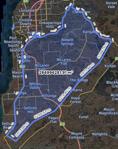
Town of Gawler
No night travel permitted in urban areas of the Town of Gawler.
Tasmanian network conditions - Click to expand
All road managers
Additional conditions applicable in Tasmania are stated on the Agricultural Heavy Vehicle Zone Map.
It is important to note that:
- Locations of some signage may not be represented on these mapping services.
- If there is a discrepancy between the load limit or height clearance signage and the information displayed through online mapping services, the signposted information provides the correct legal limit and takes precedence.
- Other low clearance items that may be present on the road network, such as transmission lines and trees, are not displayed on these mapping services.
Sign posted load limits
Travel is not allowed on roads or across bridges with sign posted load limits if the vehicle or combination exceeds the stated limits.
Advisory maps showing locations of load limited assets are available through the Department of State Growth website.
Overhead clearance limits
Travel is not allowed on the below structure with overhead clearance limit signage if the vehicle or combination exceeds the stated limits. Advisory maps showing locations of overhead clearance signage are available through the Department of State Growth website.
Bridge width limits
Travel is not allowed on the below structure with bridge width limit signage if the vehicle or combination exceeds the stated limits. Advisory maps showing locations of bridge width limit signage are available through the Department of State Growth website (or Agricultural Heavy Vehicle Zone Map).
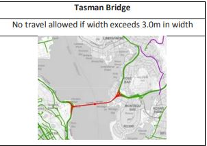
Victorian network conditions - Click to expand
Special network and Map information for Victoria
All-access conditions provided by Victorian road managers are in the conditions tab of this Guide or the national Notice, and reflected in the Victorian Oversize and Overmass Agricultural vehicles Network for Class 1 Vehicles map. The Victorian Department of Transport and Planning regularly updates this Map.
All road managers
Refer to the layers in the Agricultural Heavy Vehicle Zone Map titled: ‘Victoria – Approved Roads, Conditions & Restrictions’.
Local government areas on the Map
The Map may identify a council area as approved, pending or rejected. Table 76 provides a summary of the access.
| Status | Access | Reason for status |
|---|---|---|
| Approved |
Local roads are approved for travel under the Notice. Refer to the conditions of the Notice. |
The Road manager has provided consent to the national Notice. |
| Pending |
Travel is not approved on local government roads. |
The Road manager has not provided consent to the national Notice. |
| Rejected |
Travel is refused on local government roads. |
The local road manager has refused access under the Notice. |
|
Note: Travel is allowed (unless conditioned otherwise) on state-controlled even if an area is pending or rejected. |
||
Map Layers
The layers list in the Map applies conditions and restrictions. Operators can apply and remove layers by clicking the boxes on and off.
Note: An agricultural vehicle or combination must travel only in accordance with any condition or restriction that may apply.
For example, if travelling in Zone 5 and a road is identified as an Agricultural Heavy Vehicle Restricted Road, travel on that road must only be made at Zone 1 dimension limits. Subject to compliance with any other conditions that may exist, travel on other roads within that Zone may be at Zone 5 dimension limits.
Training video
Agricultural heavy vehicle Zone map training video - Provides a quick overview on how to use the NHVR's Agricultural heavy vehicle Zone map.
Mapped conditions and restrictions
Agricultural Heavy Vehicle Restricted Roads
The Map may identify Agricultural Heavy Vehicle Restricted Roads.
Regardless of the Zone, travel on any Agricultural Heavy Vehicle Restricted Road is restricted to vehicles complying with Zone 1 dimension limits.
Conditions on roads or structures or areas
The Map or the Guide may identify conditions for certain roads or structures, or areas.
An agricultural vehicle or combination must travel on a road or structure, or in an area, only in accordance with any conditions that may apply.
Disclaimer regarding copies of the Map
- The Map is the legally approved network for agricultural vehicles and combinations travelling under the Notice.
- Copies of the Map (either hard or electronic) may not represent the legally approved network at the time of travel.
- The Map should be checked before travel to ensure travel on public roads complies with the relevant requirements of the legally approved network.
Travel on freeways
Agricultural vehicles and combinations can travel on freeways (unless otherwise signposted) in the following jurisdictions:
- South Australia
- Tasmania
Travel must be in accordance with any other condition that may apply on the Map or in this Guide.
Agricultural vehicles or combinations must not travel on freeways in the following jurisdictions:
- The Australian Capital Territory
- New South Wales
- Queensland
In Victoria, travel on freeways by agricultural vehicles and combinations indicated on the Map.
Traffic advisory services - Click to expand
Prior to commencing any journey, operators should review traffic alerts, road closures, travel delays, and other traffic advisory information for participating jurisdictions.
Table 77 provides details and links to official traffic advisory services for each participating jurisdiction. For more information about a particular service, contact the relevant jurisdiction or department via the contact details listed on the service webpage.
|
Jurisdiction |
Website |
Purpose |
|---|---|---|
| Australian Capital Territory | Road closures | View current and upcoming road closures across the Australian Capital Territory. |
|
New South Wales |
View live information about incidents and changes in New South Wales traffic conditions. |
|
| Queensland | QLD Traffic | View live information about incidents and changes in Queensland traffic conditions, including outback road conditions. |
| South Australia | Outback Road Warnings | Access the latest information about temporary closures, restrictions, and warnings for outback roads North and West of Port Augusta. |
| Traffic SA | View live information about incidents and changes in South Australia traffic conditions. Traffic SA is available as a mobile app. See Addinsight download details on the Traffic SA website. |
|
|
Tasmania |
View Tasmania Police alerts for road closures due to emergencies or special events. |
|
| TasALERT | View emergency warnings and incidents across Tasmania, including mapped road closures. | |
| Tasmanian Roadworks map | Access the latest information about planned roadworks and road closures across Tasmania, including a map of current roadworks. | |
| Victoria | VicTraffic | View live information about incidents and changes in Victoria traffic conditions. |
| Big Build | View live information about transport disruptions in Victoria. |
Applying for an access permit - Click to expand
Applying for an access permit
Access permit applications are required for heavy vehicles that don’t comply with the conditions set out in a notice and when accessing routes that aren’t covered on an approved network.
The following pages provide useful information and resources for submitting access permit applications:
- Do I need a permit?: Information and resources for determining whether a road access permit, or a notice is required to operate on Australian roads.
If you cannot travel under the Notice, access may be possible under a Class 1 mass and/or dimension permit for the agricultural vehicle or combination, subject to a granting of consent by the relevant road manager/s. For more information, please contact the NHVR.
The following information and can assist to plan your route in the NHVR Next Generation Route Planner:
- Routing - Single route and area difference
- Single Trip, Period Permit and Multiple Trip - Information Sheet (PDF, 333KB)
Note: the below vehicle diagrams are to be used as guidance only, and actual combinations may differ. The common types of vehicle applications are summarised below.
| Vehicle Description | Configuration | How to apply |
|---|---|---|
| Harvester |
|
|
| Harvester towing a comb trailer |
|
|
| Harvester towing an agricultural implement |
|
|
| Tractor |
|
|
| Tractor towing comb trailer |
|
|
| Tractor towing a baler |
|
|
| Tractor towing a grape harvester |
|
|
| Tractor towing an agricultural implement |
|
|
| Tractor towing a seeder and air cart |
|
|
| Cane haul out truck |
|
|
| Rigid truck towing a comb trailer |
|
|
| Rigid truck towing an auger |
|
|
| Tractor towing an auger |
|
|
| Rigid truck towing an agricultural implement |
|
|
| Prime mover towing an agricultural plant trailer |
|
|
| Cotton harvester |
|
Travel time and holiday travel restrictions
Holiday travel restrictions are applied for road safety reasons when the probability of interaction between agricultural vehicles and combinations and general road users is increased.
If travel is required during a restricted period, access may be possible under a Class 1 mass and/or dimension permit for the agricultural vehicle or combination, subject to consent by the relevant road manager/s.
To assist the application process - When applying for a permit ensure you include a comment in route notes and/ or the notes section of the application advising you are seeking road manager consideration to exempt the specific travel or holiday restriction.
For more information, please contact the NHVR by email at info@nhvr.gov.au or by phone 13 NHVR (13 64 87).
Related notices
In this tab, you will find a list of National and State notices related to this National Class 1 Agricultural Vehicle and Combination Mass and Dimension Exemption Notice.
A related notice may coincide with the featured notice or provide alternatives for operators to find the appropriate notice to operate.
Related state notices
| Jurisdiction | Notice |
|---|---|
| Queensland |
Queensland Class 3 Cotton Module Transportation Dimension Exemption Notice 2024 (No.1) Provides an exemption from height and rear overhang dimension requirements for certain heavy vehicles while they are transporting cotton modules. |
| South Australia |
Provides access for Class 1 heavy vehicles, carrying either large indivisible items or agricultural vehicles, which exceed regulation dimensions, to travel on roads in South Australia subject to conditions specified in the Notice. |
| Tasmania |
Tasmania Class 3 Heavy Vehicle Fertiliser Spreader Vehicle Dimension Exemption Notice 2025 (No.1) Exempts fertiliser spreader vehicles from stated prescribed dimension requirements in Schedule 6 of the Heavy Vehicle (Mass, Dimension and Loading) National Regulation. |
| Victoria |
Exempt agricultural vehicles and special purpose vehicles from specified vehicle standards requirements. |
Supporting documents
Forms
- Braking Performance Test form (DOCX, 131KB)
- New South Wales Agricultural Vehicle Route Assessment form (DOCX, 135KB)
Factsheets
- Pilot and escorts training and recognition
- Clearance authority letter information sheet (PDF, 157KB)
- National Class 1 Agricultural Notice - Quick Reference Guide (PDF, 278KB)
- Route Planner user guide (PDF, 5.7MB)
- Routing - Single route and area difference
- Single Trip, Period Permit and Multiple Trip - Information Sheet (PDF, 333KB)
Tools and calculators
Calculators
Determining Tow Mass Ratio
When calculating the tow mass ratio, operators should weigh units of the combination when coupled. The mass of individual units may change when coupled to another vehicle, as mass can distribute across towed units in the combination.
Towing and towed vehicle masses include any load being carried by the vehicles.
Confirm your tow mass ratio with the Tow Mass Ratio Calculator (XLSX, 17KB)
Agricultural Heavy Vehicle Zones
Zones are an area of operation, and agricultural vehicles and combinations must comply with the dimension limits for the Zone of travel.
Access is to all public roads in a Zone at any time, unless otherwise stated in the Notice, this Guide or Map
|
Dimension requirement |
Zone 1 |
Zone 2 |
Zone 3 |
Zone 4 |
Zone 5 |
|
|---|---|---|---|---|---|---|
|
Single vehicle length (metres) Victoria and South Australia |
15.0m |
15.0m |
||||
| All other jurisdictions | 12.5m | |||||
|
Articulated vehicle length (metres) |
19.0m |
|||||
|
Combination length (metres) South Australia All other jurisdictions |
19.0m 25.0m |
25.0m |
25.0m |
35.0m |
35.0m |
|
|
Agricultural implement length (metres) |
12.5m |
15.0m |
20.0m |
25.0m |
25.0m |
|
|
Height (metres) Cotton Harvesters All other eligible vehicles |
5.3m 5.0m |
|||||
|
Width (metres) Victoria |
2.5m |
3.7m* |
5.0m* | 6.5m* |
N/A |
|
| *except for agricultural implements operating as an agricultural trailer, which are subject to a maximum width of 3.0m. | ||||||
| All other states | 3.0m | 3.7m | 5.0m | 6.5m | 7.5m | |
|
Single vehicle rear overhang (metres) |
5.5m |
|||||
|
Auger and conveyor rear overhang (metres) Victoria |
8.0m |
8.0m |
9.0m |
10.0m |
||
| All other jurisdictions | 5.5m | |||||
| In New South Wales, an auger or conveyor rear overhang in Zone 1 may be up to 7.0 if the agricultural combination has a pilot vehicle positioned at the rear. | ||||||
|
Implement rear overhang (metres) |
5.5m |
6.5m |
||||
|
Harvester rear overhang (metres) |
5.5m |
6.5m |
||||
|
Note: In Queensland, the rear overhang of a sugarcane harvester may be up to 7.8m during day and night travel, subject to compliance with a pilot vehicle. Refer to Queensland – Pilot vehicle requirements for sugarcane harvesters with rear overhang up to 7.8m. |
||||||
Participating jurisdiction heavy vehicle resources
For more information about operating a heavy vehicle in participating jurisdictions, refer to the following sites:
- Australian Capital Territory: Transport Canberra and City Services - Heavy vehicle conditions and network
- New South Wales: Transport for New South Wales (TfNSW) - Heavy vehicles
- Queensland: Department of Transport and Main Roads (TMR) - Heavy vehicles
- South Australia: Department for Infrastructure and Transport (DIT) - Heavy vehicles
- Tasmania: Department of State Growth (DSG) - Heavy vehicles
- Victoria: Department of Transport and Planning - Heavy vehicle industry
Changes and updates
| Date | Summary | Links to resources and communications |
|---|---|---|
| 9 June 2025 | Amendments include the removal of longstanding structural constraints associated with the old Bridgewater Bridge, Tasmania, relating to height (4.6m) and width (2.5m) which have historically limited heavy vehicle access under several notices following the 2 June 2025 opening of the new Bridgewater Bridge. | New Bridgewater Bridge construction update |
| 15 January 2025 | Removed the City of Victor Harbor from the list of non-participating night travel road managers in Table 27. | |
| 17 December 2024 | Updated to add conditional access information in 'Network and Mapping' for Snowy Monaro Regional Council. | |
| 1 May 2024 | National Class 1 Agricultural Vehicle and Combination Mass and Dimension Notice 2024 (No.1) commenced. | |
| 10 Feb 2024 | South Australia Class 1 Rubber Tracked Tractor Mass and Dimension Exemption Notice 2019 (No.1) expired. Access will continue under the National Class 1 Agricultural Vehicle and Combination Mass and Dimension Exemption Notice. | |
| 5 Feb 2024 | Added the National Class 1 Agricultural Notice - Quick Reference Guide which helps operators understand the general conditions and requirements of this Notice. | |
| 16 Oct 2023 |
Updates in Network and Mapping tab Queensland network conditions to Isaac Regional Council.
|
|
| 26 May 2023 |
Update to the table 'Dimensions for travel in Queensland' to include a reference to cotton harvesters up to 5.55m wide and the need for them to travel in accordance with the escort requirements in the table. Amend wording immediately following the table to ensure that agricultural vehicles and combinations with a width greater than 3.5m travelling in Coastal Zone 3 on Critical Roads comply with the requirements in the table for 'Pilot requirements for Certain identified Roads in Queensland'. |
|
| 26 May 2023 | Amend eligible cotton harvesters in New South Wales to those that comply with applicable Zone and Notice conditions. | |
| 31 Mar 2023 | Revocation of South Australia Class 1 Agricultural Vehicle Mass and Dimension Exemption Notice 2019 (No.1) and Victoria Class 1 Agricultural Vehicle Exemption Notice 2018 (No.3). Access is now provided under the National Class 1 Agricultural Vehicle and Combination Mass and Dimension Exemption Notice. | On the Road Issue 157 - 14 February |
| 20 Mar 2023 | Update to the table 'Pilot requirements for Certain identified Roads in Queensland'. Remove the 5km maximum travel requirement when accompanied with one pilot and a Level 1 pilot but retain the 5km maximum travel requirement when travelling with one pilot and roadside signage. The change will allow agricultural vehicles to travel further than 5km under pilot escort. | |
| 1 Jan 2023 | Revocation of New South Wales Class 1 Silage Trailer Mass and Dimension Exemption Notice 2018 (No.1). Access is now provided under the National Class 1 Agricultural Vehicle and Combination Mass and Dimension Exemption Notice. | Notice of Revocation – New South Wales Class 1 Silage Trailer Mass and Dimension Exemption Notice 2018 (No.1) |
| 7 Oct 2022 | Inclusion of the Queensland speed conditions for a motor vehicle (other than an agricultural machine) towing a comb implement. Refer to Queensland network conditions. | |
| 30 Jun 2022 | Queensland Class 1 Comb Trailer Dimension Exemption Notice 2017 (No. 1) expired. Access is now provided under the National Class 1 Agricultural Vehicle and Combination Mass and Dimension Exemption Notice. | |
| 8 Jun 2022 | Update to the table 'Holiday restrictions for NSW'. Includes a new piloting requirement in NSW Zone 3 and Zone 5. | On The Road Issue 141 - 8 June 2022 |
| 23 Mar 2022 |
Update to South Australian Table, 'Limited access locations in South Australia.' Adelaide Metropolitan
Yorke and Mid North
|
|
| 17 Dec 2021 |
Incorporating feedback from key industry stakeholders, a new look for National Agricultural Notice Operator’s Guide. A key difference from the previous PDF version is that the Operator’s Guide now includes the South Australian night travel conditions that were previously outlined separately. |
|
| 10 Nov 2021 |
Amendment to comb implements eligibility to include access under the National Class 1 Agricultural Vehicle and Combination Mass and Dimension Exemption Notice. |
|
|
2 August 2021 |
Revocation of the following State notices as access is now provided under the National Class 1 Agricultural Vehicle and Combination Mass and Dimension Exemption Notice. New South Wales
Queensland
Tasmania
|
National Class 1 Agricultural Vehicle and Combination Mass and Dimension (Revocation) Notice 2021 (No.1) |
| 23 November 2020 |
Removal of associated Notice from Table 1 Authorisation Instruments Queensland conditions of access amendment
|
|
| 13 March 2020 | A minor amendment to the Operator Guide was made to define a rubber tracked tractor to specify the status of 'half-tracked tractors". | |
| 26 August 2019 | Queensland Class 3 & Class 1 Permit delegation returned to NHVR | |
| 1 May 2019 | First publication of the National Class 1 Agricultural Vehicle and Combination Mass and Dimension Exemption Notice | On the Road Issue 58 - 30 April 2019 |
| 30 April 2019 | New South Wales Class 1 Agricultural Permit delegation returned to NHVR |

www.nhvr.gov.au
E info@nhvr.gov.au
P 13 NHVR (136 487)
PO Box 492, Fortitude Valley QLD 4006

 Accessibility tools

